Estimated Value: $291,681 - $399,000
Studio
3
Baths
2,870
Sq Ft
$124/Sq Ft
Est. Value
About This Home
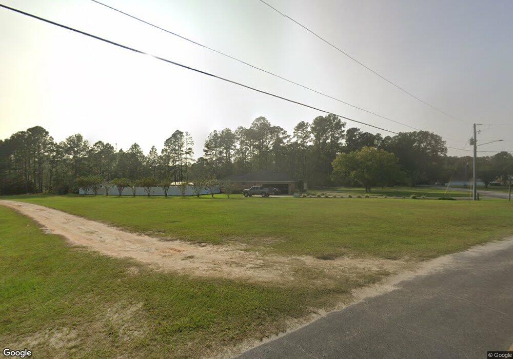
This home is located at 100 Ivy St, Odum, GA 31555 and is currently estimated at $355,670, approximately $123 per square foot. 100 Ivy St is a home located in Wayne County with nearby schools including Odum Elementary School, Martha Puckett Middle School, and Wayne County High School.
Ownership History
Date
Name
Owned For
Owner Type
Purchase Details
Closed on
Oct 7, 2016
Sold by
Mayers Bedell
Bought by
Harter Brennan T and Harter Shelli L
Current Estimated Value
Home Financials for this Owner
Home Financials are based on the most recent Mortgage that was taken out on this home.
Original Mortgage
$181,000
Outstanding Balance
$143,837
Interest Rate
3.44%
Mortgage Type
New Conventional
Estimated Equity
$211,833
Purchase Details
Closed on
Nov 27, 2013
Sold by
Daniel Douglas D
Bought by
Daniel Sylvia and Mayers Bedell
Purchase Details
Closed on
Nov 1, 1991
Bought by
Daniel Douglas D
Create a Home Valuation Report for This Property
The Home Valuation Report is an in-depth analysis detailing your home's value as well as a comparison with similar homes in the area
Purchase History
| Date | Buyer | Sale Price | Title Company |
|---|---|---|---|
| Harter Brennan T | $226,250 | -- | |
| Daniel Sylvia | -- | -- | |
| Daniel Douglas D | $3,500 | -- |
Source: Public Records
Mortgage History
| Date | Status | Borrower | Loan Amount |
|---|---|---|---|
| Open | Harter Brennan T | $181,000 |
Source: Public Records
Tax History
| Year | Tax Paid | Tax Assessment Tax Assessment Total Assessment is a certain percentage of the fair market value that is determined by local assessors to be the total taxable value of land and additions on the property. | Land | Improvement |
|---|---|---|---|---|
| 2025 | $3,292 | $112,159 | $1,392 | $110,767 |
| 2024 | $3,137 | $108,496 | $1,392 | $107,104 |
| 2023 | $2,788 | $79,386 | $1,392 | $77,994 |
| 2022 | $2,342 | $79,386 | $1,392 | $77,994 |
| 2021 | $2,508 | $79,386 | $1,392 | $77,994 |
| 2020 | $2,595 | $79,386 | $1,392 | $77,994 |
| 2019 | $2,672 | $79,386 | $1,392 | $77,994 |
| 2018 | $2,672 | $79,386 | $1,392 | $77,994 |
| 2017 | $2,300 | $79,386 | $1,392 | $77,994 |
| 2016 | $887 | $79,386 | $1,392 | $77,994 |
| 2014 | $885 | $79,386 | $1,392 | $77,994 |
| 2013 | -- | $79,386 | $1,392 | $77,994 |
Source: Public Records
Map
Nearby Homes
- 512 Tillman St
- 1029 S Main St
- 0 Ingram Road Summer Way Unit 169105
- TRACT 3 Reddish Rd
- TRACT 5 Reddish Rd
- TRACT 4 Reddish Rd
- 10.00 AC Hwy 341 Odum Hwy
- 0 N Church St
- TRACT 2 Tank Rd
- 000 Beards Bluff Rd
- Lot 00 Moss Landing
- Lots 26+ Moss Landing
- Lot 21 Moss Landing
- 2505 Odum Rd S
- 0 Tract 3 Hwy 341 & Bennett Mill Pond Rd Unit 1656129
- 0 Tract 6 Hwy 341 & Bennett Mill Rd Unit 1656128
- 1670 Beaver Dam Rd
- TRACT 1 Wheaton Rd
- 10.00 AC Highway 341
- 4848 Holmesville Rd
- 407 S Church St
- 811 Roberson Rd
- 815 Roberson Rd
- 113 Ivy St
- 513 S Church St
- 405 S Church St
- 400 Roberson Rd
- 605 S Church St
- 401 Roberson Rd
- 116 Shon St
- 120 Shon St
- 305 S Church St
- 402 Roberson Rd
- 504 Tillman St
- 520 Tillman St
- 424 S Church St
- 301 Roberson Rd
- 509 Tillman St
- 508 Tillman St
- 410 Tillman St
Your Personal Tour Guide
Ask me questions while you tour the home.