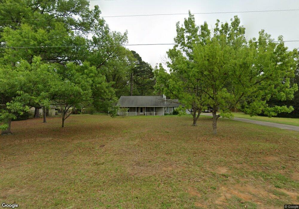
100 Keith Rd Bonaire, GA 31005
Estimated Value: $227,000 - $247,000
3
Beds
2
Baths
1,378
Sq Ft
$170/Sq Ft
Est. Value
About This Home
This home is located at 100 Keith Rd, Bonaire, GA 31005 and is currently estimated at $234,874, approximately $170 per square foot. 100 Keith Rd is a home located in Houston County with nearby schools including Hilltop Elementary School, Bonaire Middle School, and Veterans High School.
Ownership History
Date
Name
Owned For
Owner Type
Purchase Details
Closed on
Sep 15, 2022
Sold by
Westley Tanner John
Bought by
Tanner Nathan and Tanner John Westley
Current Estimated Value
Purchase Details
Closed on
May 9, 2012
Sold by
Tanner John W and Tanner Glenda R
Bought by
Tanner John W
Purchase Details
Closed on
Sep 9, 1992
Sold by
Tanner John W
Bought by
Tanner John W and Glenda R*
Purchase Details
Closed on
Apr 4, 1990
Sold by
Flood Michael
Bought by
Tanner John W
Purchase Details
Closed on
Mar 30, 1982
Sold by
Clark Jack L
Bought by
Flood Michael
Purchase Details
Closed on
Nov 1, 1978
Sold by
Allied Asphalt Company
Bought by
Clark Jack L
Create a Home Valuation Report for This Property
The Home Valuation Report is an in-depth analysis detailing your home's value as well as a comparison with similar homes in the area
Home Values in the Area
Average Home Value in this Area
Purchase History
| Date | Buyer | Sale Price | Title Company |
|---|---|---|---|
| Tanner Nathan | -- | -- | |
| Tanner John W | -- | None Available | |
| Tanner John W | -- | -- | |
| Tanner John W | $13,000 | -- | |
| Flood Michael | $6,500 | -- | |
| Clark Jack L | $6,000 | -- |
Source: Public Records
Tax History Compared to Growth
Tax History
| Year | Tax Paid | Tax Assessment Tax Assessment Total Assessment is a certain percentage of the fair market value that is determined by local assessors to be the total taxable value of land and additions on the property. | Land | Improvement |
|---|---|---|---|---|
| 2024 | $1,575 | $65,840 | $11,640 | $54,200 |
| 2023 | $1,383 | $57,200 | $11,640 | $45,560 |
| 2022 | $1,355 | $56,080 | $11,640 | $44,440 |
| 2021 | $1,262 | $51,960 | $11,640 | $40,320 |
| 2020 | $1,149 | $47,080 | $11,640 | $35,440 |
| 2019 | $1,149 | $47,080 | $11,640 | $35,440 |
| 2018 | $1,149 | $47,080 | $11,640 | $35,440 |
| 2017 | $1,150 | $47,080 | $11,640 | $35,440 |
| 2016 | $1,152 | $47,080 | $11,640 | $35,440 |
| 2015 | $1,105 | $45,080 | $11,640 | $33,440 |
| 2014 | -- | $45,080 | $11,640 | $33,440 |
| 2013 | -- | $45,080 | $11,640 | $33,440 |
Source: Public Records
Map
Nearby Homes
- 215 Highland Park Dr
- 3230 Moody Rd
- 109 Harley Dr
- 106 Belfaire Estates
- 202 Brook Hollow Ct
- 203 Pine Trace Ln
- 111 Chipper St
- 300 Pine Trace Ln Unit 74
- 300 Pine Trace Ln
- 101 Falls Dr
- 105 Anderson Ct
- 123 Alton Tucker Sr Blvd
- 129 Alton Tucker Sr Blvd
- 131 Alton Tucker Sr Blvd
- 125 Alton Tucker Sr Blvd
- 115 Sutter Butte Place
- 225 Fieldfare Dr
- 100 Alton Tucker Sr Blvd
- 118 Newton Ln
- 219 Woodlands Blvd