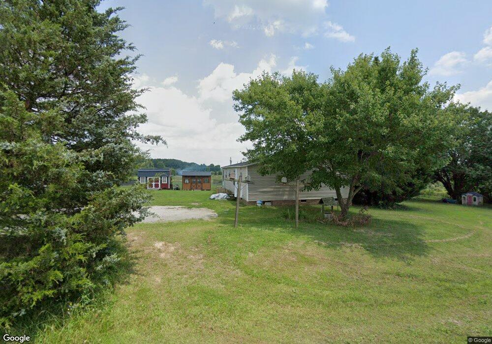
100 Lois Ln Kings Mountain, NC 28086
Estimated Value: $111,000 - $169,000
--
Bed
--
Bath
1,456
Sq Ft
$97/Sq Ft
Est. Value
About This Home
This home is located at 100 Lois Ln, Kings Mountain, NC 28086 and is currently estimated at $141,384, approximately $97 per square foot. 100 Lois Ln is a home located in Cleveland County with nearby schools including North Elementary School, Kings Mountain Middle, and Kings Mountain Intermediate School.
Ownership History
Date
Name
Owned For
Owner Type
Purchase Details
Closed on
Feb 20, 2015
Sold by
Pursley Kelly and Pursley Sandra
Bought by
Marr Troy and Marr Katrina
Current Estimated Value
Home Financials for this Owner
Home Financials are based on the most recent Mortgage that was taken out on this home.
Original Mortgage
$32,000
Interest Rate
3.81%
Mortgage Type
Purchase Money Mortgage
Purchase Details
Closed on
Jun 11, 2012
Sold by
Federal Home Loan Mortgage Corporation
Bought by
Pursley Kelly
Purchase Details
Closed on
Jan 19, 2012
Sold by
Marlow Loretta L and Marlow Loretta
Bought by
Federal National Mortgage Association
Create a Home Valuation Report for This Property
The Home Valuation Report is an in-depth analysis detailing your home's value as well as a comparison with similar homes in the area
Home Values in the Area
Average Home Value in this Area
Purchase History
| Date | Buyer | Sale Price | Title Company |
|---|---|---|---|
| Marr Troy | $36,000 | None Available | |
| Pursley Kelly | -- | None Available | |
| Federal National Mortgage Association | -- | None Available |
Source: Public Records
Mortgage History
| Date | Status | Borrower | Loan Amount |
|---|---|---|---|
| Closed | Marr Troy | $32,000 | |
| Closed | Federal National Mortgage Association | $0 |
Source: Public Records
Tax History Compared to Growth
Tax History
| Year | Tax Paid | Tax Assessment Tax Assessment Total Assessment is a certain percentage of the fair market value that is determined by local assessors to be the total taxable value of land and additions on the property. | Land | Improvement |
|---|---|---|---|---|
| 2025 | $765 | $120,445 | $17,028 | $103,417 |
| 2024 | $576 | $62,293 | $14,256 | $48,037 |
| 2023 | $573 | $62,293 | $14,256 | $48,037 |
| 2022 | $573 | $62,293 | $14,256 | $48,037 |
| 2021 | $573 | $62,293 | $14,256 | $48,037 |
| 2020 | $537 | $55,953 | $12,640 | $43,313 |
| 2019 | $485 | $55,953 | $12,640 | $43,313 |
| 2018 | $484 | $55,953 | $12,640 | $43,313 |
| 2017 | $481 | $55,953 | $12,640 | $43,313 |
| 2016 | $461 | $55,953 | $12,640 | $43,313 |
| 2015 | $512 | $56,924 | $11,088 | $45,836 |
| 2014 | $512 | $56,924 | $11,088 | $45,836 |
Source: Public Records
Map
Nearby Homes
- 155 Castle Ct
- 103 Amy Dr
- 5212 Timber Creek Ct
- 5324 Weblee Ct
- 109 Belmar Rd
- 213 Press Sweezy Rd
- 5112 Southbrook Dr
- 2198 County Line Rd
- 5107 Southbrook Dr
- 130 Sunnyside Shady Rest Rd
- 3367 Marshall Wolfe Rd
- 00 Gary Beam Rd
- 00 Marys Grove Church Rd
- 608 Rollingbrook Rd
- 124 Rollingbrook Rd
- 125 Bridges Cir
- 215 J Robinson Pkwy
- 645 Chestnut Ridge Church Rd
- 123 Gold Run Ct
- 1756 Martin Rd
- 320 Saint Luke Church Rd
- 102 Lois Ln
- 00 Saint Lukes Church Rd
- 101 Lois Ln
- 318 Saint Luke Church Rd
- 104 Lois Ln
- 326 Saint Luke Church Rd
- 103 Lois Ln
- 106 Lois Ln
- 105 Lois Ln
- 328 Saint Luke Church Rd
- 107 Lois Ln
- 108 Lois Ln
- 109 Lois Ln
- 331 Saint Luke Church Rd
- 110 Lois Ln
- 310 Saint Luke Church Rd Unit 1
- 310 Saint Luke Church Rd
- 311 Saint Luke Church Rd
- 105 Amy Dr