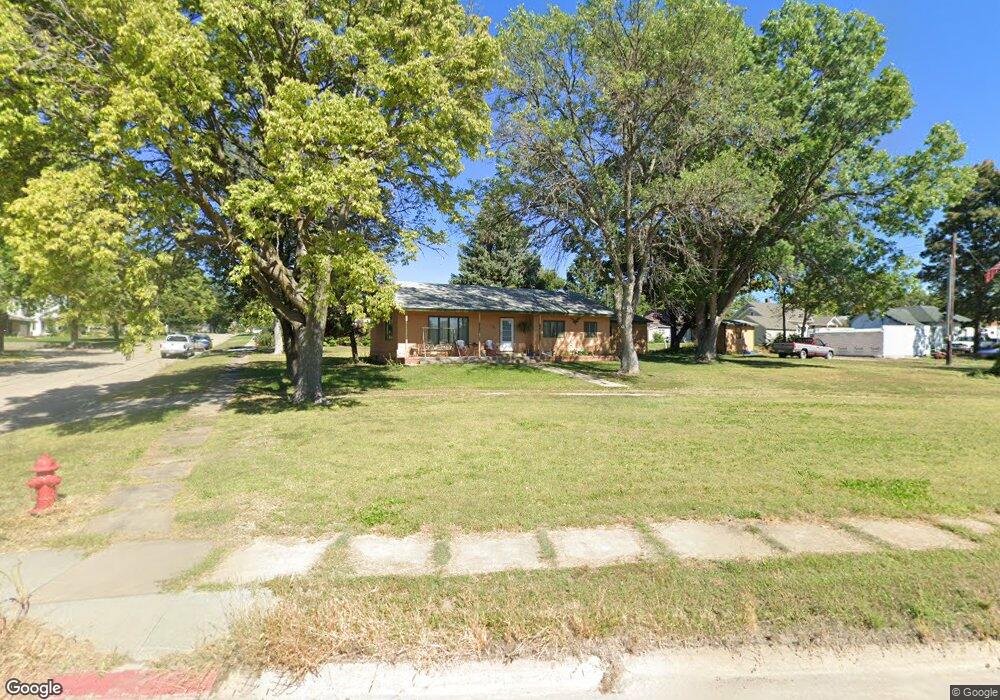
100 N Hamilton St Eustis, NE 69028
Estimated Value: $143,000 - $270,000
2
Beds
2
Baths
1,261
Sq Ft
$148/Sq Ft
Est. Value
About This Home
This home is located at 100 N Hamilton St, Eustis, NE 69028 and is currently estimated at $186,659, approximately $148 per square foot. 100 N Hamilton St is a home located in Frontier County with nearby schools including Elementary School at Eustis and Eustis-Farnam High School.
Ownership History
Date
Name
Owned For
Owner Type
Purchase Details
Closed on
Aug 15, 2016
Sold by
Darnall Janice
Bought by
Barngraff Gerald and Barngraff Carol
Current Estimated Value
Home Financials for this Owner
Home Financials are based on the most recent Mortgage that was taken out on this home.
Original Mortgage
$71,600
Outstanding Balance
$56,999
Interest Rate
3.41%
Mortgage Type
Purchase Money Mortgage
Estimated Equity
$129,660
Create a Home Valuation Report for This Property
The Home Valuation Report is an in-depth analysis detailing your home's value as well as a comparison with similar homes in the area
Purchase History
| Date | Buyer | Sale Price | Title Company |
|---|---|---|---|
| Barngraff Gerald | $89,500 | None Available |
Source: Public Records
Mortgage History
| Date | Status | Borrower | Loan Amount |
|---|---|---|---|
| Open | Barngraff Gerald | $71,600 |
Source: Public Records
Tax History
| Year | Tax Paid | Tax Assessment Tax Assessment Total Assessment is a certain percentage of the fair market value that is determined by local assessors to be the total taxable value of land and additions on the property. | Land | Improvement |
|---|---|---|---|---|
| 2025 | $1,126 | $112,376 | $25,126 | $87,250 |
| 2024 | $1,470 | $112,376 | $25,126 | $87,250 |
| 2023 | $1,341 | $111,957 | $12,563 | $99,394 |
| 2022 | $1,341 | $97,140 | $12,563 | $84,577 |
| 2021 | $1,217 | $97,140 | $12,563 | $84,577 |
| 2020 | $1,147 | $91,559 | $6,982 | $84,577 |
| 2019 | $1,102 | $91,559 | $6,982 | $84,577 |
| 2018 | $1,082 | $91,559 | $6,982 | $84,577 |
| 2017 | $1,043 | $91,559 | $6,982 | $84,577 |
| 2016 | $894 | $75,560 | $8,167 | $67,393 |
| 2015 | $899 | $75,560 | $8,167 | $67,393 |
| 2014 | $142 | $70,680 | $8,167 | $62,513 |
Source: Public Records
Map
Nearby Homes
- 406 N Hamilton St
- 406 N Clay St
- 502 W Hendricks St
- 602 W Cameron
- 4 W Plum Creek Canyon Uebele
- 0 Rd 775 & Hwy 21 Hwy Unit 22606175
- 16 Burkholder Dr
- Lot 1 Reddington Farms Subdivision
- Lot 13 Reddington Farms Subdivision
- Lot 2 Reddington Farms Subdivision
- Lot 12 Reddington Farms Subdivision
- Lot 16 Reddington Farms Subdivision
- Lot 14 Reddington Farms Subdivision
- Lot 3 Reddington Farms Subdivision
- Lot 11 Reddington Farms Subdivision
- Lot 6 Reddington Farms Subdivision
- Lot 15 Reddington Farms Subdivision
- Lot 5 Reddington Farms Subdivision
- Lot 8 Reddington Farms Subdivision
- Lot 4 Reddington Farms Subdivision
- 105 N Hale St
- 101 N Hale St
- 200 N Hamilton St
- 101 N Hamilton St
- 107 N Hale St
- 201 N Hale St
- 103 N Hamilton St
- 102 S Hamilton St
- 201 N Hamilton St
- 103 S Hamilton St
- 203 N Hale St
- 203 W Chandler St
- 203 N Hamilton St
- 102 N Hale St
- 206 N Hamilton St
- 401 W South Railroad St
- 105 S Hamilton St
- 103 S Hale St
- 205 N Hale St
- 201 W Chandler St
Your Personal Tour Guide
Ask me questions while you tour the home.