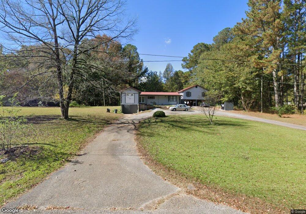
100 Oakridge Dr Lagrange, GA 30240
Estimated Value: $86,000 - $184,000
3
Beds
2
Baths
1,324
Sq Ft
$110/Sq Ft
Est. Value
About This Home
This home is located at 100 Oakridge Dr, Lagrange, GA 30240 and is currently estimated at $145,323, approximately $109 per square foot. 100 Oakridge Dr is a home located in Troup County with nearby schools including Berta Weathersbee Elementary School, Long Cane Elementary School, and Whitesville Road Elementary School.
Ownership History
Date
Name
Owned For
Owner Type
Purchase Details
Closed on
Oct 14, 2020
Sold by
Williams Elizabeth G
Bought by
Benefield Blake W
Current Estimated Value
Home Financials for this Owner
Home Financials are based on the most recent Mortgage that was taken out on this home.
Original Mortgage
$33,000
Interest Rate
2.8%
Mortgage Type
New Conventional
Purchase Details
Closed on
Jul 8, 1991
Bought by
Apple Tree Day Schools Inc
Purchase Details
Closed on
Jan 28, 1991
Purchase Details
Closed on
Mar 7, 1989
Purchase Details
Closed on
Oct 1, 1988
Purchase Details
Closed on
Nov 1, 1986
Purchase Details
Closed on
Aug 9, 1984
Purchase Details
Closed on
Jan 1, 1959
Create a Home Valuation Report for This Property
The Home Valuation Report is an in-depth analysis detailing your home's value as well as a comparison with similar homes in the area
Purchase History
| Date | Buyer | Sale Price | Title Company |
|---|---|---|---|
| Benefield Blake W | $38,000 | -- | |
| Apple Tree Day Schools Inc | $215,000 | -- | |
| -- | $43,000 | -- | |
| -- | $40,000 | -- | |
| -- | $40,000 | -- | |
| -- | -- | -- | |
| -- | -- | -- | |
| -- | -- | -- | |
| -- | -- | -- |
Source: Public Records
Mortgage History
| Date | Status | Borrower | Loan Amount |
|---|---|---|---|
| Closed | Benefield Blake W | $33,000 |
Source: Public Records
Tax History
| Year | Tax Paid | Tax Assessment Tax Assessment Total Assessment is a certain percentage of the fair market value that is determined by local assessors to be the total taxable value of land and additions on the property. | Land | Improvement |
|---|---|---|---|---|
| 2025 | $948 | $34,760 | $6,880 | $27,880 |
| 2024 | $815 | $29,880 | $6,880 | $23,000 |
| 2023 | $703 | $25,760 | $6,880 | $18,880 |
| 2022 | $691 | $24,760 | $6,880 | $17,880 |
| 2021 | $458 | $24,960 | $6,640 | $18,320 |
| 2020 | $753 | $24,960 | $6,640 | $18,320 |
| 2019 | $750 | $24,880 | $6,640 | $18,240 |
| 2018 | $718 | $23,816 | $7,216 | $16,600 |
| 2017 | $718 | $23,816 | $7,216 | $16,600 |
| 2016 | $701 | $23,256 | $7,216 | $16,040 |
| 2015 | $817 | $27,032 | $7,216 | $19,816 |
| 2014 | $818 | $27,032 | $7,216 | $19,816 |
| 2013 | -- | $27,032 | $7,216 | $19,816 |
Source: Public Records
Map
Nearby Homes
- 808 S Fling Rd
- 0 Bradfield Dr Unit 10568803
- 53 Horace Carter Rd
- 288 Bradfield Dr
- 2239 Pegasus Pkwy
- 8 Horace Carter Rd
- 427 Fling Rd
- 402 Ginger Cir
- 0 Glass Bridge Rd Unit 10679358
- 22 Freeman Rd
- 3009 Old West Point Rd
- 105 Redwood Dr
- 112 Foxdale Dr
- 3 Reed Dr
- 98 Hearn Rd
- 640 Hudson Rd
- 0 Unit 10514554
- 210 Pinehaven Dr
- 112 Brookwood Dr
- 117 Brookwood Dr
- 100 Oakridge Dr
- 74 Oakridge Dr
- 109 Oakridge Dr
- 56 Oakridge Dr
- 44 Oakridge Dr
- 809 S Fling Rd
- 803 S Fling Rd
- 45 Oakridge Dr
- 805 S Fling Rd
- 24 Oakridge Dr
- 25 Oakridge Dr
- 2785 West Point Rd
- 801 S Fling Rd
- 2725 West Point Rd
- 2809 West Point Rd
- 17 Oakridge Dr
- 799 S Fling Rd
- 2725 W Point Rd
- 810 S Fling Rd
- 806 S Fling Rd
Your Personal Tour Guide
Ask me questions while you tour the home.