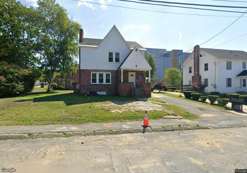
100 Porter St North Adams, MA 01247
Estimated Value: $398,136
4
Beds
2
Baths
2,331
Sq Ft
$171/Sq Ft
Est. Value
About This Home
This home is located at 100 Porter St, North Adams, MA 01247 and is currently estimated at $398,136, approximately $170 per square foot. 100 Porter St is a home located in Berkshire County with nearby schools including Colegrove Park Elementary School and Drury High School.
Ownership History
Date
Name
Owned For
Owner Type
Purchase Details
Closed on
Aug 11, 1999
Sold by
Terio Philip A
Bought by
Massachusetts Coll Fnd
Current Estimated Value
Purchase Details
Closed on
Sep 9, 1994
Sold by
Gouge John A and Dariddi-Gouge Am
Bought by
Terio Phillip A
Purchase Details
Closed on
Apr 25, 1990
Sold by
Redd Helen B
Bought by
Gouge John A
Home Financials for this Owner
Home Financials are based on the most recent Mortgage that was taken out on this home.
Original Mortgage
$112,500
Interest Rate
10.26%
Mortgage Type
Purchase Money Mortgage
Create a Home Valuation Report for This Property
The Home Valuation Report is an in-depth analysis detailing your home's value as well as a comparison with similar homes in the area
Home Values in the Area
Average Home Value in this Area
Purchase History
| Date | Buyer | Sale Price | Title Company |
|---|---|---|---|
| Massachusetts Coll Fnd | $110,000 | -- | |
| Massachusetts Coll Fnd | $110,000 | -- | |
| Terio Phillip A | $80,000 | -- | |
| Terio Phillip A | $80,000 | -- | |
| Gouge John A | $125,000 | -- | |
| Gouge John A | $125,000 | -- |
Source: Public Records
Mortgage History
| Date | Status | Borrower | Loan Amount |
|---|---|---|---|
| Previous Owner | Gouge John A | $112,500 |
Source: Public Records
Tax History Compared to Growth
Tax History
| Year | Tax Paid | Tax Assessment Tax Assessment Total Assessment is a certain percentage of the fair market value that is determined by local assessors to be the total taxable value of land and additions on the property. | Land | Improvement |
|---|---|---|---|---|
| 2025 | -- | $163,400 | $33,100 | $130,300 |
| 2024 | -- | $149,600 | $30,300 | $119,300 |
| 2023 | $0 | $149,300 | $30,300 | $119,000 |
| 2022 | $0 | $149,300 | $30,300 | $119,000 |
| 2021 | $0 | $138,200 | $28,000 | $110,200 |
| 2020 | $0 | $159,500 | $27,900 | $131,600 |
| 2019 | $0 | $148,100 | $27,900 | $120,200 |
| 2018 | $0 | $147,200 | $29,300 | $117,900 |
| 2017 | $0 | $145,800 | $29,000 | $116,800 |
| 2016 | -- | $149,800 | $29,000 | $120,800 |
| 2015 | -- | $150,800 | $30,000 | $120,800 |
Source: Public Records
Map
Nearby Homes
- 31 Dover St
- 30 Dover St
- 11-15 Perry St
- 74 Washington Ave
- 153 Corinth St
- 388 Ashland St Unit 1
- 235 Kemp Ave
- 299 E Main St
- 0 Ashland St Unit 245228
- 10 Miner St
- 0 Church St
- 19 N Church St Unit 12
- 19 N Church St Unit 14
- 19 N Church St Unit 11
- 19 N Church St Unit 7
- 77 Front St
- 50 Gallup St
- 297 Walnut St
- 35 Jackson St
- 57 Beacon St
- 282 Church St
- 268 Church St
- 80 Porter St
- 296 Church St
- 262 Church St
- 12 Montana St
- 54 Elmwood Ave
- 67 Porter St
- 68 Elmwood Ave
- 8 Montana St Unit 10
- 60 Porter St
- 12 Elmwood Ave
- 9 Montana St Unit 11
- 74 Elmwood Ave
- 15 Montana St Unit 17
- 242 Church St
- 45 Blackinton St
- 61 Porter St
- 19 Elmwood Ave Unit 21
- 6 Elmwood Ave