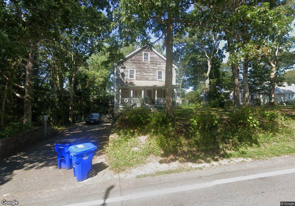
100 Presidents Rd Bourne, MA 2532
Estimated Value: $739,000 - $1,029,000
4
Beds
3
Baths
2,400
Sq Ft
$364/Sq Ft
Est. Value
About This Home
This home is located at 100 Presidents Rd, Bourne, MA 2532 and is currently estimated at $873,723, approximately $364 per square foot. 100 Presidents Rd is a home located in Barnstable County with nearby schools including Bourne High School, St Margaret Regional School, and Cadence Academy Preschool - Bourne.
Ownership History
Date
Name
Owned For
Owner Type
Purchase Details
Closed on
Feb 8, 2011
Sold by
Fraga Luis G
Bought by
Presidents Road Rt and Fraga
Current Estimated Value
Purchase Details
Closed on
Aug 1, 1997
Sold by
Tyser Michael L and Tyser Deborah A
Bought by
Fraga Luis G and Fraga Maria J
Purchase Details
Closed on
May 13, 1994
Sold by
Collins Charles L and Collins Catherine V
Bought by
Tyser Michael L and Tyser Deborah A
Create a Home Valuation Report for This Property
The Home Valuation Report is an in-depth analysis detailing your home's value as well as a comparison with similar homes in the area
Home Values in the Area
Average Home Value in this Area
Purchase History
| Date | Buyer | Sale Price | Title Company |
|---|---|---|---|
| Presidents Road Rt | -- | -- | |
| Presidents Road Rt | -- | -- | |
| Fraga Luis G | $169,900 | -- | |
| Fraga Luis G | $169,900 | -- | |
| Tyser Michael L | $20,000 | -- | |
| Tyser Michael L | $20,000 | -- |
Source: Public Records
Mortgage History
| Date | Status | Borrower | Loan Amount |
|---|---|---|---|
| Previous Owner | Tyser Michael L | $84,000 | |
| Previous Owner | Tyser Michael L | $70,000 |
Source: Public Records
Tax History Compared to Growth
Tax History
| Year | Tax Paid | Tax Assessment Tax Assessment Total Assessment is a certain percentage of the fair market value that is determined by local assessors to be the total taxable value of land and additions on the property. | Land | Improvement |
|---|---|---|---|---|
| 2025 | $5,405 | $692,100 | $311,700 | $380,400 |
| 2024 | $5,286 | $659,100 | $296,900 | $362,200 |
| 2023 | $5,138 | $583,200 | $262,700 | $320,500 |
| 2022 | $4,944 | $490,000 | $232,500 | $257,500 |
| 2021 | $4,836 | $449,000 | $211,600 | $237,400 |
| 2020 | $4,702 | $437,800 | $209,600 | $228,200 |
| 2019 | $4,677 | $445,000 | $227,000 | $218,000 |
| 2018 | $4,143 | $393,100 | $183,000 | $210,100 |
| 2017 | $3,927 | $381,300 | $175,800 | $205,500 |
| 2016 | $3,824 | $376,400 | $175,800 | $200,600 |
| 2015 | $3,790 | $376,400 | $175,800 | $200,600 |
Source: Public Records
Map
Nearby Homes
- 16 Washington Ave
- 151 - 153 Main St
- 203 County Rd
- 34 Washington Ave
- 46 Holt Rd
- 46 Holt Rd Unit A
- 18 Carlton Rd
- 13 Laurel Hill Ct
- 56 Rip Van Winkle Way
- 1 Pine Tree Dr
- 44 Cotuit Rd
- 22 Bay View Ave
- 14 Great Rock Rd
- 5 Sea Knoll Ct
- 12 Beachwood Rd
- 18 Douglas Ave
- 3 Fairway Dr Unit F
- 3 Wolf Rd
- 26 Carnoustie Rd
- 12 Turnberry Rd Unit 12