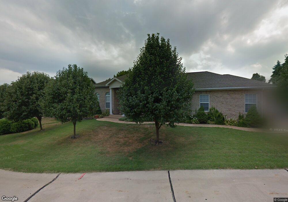
100 Rachel Carol Ct Saint Louis, MO 63123
Estimated Value: $436,000 - $530,000
3
Beds
2
Baths
2,080
Sq Ft
$234/Sq Ft
Est. Value
About This Home
This home is located at 100 Rachel Carol Ct, Saint Louis, MO 63123 and is currently estimated at $487,689, approximately $234 per square foot. 100 Rachel Carol Ct is a home located in St. Louis County with nearby schools including Mesnier Primary School, Gotsch Intermediate School, and Rogers Middle School.
Ownership History
Date
Name
Owned For
Owner Type
Purchase Details
Closed on
Aug 18, 2000
Sold by
Kuehnle Brothers Construction Company
Bought by
Abbate Salvatore and Abbate Lia A
Current Estimated Value
Home Financials for this Owner
Home Financials are based on the most recent Mortgage that was taken out on this home.
Original Mortgage
$115,000
Outstanding Balance
$41,492
Interest Rate
8.15%
Estimated Equity
$446,197
Create a Home Valuation Report for This Property
The Home Valuation Report is an in-depth analysis detailing your home's value as well as a comparison with similar homes in the area
Home Values in the Area
Average Home Value in this Area
Purchase History
| Date | Buyer | Sale Price | Title Company |
|---|---|---|---|
| Abbate Salvatore | $237,468 | -- |
Source: Public Records
Mortgage History
| Date | Status | Borrower | Loan Amount |
|---|---|---|---|
| Open | Abbate Salvatore | $115,000 |
Source: Public Records
Tax History Compared to Growth
Tax History
| Year | Tax Paid | Tax Assessment Tax Assessment Total Assessment is a certain percentage of the fair market value that is determined by local assessors to be the total taxable value of land and additions on the property. | Land | Improvement |
|---|---|---|---|---|
| 2025 | $6,282 | $85,460 | $16,170 | $69,290 |
| 2024 | $6,282 | $77,720 | $11,690 | $66,030 |
| 2023 | $6,073 | $77,720 | $11,690 | $66,030 |
| 2022 | $6,420 | $70,420 | $12,560 | $57,860 |
| 2021 | $5,476 | $65,820 | $12,560 | $53,260 |
| 2020 | $5,252 | $58,900 | $10,770 | $48,130 |
| 2019 | $5,242 | $58,900 | $10,770 | $48,130 |
| 2018 | $5,466 | $54,310 | $8,990 | $45,320 |
| 2017 | $5,432 | $54,310 | $8,990 | $45,320 |
| 2016 | $4,659 | $49,510 | $9,880 | $39,630 |
| 2015 | $4,679 | $49,510 | $9,880 | $39,630 |
| 2014 | $4,289 | $45,160 | $2,850 | $42,310 |
Source: Public Records
Map
Nearby Homes
- 10354 Jade Forest Dr
- 10161 Squire Meadows Dr Unit E
- 10161 Squire Meadows Dr Unit C
- 9920 Casa Rosa Dr
- 10227 Concord Valley Ct
- 9928 Bonton Dr
- 9926 Mackenzie Rd
- 9723 Crayford Rd Unit 1B
- 9740 Bexley Station Dr
- 10016 Kilmeade Dr
- 9744 Bexley Station Dr Unit 8J
- 10360 Roscommon Dr
- 9529 MacKenzie Circle Dr
- 2 Aspen at Grove at Grant's Trail Manors
- 9425 MacKenzie Circle Ct
- 9401 Pancho Dr
- 10560 Crecelius Dr
- 2 Aspen II at Grove at Grant’s Trail Manors
- 9511 Alix Dr
- 2 Manors
- 104 Rachel Carol Ct
- 9928 Wolff Dr
- 108 Rachel Carol Ct
- 9930 Wolff Dr
- 9931 Wolff Dr
- 105 Rachel Carol Ct
- 9965 Tesson Creek Estates Dr
- 112 Rachel Carol Ct
- 109 Rachel Carol Ct
- 9921 Wolff Dr
- 9969 Tesson Creek Estates Dr
- 9933 Wolff Dr
- 10112 Morgan Ridge Dr
- 9961 Tesson Creek Estates Dr
- 9916 Wolff Dr
- 9915 Wolff Dr
- 10108 Morgan Ridge Dr
- 10116 Morgan Ridge Dr
- 9961 Markhall Ln
- 9934 Wolff Dr