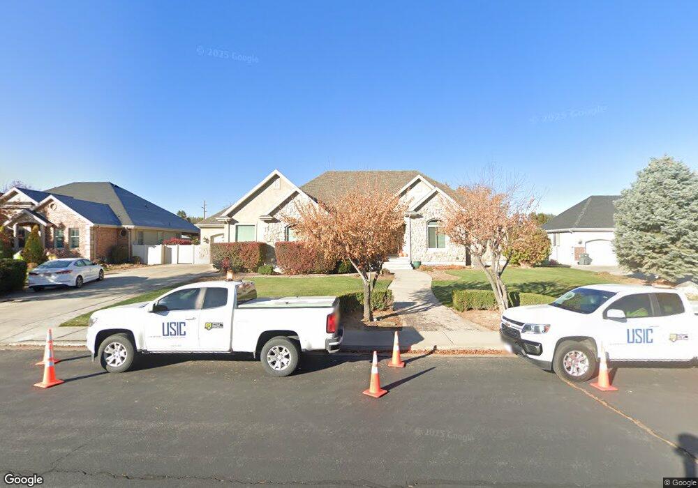
100 S 680 W Mapleton, UT 84664
Estimated Value: $1,138,000 - $1,266,081
7
Beds
5
Baths
5,242
Sq Ft
$232/Sq Ft
Est. Value
About This Home
This home is located at 100 S 680 W, Mapleton, UT 84664 and is currently estimated at $1,218,360, approximately $232 per square foot. 100 S 680 W is a home located in Utah County with nearby schools including Mapleton School, Mapleton Junior High School, and Maple Mountain High School.
Ownership History
Date
Name
Owned For
Owner Type
Purchase Details
Closed on
Mar 29, 2024
Sold by
Tranchell Nathan and Tranchell Nathan L
Bought by
Tnt Family Trust and Tranchell
Current Estimated Value
Purchase Details
Closed on
Apr 29, 2016
Sold by
Nielsen Kyle R and Nielsen Steven P
Bought by
Tranchell Nathan L and Tranchell Tiffany
Home Financials for this Owner
Home Financials are based on the most recent Mortgage that was taken out on this home.
Original Mortgage
$417,000
Interest Rate
3.71%
Mortgage Type
New Conventional
Create a Home Valuation Report for This Property
The Home Valuation Report is an in-depth analysis detailing your home's value as well as a comparison with similar homes in the area
Home Values in the Area
Average Home Value in this Area
Purchase History
| Date | Buyer | Sale Price | Title Company |
|---|---|---|---|
| Tnt Family Trust | -- | None Listed On Document | |
| Tranchell Nathan L | -- | North American Title |
Source: Public Records
Mortgage History
| Date | Status | Borrower | Loan Amount |
|---|---|---|---|
| Previous Owner | Tranchell Nathan L | $417,000 |
Source: Public Records
Tax History
| Year | Tax Paid | Tax Assessment Tax Assessment Total Assessment is a certain percentage of the fair market value that is determined by local assessors to be the total taxable value of land and additions on the property. | Land | Improvement |
|---|---|---|---|---|
| 2025 | $5,539 | $622,820 | -- | -- |
| 2024 | $5,539 | $542,575 | $0 | $0 |
| 2023 | $5,610 | $553,080 | $0 | $0 |
| 2022 | $5,879 | $573,045 | $0 | $0 |
| 2021 | $5,027 | $752,300 | $255,700 | $496,600 |
| 2020 | $4,862 | $703,800 | $226,300 | $477,500 |
| 2019 | $4,763 | $703,800 | $226,300 | $477,500 |
| 2018 | $4,769 | $670,800 | $193,300 | $477,500 |
| 2017 | $4,379 | $326,865 | $0 | $0 |
| 2016 | $3,922 | $291,005 | $0 | $0 |
| 2015 | $3,441 | $253,825 | $0 | $0 |
| 2014 | $3,370 | $244,090 | $0 | $0 |
Source: Public Records
Map
Nearby Homes
- 4664 S 680 W Unit S101
- 4664 S 680 W Unit S303
- 4664 S 680 W Unit S301
- 4664 S 680 W Unit S302
- 4664 S 680 W Unit S204
- 4664 S 680 W Unit S202
- 4664 S 680 W Unit S203
- 4664 S 680 W Unit S102
- 4664 S 680 W Unit S201
- 4664 S 680 W Unit S304
- 415 S 1200 W
- 896 W 675 S
- 1142 W 220 N
- 1222 W 190 N
- 1272 W 220 N
- 667 N 550 W
- 787 N 300 W
- 715 W 4600 S Unit Lot I101
- 715 W 4600 S Unit Lot I102
- 715 W 4600 S Unit Lot I303
Your Personal Tour Guide
Ask me questions while you tour the home.