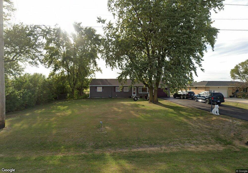
100 S 7000w Rd Kankakee, IL 60901
Estimated Value: $182,000 - $216,000
--
Bed
--
Bath
--
Sq Ft
0.34
Acres
About This Home
This home is located at 100 S 7000w Rd, Kankakee, IL 60901 and is currently estimated at $197,734. 100 S 7000w Rd is a home located in Kankakee County with nearby schools including Herscher High School.
Ownership History
Date
Name
Owned For
Owner Type
Purchase Details
Closed on
Aug 9, 2022
Sold by
Jorden Delane and Conrad Delane M
Bought by
Jorden Delane and Jorden Jeffrey
Current Estimated Value
Home Financials for this Owner
Home Financials are based on the most recent Mortgage that was taken out on this home.
Original Mortgage
$68,500
Outstanding Balance
$65,484
Interest Rate
5.5%
Mortgage Type
New Conventional
Estimated Equity
$132,250
Purchase Details
Closed on
Jun 20, 2019
Sold by
Conrad Louis A
Bought by
Conrad Delane M
Create a Home Valuation Report for This Property
The Home Valuation Report is an in-depth analysis detailing your home's value as well as a comparison with similar homes in the area
Home Values in the Area
Average Home Value in this Area
Purchase History
| Date | Buyer | Sale Price | Title Company |
|---|---|---|---|
| Jorden Delane | -- | National Link | |
| Conrad Delane M | -- | Chaplinski Claire |
Source: Public Records
Mortgage History
| Date | Status | Borrower | Loan Amount |
|---|---|---|---|
| Open | Jorden Delane | $68,500 |
Source: Public Records
Tax History Compared to Growth
Tax History
| Year | Tax Paid | Tax Assessment Tax Assessment Total Assessment is a certain percentage of the fair market value that is determined by local assessors to be the total taxable value of land and additions on the property. | Land | Improvement |
|---|---|---|---|---|
| 2024 | $3,160 | $49,292 | $3,018 | $46,274 |
| 2023 | $2,938 | $45,222 | $2,769 | $42,453 |
| 2022 | $2,747 | $41,776 | $2,558 | $39,218 |
| 2021 | $2,675 | $39,882 | $2,442 | $37,440 |
| 2020 | $2,648 | $39,100 | $2,394 | $36,706 |
| 2019 | $2,607 | $38,428 | $2,353 | $36,075 |
| 2018 | $2,563 | $37,860 | $2,318 | $35,542 |
| 2017 | $2,539 | $37,301 | $2,284 | $35,017 |
| 2016 | $2,474 | $36,303 | $2,223 | $34,080 |
| 2015 | $2,306 | $35,418 | $2,169 | $33,249 |
| 2014 | $2,322 | $36,141 | $2,213 | $33,928 |
| 2013 | -- | $36,692 | $2,247 | $34,445 |
Source: Public Records
Map
Nearby Homes
- 5690 W State Route 17
- 5285 W State Route 17 Unit A
- 1359 N 7000 Rd W
- 5101 W 1000n Rd
- 2414 N 7000w Rd
- 4052 Foxborough Dr
- 4020 Foxborough Dr
- 4079 Foxwood Dr
- 4015 Foxwood Dr
- 3842 Stone Oaks Dr
- 0 W 3000 Rd N Unit 23921814
- 10561 W State Route 17
- 2089 Sunset View Ln
- 1407 N 2750w Rd
- 2799 Stone Fence Dr
- 3267 Edgewater Dr
- 2962 Stonefence Dr
- 2062 Flagstone Dr
- 2754 Deer Run Dr
- 2757 Deer Run Dr
- 118 S 7000w Rd
- 92 S 7000w Rd
- 136 S 7000w Rd
- 32 S 7000w Rd
- 172 S 7000w Rd
- 7096 W State Route 17
- 6978 W State Route 17
- 188 S 7000w Rd
- 202 S 7000w Rd
- 7202 W State Route 17
- 224 S 7000w Rd
- 7226 W State Route 17
- 7362 W State Route 17
- 7390 W State Route 17
- 7452 W State Route 17
- 7484 W State Route 17
- 6750 W State Route 17
- 7534 W State Route 17
- 6632 W State Route 17
- 139 N 7000 Rd W