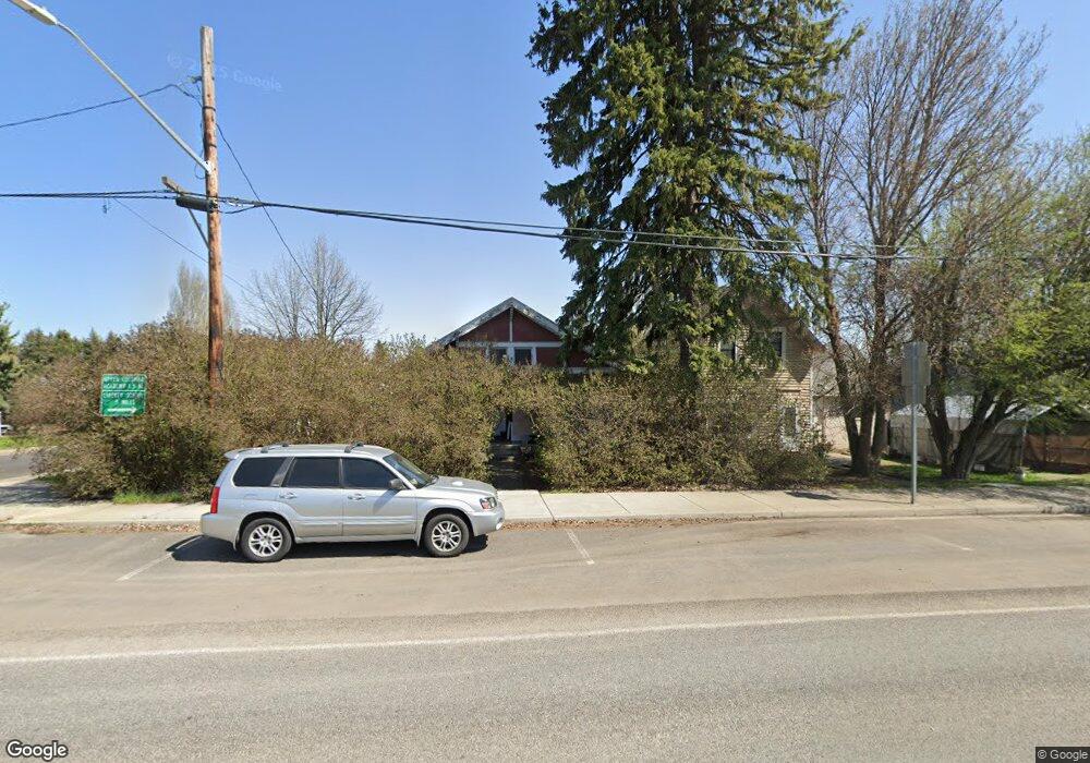
100 S Main St Spangle, WA 99031
Estimated Value: $198,000 - $327,000
3
Beds
1
Bath
1,818
Sq Ft
$142/Sq Ft
Est. Value
About This Home
This home is located at 100 S Main St, Spangle, WA 99031 and is currently estimated at $257,989, approximately $141 per square foot. 100 S Main St is a home located in Spokane County with nearby schools including Liberty Elementary/Junior High School, Liberty High School, and Upper Columbia Academy - Elementary School.
Ownership History
Date
Name
Owned For
Owner Type
Purchase Details
Closed on
Aug 2, 2006
Sold by
Hanson Kyle L and Hanson Kolby
Bought by
Twitt Eddie D and Arnold Twitt Rhonda J
Current Estimated Value
Purchase Details
Closed on
Apr 14, 2006
Sold by
Hanson Kyle
Bought by
Hanson Kolby
Purchase Details
Closed on
Oct 1, 2002
Sold by
Hanson Deborah A
Bought by
Hanson Kyle
Purchase Details
Closed on
Aug 27, 1999
Sold by
Hanson Kyle and Hanson Deborah
Bought by
Hanson Kyle L
Purchase Details
Closed on
May 25, 1999
Sold by
Newlun Sarah L
Bought by
Hanson Kyle L and Hanson Deborah A
Home Financials for this Owner
Home Financials are based on the most recent Mortgage that was taken out on this home.
Original Mortgage
$79,387
Interest Rate
6.86%
Create a Home Valuation Report for This Property
The Home Valuation Report is an in-depth analysis detailing your home's value as well as a comparison with similar homes in the area
Purchase History
| Date | Buyer | Sale Price | Title Company |
|---|---|---|---|
| Twitt Eddie D | $110,000 | Spokane County Title Co | |
| Hanson Kolby | -- | None Available | |
| Hanson Kyle | -- | First American Title Ins Co | |
| Hanson Kyle L | -- | -- | |
| Hanson Kyle L | $79,900 | Spokane County Title Co |
Source: Public Records
Mortgage History
| Date | Status | Borrower | Loan Amount |
|---|---|---|---|
| Previous Owner | Hanson Kyle L | $79,387 |
Source: Public Records
Tax History
| Year | Tax Paid | Tax Assessment Tax Assessment Total Assessment is a certain percentage of the fair market value that is determined by local assessors to be the total taxable value of land and additions on the property. | Land | Improvement |
|---|---|---|---|---|
| 2025 | $2,154 | $203,000 | $36,000 | $167,000 |
| 2024 | $2,154 | $223,300 | $30,000 | $193,300 |
| 2023 | $1,441 | $195,100 | $30,000 | $165,100 |
| 2022 | $1,456 | $170,500 | $25,000 | $145,500 |
| 2021 | $1,396 | $113,900 | $18,900 | $95,000 |
| 2020 | $1,369 | $107,300 | $18,000 | $89,300 |
| 2019 | $1,165 | $93,200 | $16,000 | $77,200 |
| 2018 | $1,234 | $84,700 | $12,000 | $72,700 |
| 2017 | $1,194 | $82,900 | $10,200 | $72,700 |
| 2016 | $1,076 | $80,200 | $10,200 | $70,000 |
| 2015 | $1,088 | $77,400 | $4,900 | $72,500 |
| 2014 | -- | $86,900 | $4,900 | $82,000 |
| 2013 | -- | $0 | $0 | $0 |
Source: Public Records
Map
Nearby Homes
- 365 N Pine St
- Lot 2 Nka Cheney Spangle Rd Unit Parcel 32085.9041
- 1112 E Jennings Rd
- 3013 E Watt Rd
- XXX E Cornwall Rd
- 102 E Cameron Rd
- 1403 W Jennings Rd
- 21608 S Mill Rd
- 20xxx S Parker Rd
- 22711 S Gateway Ln
- 18616 S Smythe Rd
- 0 Unassigned Address Rd Unit SAR202513397
- 4408 E Spangle Creek Rd
- 19212 S Aspen Meadows Dr
- 32311 S North Pine Creek Rd
- 27711 S Cheney Spangle Rd
- 20112 S Short Rd
- 17901 S Aspen Meadows Dr
- 16621 S Sherman Rd
- 15010 S Stentz Rd
Your Personal Tour Guide
Ask me questions while you tour the home.