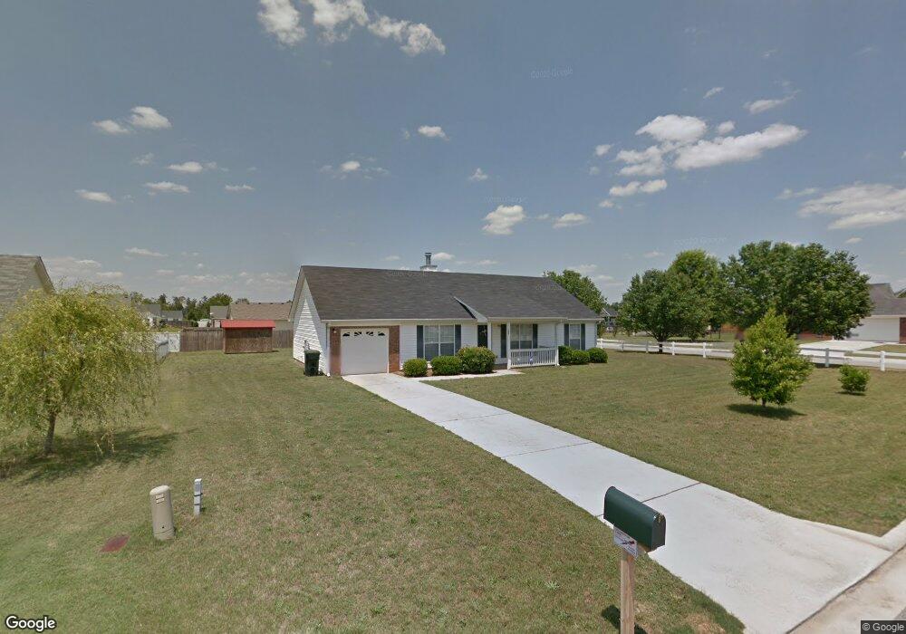
100 Shelby Ct Macon, GA 31216
Estimated Value: $205,764 - $240,000
3
Beds
2
Baths
1,458
Sq Ft
$154/Sq Ft
Est. Value
About This Home
This home is located at 100 Shelby Ct, Macon, GA 31216 and is currently estimated at $224,941, approximately $154 per square foot. 100 Shelby Ct is a home located in Bibb County with nearby schools including Heard Elementary School, Rutland Middle School, and Rutland High School.
Ownership History
Date
Name
Owned For
Owner Type
Purchase Details
Closed on
Dec 2, 2019
Sold by
Bennett Michelle
Bought by
Ellis Lewis B and Ellis Lorre N
Current Estimated Value
Home Financials for this Owner
Home Financials are based on the most recent Mortgage that was taken out on this home.
Original Mortgage
$132,554
Outstanding Balance
$116,595
Interest Rate
3.7%
Mortgage Type
FHA
Estimated Equity
$108,346
Purchase Details
Closed on
Sep 16, 2002
Bought by
Bennett Michelle
Create a Home Valuation Report for This Property
The Home Valuation Report is an in-depth analysis detailing your home's value as well as a comparison with similar homes in the area
Home Values in the Area
Average Home Value in this Area
Purchase History
| Date | Buyer | Sale Price | Title Company |
|---|---|---|---|
| Ellis Lewis B | $135,000 | None Available | |
| Bennett Michelle | $98,000 | -- |
Source: Public Records
Mortgage History
| Date | Status | Borrower | Loan Amount |
|---|---|---|---|
| Open | Ellis Lewis B | $132,554 |
Source: Public Records
Tax History Compared to Growth
Tax History
| Year | Tax Paid | Tax Assessment Tax Assessment Total Assessment is a certain percentage of the fair market value that is determined by local assessors to be the total taxable value of land and additions on the property. | Land | Improvement |
|---|---|---|---|---|
| 2025 | $1,334 | $67,246 | $10,000 | $57,246 |
| 2024 | $1,383 | $67,246 | $10,000 | $57,246 |
| 2023 | $738 | $59,828 | $10,000 | $49,828 |
| 2022 | $1,751 | $62,411 | $6,400 | $56,011 |
| 2021 | $1,242 | $44,442 | $5,250 | $39,192 |
| 2020 | $1,269 | $44,442 | $5,250 | $39,192 |
| 2019 | $1,167 | $36,818 | $2,500 | $34,318 |
| 2018 | $1,684 | $32,085 | $2,500 | $29,585 |
| 2017 | $940 | $32,085 | $2,500 | $29,585 |
| 2016 | $868 | $32,085 | $2,500 | $29,585 |
| 2015 | $1,229 | $32,085 | $2,500 | $29,585 |
| 2014 | $1,231 | $32,085 | $2,500 | $29,585 |
Source: Public Records
Map
Nearby Homes
- 436 Joseph Chandler Dr
- 411 Bob White Rd
- 428 Bob White Rd
- 465 Bob White Rd
- 813 Ocala National Trail
- 708 Coopers Lnd
- 330 Cody Dr
- 328 Cody Dr
- 102 Haylie Ct
- 405 Stonecrest Ct
- 104 Alayna Ct
- DUPONT Plan at Quail Ridge
- GARDNER Plan at Quail Ridge
- KINGSTON Plan at Quail Ridge
- ESSEX Plan at Quail Ridge
- 408 Resting Fawn Place
- 318 Cody Dr
- Jodeco Plan at Goodall Woods
- Sierra Plan at Goodall Woods
- 104 Shelby Ct
- 196 Mason Philip Dr
- 192 Mason Philip Dr
- 101 Sarakay Cir
- 108 Shelby Ct
- 101 Shelby Ct
- 200 Mason Philip Dr
- 188 Mason Philip Dr
- 105 Shelby Ct
- 0 Shelby Ct Unit 8593203
- 0 Shelby Ct Unit 8298811
- 0 Shelby Ct Unit 8606603
- 0 Shelby Ct Unit 7010441
- 100 Sarakay Cir
- 110 Shelby Ct
- 105 Sarakay Cir
- 109 Shelby Ct
- 182 Mason Philip Dr
- 204 Mason Philip Dr
- 195 Mason Philip Dr