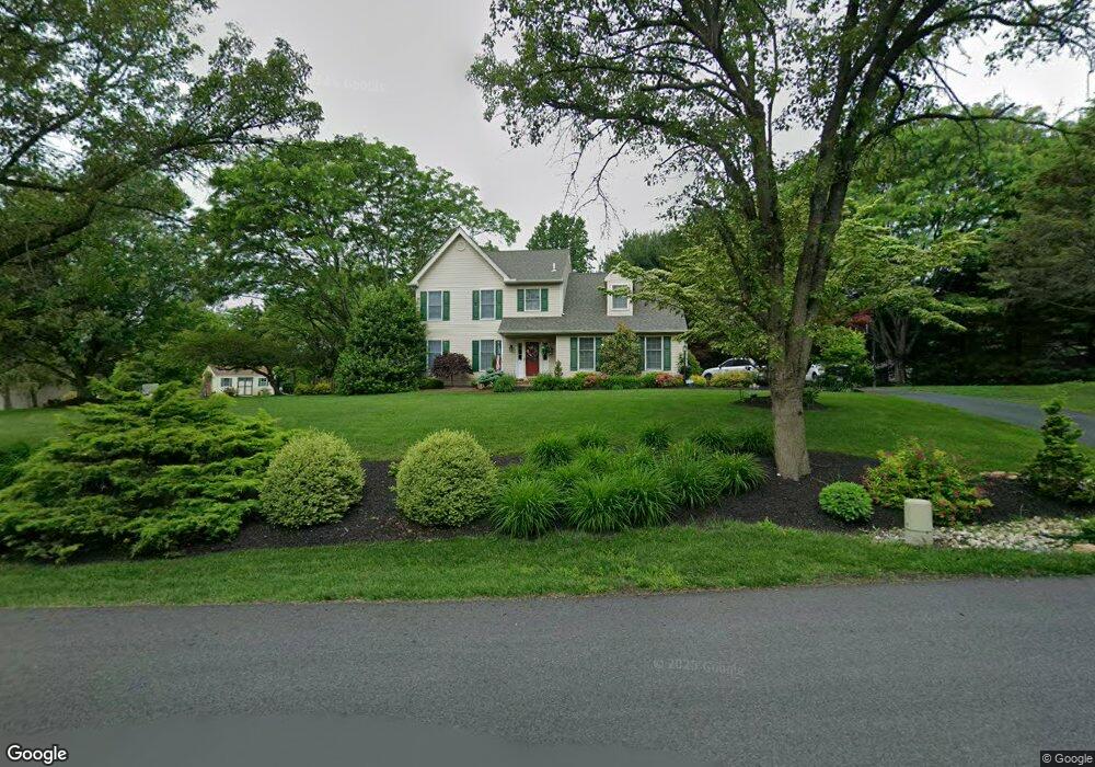
100 Shepherd Ln Lincoln University, PA 19352
Estimated Value: $519,000 - $606,000
3
Beds
3
Baths
2,549
Sq Ft
$223/Sq Ft
Est. Value
About This Home
This home is located at 100 Shepherd Ln, Lincoln University, PA 19352 and is currently estimated at $569,256, approximately $223 per square foot. 100 Shepherd Ln is a home located in Chester County with nearby schools including Penn London Elementary School, Avon Grove Intermediate School, and Fred S Engle Middle School.
Ownership History
Date
Name
Owned For
Owner Type
Purchase Details
Closed on
Sep 28, 2009
Sold by
Harkins Andrea L and Davis Andrea L
Bought by
Davis Andrea L
Current Estimated Value
Home Financials for this Owner
Home Financials are based on the most recent Mortgage that was taken out on this home.
Original Mortgage
$268,200
Outstanding Balance
$175,220
Interest Rate
5.09%
Mortgage Type
New Conventional
Estimated Equity
$394,036
Create a Home Valuation Report for This Property
The Home Valuation Report is an in-depth analysis detailing your home's value as well as a comparison with similar homes in the area
Home Values in the Area
Average Home Value in this Area
Purchase History
| Date | Buyer | Sale Price | Title Company |
|---|---|---|---|
| Davis Andrea L | -- | Old Republic National Title |
Source: Public Records
Mortgage History
| Date | Status | Borrower | Loan Amount |
|---|---|---|---|
| Open | Davis Andrea L | $268,200 |
Source: Public Records
Tax History Compared to Growth
Tax History
| Year | Tax Paid | Tax Assessment Tax Assessment Total Assessment is a certain percentage of the fair market value that is determined by local assessors to be the total taxable value of land and additions on the property. | Land | Improvement |
|---|---|---|---|---|
| 2025 | $7,188 | $177,470 | $36,590 | $140,880 |
| 2024 | $7,188 | $177,470 | $36,590 | $140,880 |
| 2023 | $6,948 | $177,470 | $36,590 | $140,880 |
| 2022 | $6,934 | $177,470 | $36,590 | $140,880 |
| 2021 | $6,790 | $177,470 | $36,590 | $140,880 |
| 2020 | $6,563 | $177,470 | $36,590 | $140,880 |
| 2019 | $6,399 | $177,470 | $36,590 | $140,880 |
| 2018 | $6,236 | $177,470 | $36,590 | $140,880 |
| 2017 | $6,107 | $177,470 | $36,590 | $140,880 |
| 2016 | $5,009 | $177,470 | $36,590 | $140,880 |
| 2015 | $5,009 | $177,470 | $36,590 | $140,880 |
| 2014 | $5,009 | $177,470 | $36,590 | $140,880 |
Source: Public Records
Map
Nearby Homes
- 12 Owenwood Dr
- 200 Armitage Ct
- 570 Lewisville Rd
- 132 Hess Mill Rd
- 1005 Oxford Rd
- Sebastian Plan at Lexington Point
- Savannah Plan at Lexington Point
- Nottingham Plan at Lexington Point
- Covington Plan at Lexington Point
- Arcadia Plan at Lexington Point
- Ethan Plan at Lexington Point
- Magnolia Plan at Lexington Point
- Caldwell Plan at Lexington Point
- Andrews Plan at Lexington Point
- Kipling Plan at Lexington Point
- Lachlan Plan at Lexington Point
- Devonshire Plan at Lexington Point
- Hawthorne Plan at Lexington Point
- Augusta Plan at Lexington Point
- Woodford Plan at Lexington Point