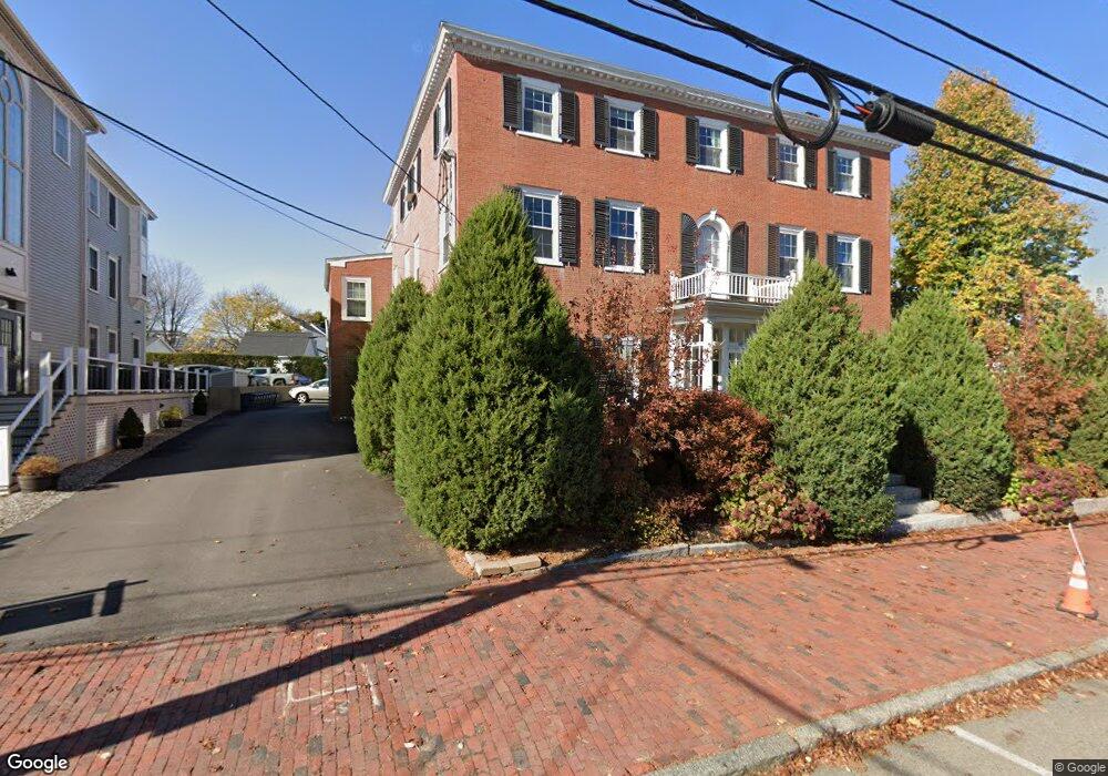
100 State St Unit 5 1 Newburyport, MA 01950
Estimated Value: $650,000 - $736,013
3
Beds
2
Baths
1,100
Sq Ft
$635/Sq Ft
Est. Value
About This Home
This home is located at 100 State St Unit 5 1, Newburyport, MA 01950 and is currently estimated at $698,753, approximately $635 per square foot. 100 State St Unit 5 1 is a home located in Essex County with nearby schools including Francis T. Bresnahan Elementary School, Edward G. Molin Elementary School, and Rupert A. Nock Middle School.
Ownership History
Date
Name
Owned For
Owner Type
Purchase Details
Closed on
Apr 22, 2014
Sold by
Teneriello Steven
Bought by
Malloy James
Current Estimated Value
Purchase Details
Closed on
May 28, 2010
Sold by
Conway Pamela A
Bought by
Teneriello Steven
Home Financials for this Owner
Home Financials are based on the most recent Mortgage that was taken out on this home.
Original Mortgage
$317,968
Interest Rate
4.87%
Mortgage Type
FHA
Purchase Details
Closed on
Dec 14, 2001
Sold by
Fitch James P
Bought by
Conway Pamela A
Purchase Details
Closed on
Mar 1, 2000
Sold by
Ghamami Sheila E
Bought by
Fitch James P
Purchase Details
Closed on
Feb 13, 1998
Sold by
100 State St Rt and Guertin Ronald P
Bought by
Ghamami Sheila E
Create a Home Valuation Report for This Property
The Home Valuation Report is an in-depth analysis detailing your home's value as well as a comparison with similar homes in the area
Home Values in the Area
Average Home Value in this Area
Purchase History
| Date | Buyer | Sale Price | Title Company |
|---|---|---|---|
| Malloy James | $369,500 | -- | |
| Teneriello Steven | $329,000 | -- | |
| Conway Pamela A | $269,900 | -- | |
| Fitch James P | $238,900 | -- | |
| Ghamami Sheila E | $159,900 | -- |
Source: Public Records
Mortgage History
| Date | Status | Borrower | Loan Amount |
|---|---|---|---|
| Previous Owner | Ghamami Sheila E | $317,968 | |
| Previous Owner | Ghamami Sheila E | $50,000 |
Source: Public Records
Tax History Compared to Growth
Tax History
| Year | Tax Paid | Tax Assessment Tax Assessment Total Assessment is a certain percentage of the fair market value that is determined by local assessors to be the total taxable value of land and additions on the property. | Land | Improvement |
|---|---|---|---|---|
| 2025 | $5,745 | $599,700 | $0 | $599,700 |
| 2024 | $5,608 | $562,500 | $0 | $562,500 |
| 2023 | $5,588 | $520,300 | $0 | $520,300 |
| 2022 | $5,456 | $454,300 | $0 | $454,300 |
| 2021 | $5,419 | $428,700 | $0 | $428,700 |
| 2020 | $5,213 | $406,000 | $0 | $406,000 |
| 2019 | $4,418 | $337,800 | $0 | $337,800 |
| 2018 | $4,347 | $327,800 | $0 | $327,800 |
| 2017 | $4,802 | $357,000 | $0 | $357,000 |
| 2016 | $4,518 | $337,400 | $0 | $337,400 |
| 2015 | $4,042 | $303,000 | $0 | $303,000 |
Source: Public Records
Map
Nearby Homes
- 105 State St Unit 301
- 105 State St Unit 101
- 105 State St Unit 201
- 95 High St Unit 4
- 95 High St Unit 1
- 11 Charter St
- 1 Hill St
- 1 Hill St Unit 1
- 2 Court St Unit 4
- 10 10th St
- 11 Orange St Unit 2
- 42 Federal St Unit B
- 58 Merrimac St Unit 2-5
- 30-32 Water St Unit 4
- 58 Lime St Unit 5
- 44 Washington St Unit C
- 41 Washington St Unit B
- 57 Lime St Unit 1
- 45 Boardman St Unit 1
- 113 Prospect St Unit B
- 100 State St Unit 9
- 100 State St Unit 7
- 100 State St Unit 6
- 100 State St Unit 5
- 100 State St Unit 4
- 100 State St Unit 3
- 100 State St Unit 2
- 100 State St Unit 1
- 100 State St Unit 6 1
- 102 State St Unit E
- 102 State St Unit D
- 102 State St Unit C
- 102 State St Unit B
- 102 State St Unit A
- 102 State St Unit G
- 102 State St
- 102 State St Unit F
- 1 Harris St Unit 3
- 1 Harris St Unit 6
- 1 Harris St Unit 6&7