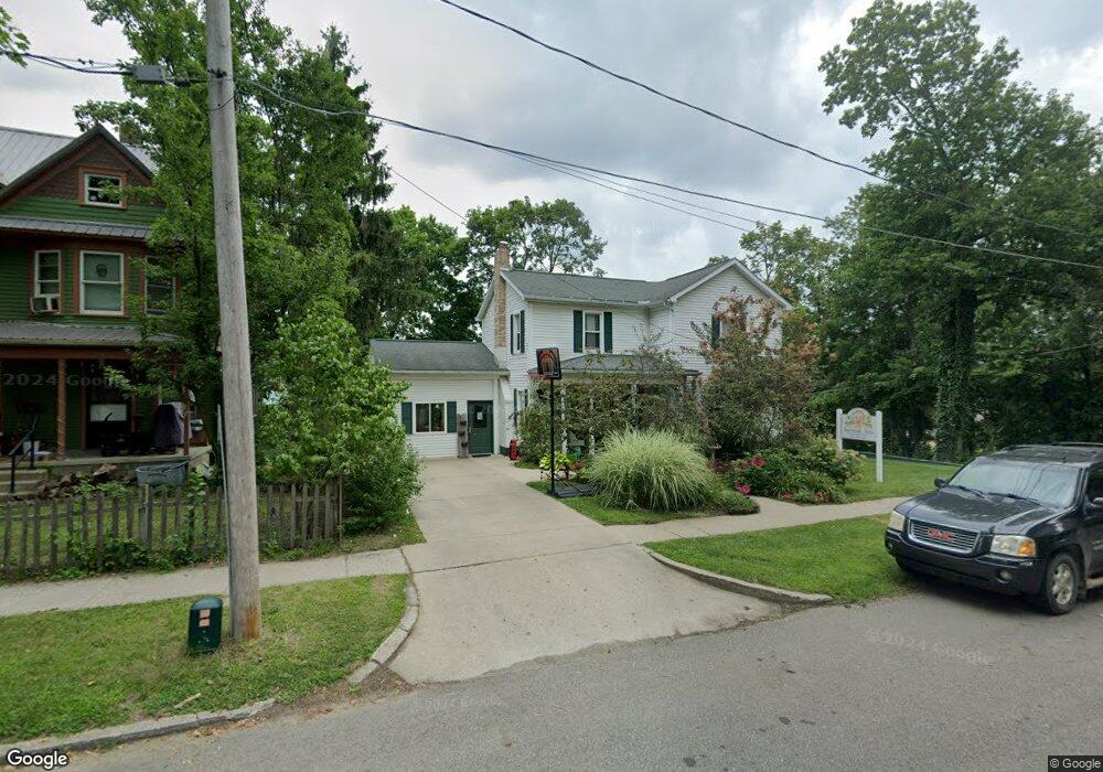
100 Summit St Hudson, MI 49247
Estimated Value: $149,000 - $162,000
3
Beds
2
Baths
1,589
Sq Ft
$99/Sq Ft
Est. Value
About This Home
This home is located at 100 Summit St, Hudson, MI 49247 and is currently estimated at $157,860, approximately $99 per square foot. 100 Summit St is a home located in Lenawee County with nearby schools including Lincoln Elementary School, Southern Michigan Center For Science & Industry (SMCSI), and Hudson Middle School.
Ownership History
Date
Name
Owned For
Owner Type
Purchase Details
Closed on
Feb 24, 2009
Sold by
Citimortgage Inc
Bought by
Cole Jordan E and Cole Catherine R
Current Estimated Value
Home Financials for this Owner
Home Financials are based on the most recent Mortgage that was taken out on this home.
Original Mortgage
$55,998
Outstanding Balance
$35,532
Interest Rate
5.09%
Mortgage Type
Commercial
Estimated Equity
$122,328
Purchase Details
Closed on
Apr 10, 2008
Sold by
Osborn Derick and Osborn Jennifer
Bought by
Citifinanceial Mortgage Comapny Inc
Create a Home Valuation Report for This Property
The Home Valuation Report is an in-depth analysis detailing your home's value as well as a comparison with similar homes in the area
Home Values in the Area
Average Home Value in this Area
Purchase History
| Date | Buyer | Sale Price | Title Company |
|---|---|---|---|
| Cole Jordan E | $54,900 | First American Title Insuran | |
| Citifinanceial Mortgage Comapny Inc | $44,900 | None Available |
Source: Public Records
Mortgage History
| Date | Status | Borrower | Loan Amount |
|---|---|---|---|
| Open | Cole Jordan E | $55,998 |
Source: Public Records
Tax History
| Year | Tax Paid | Tax Assessment Tax Assessment Total Assessment is a certain percentage of the fair market value that is determined by local assessors to be the total taxable value of land and additions on the property. | Land | Improvement |
|---|---|---|---|---|
| 2025 | $1,617 | $77,600 | $0 | $0 |
| 2023 | $13 | $65,300 | $0 | $0 |
| 2021 | $1,392 | $56,000 | $0 | $0 |
| 2020 | $1,295 | $33,400 | $0 | $0 |
| 2019 | $101,606 | $33,400 | $0 | $0 |
| 2018 | $1,220 | $63,324 | $0 | $0 |
| 2017 | $1,270 | $63,734 | $0 | $0 |
| 2016 | $1,210 | $34,657 | $0 | $0 |
Source: Public Records
Map
Nearby Homes
- 143 Lafayette St
- 200 Grove St
- 207 N Church St
- 110 Hill St
- 324 Railroad St
- 321 S Wood St
- 310 School St
- 14700 Hudson Rd
- 437 Mckenzie St
- 560 State St
- 645 S Meridian Rd
- 14300 Union Rd
- 792 Meadowbrook Dr
- 3120 N Posey Lake Hwy
- 14940 Medina Rd
- 7100 S Waldron Rd
- 14000 Medina Rd
- 15000 Blk Medina Rd
- 18430 Forrister Rd
- 18000 blk #1 Forrister Rd
- 512 S Market St
- 520 S Market St
- 517 S Market St
- 511 S Market St
- 507 S Market St
- 521 S Market St
- 500 S Market St
- 501 S Market St
- 104 Summit St
- 415 S Church St
- 403 S Church St
- 425 S Church St
- 427 S Church St
- 120 Pleasant St
- 319 S Church St
- 100 Pleasant St
- 100 Pleasant St Unit BLK
- 410 S Church St
- 414 S Church St
- 420 S Church St
Your Personal Tour Guide
Ask me questions while you tour the home.