100 Tower Dr Stevensville, MD 21666
Estimated Value: $633,000 - $721,000
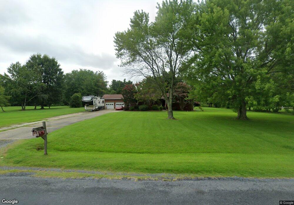
About This Home
This home is located at 100 Tower Dr, Stevensville, MD 21666 and is currently estimated at $672,566, approximately $322 per square foot. 100 Tower Dr is a home located in Queen Anne's County with nearby schools including Matapeake Elementary School, Matapeake Middle School, and Kent Island High School.
Ownership History
We collect this data history from publicly available records. To have your information removed, we recommend requesting removal directly through your county’s website.
Purchase Details
Purchase Details
Purchase Details
Purchase Details
Purchase Details
Purchase History
We collect this data history from publicly available records. To have your information removed, we recommend requesting removal directly through your county’s website.
| Date | Buyer | Sale Price | Title Company |
|---|---|---|---|
| $400,500 | -- | ||
| $400,500 | -- | ||
| -- | -- | ||
| -- | -- | ||
| -- | -- |
Mortgage History
We collect this data history from publicly available records. To have your information removed, we recommend requesting removal directly through your county’s website.
| Date | Status | Borrower | Loan Amount |
|---|---|---|---|
| Closed | -- |
Tax History
We collect this data history from publicly available records. To have your information removed, we recommend requesting removal directly through your county’s website.
| Year | Tax Paid | Tax Assessment Tax Assessment Total Assessment is a certain percentage of the fair market value that is determined by local assessors to be the total taxable value of land and additions on the property. | Land | Improvement |
|---|---|---|---|---|
| 2025 | $4,506 | $478,333 | $0 | $0 |
| 2024 | $4,173 | $442,967 | $0 | $0 |
| 2023 | $3,900 | $407,600 | $165,700 | $241,900 |
| 2022 | $3,841 | $401,367 | $0 | $0 |
| 2021 | $3,790 | $395,133 | $0 | $0 |
| 2020 | $3,790 | $388,900 | $160,700 | $228,200 |
| 2019 | $3,738 | $383,467 | $0 | $0 |
| 2018 | $3,686 | $378,033 | $0 | $0 |
| 2017 | $3,634 | $372,600 | $0 | $0 |
| 2016 | -- | $372,600 | $0 | $0 |
| 2015 | $3,688 | $372,600 | $0 | $0 |
| 2014 | $3,688 | $387,100 | $0 | $0 |
Map
- 114 N Lake Dr
- Lot 1 - E/Kent Point Romancoke
- 0 Touhey Dr Unit MDQA2016822
- 121 Margaret Dr
- Lot 8 Ackerman Dr
- 0 Ackerman Dr
- 201 Ackerman Dr
- 101 Beachside Dr
- 000 Romancoke Rd
- 115 NW Creek Dr
- 102 Golf Ct
- 111 Utah Rd
- 9401 Romancoke Rd
- 132 Cecil Rd
- 301 Penny Dr
- 400 Beachside Dr
- 317 Virginia Rd
- 713 Bay Dr
- 132 Tanners Point Dr
- 101 Queen Anne Rd
Ask me questions while you tour the home.