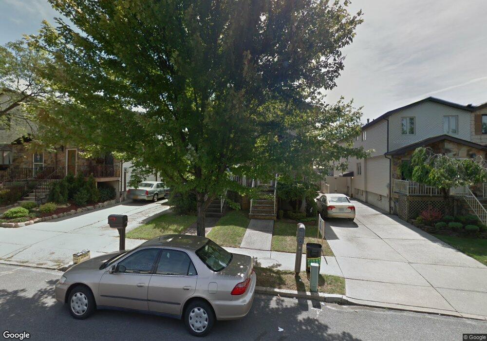
100 Travis Ave Staten Island, NY 10314
New Springville NeighborhoodEstimated Value: $722,923 - $816,000
3
Beds
4
Baths
1,362
Sq Ft
$558/Sq Ft
Est. Value
About This Home
This home is located at 100 Travis Ave, Staten Island, NY 10314 and is currently estimated at $760,231, approximately $558 per square foot. 100 Travis Ave is a home located in Richmond County with nearby schools including P.S. 69 - Daniel D. Tompkins, Is 72 Rocco Laurie, and Susan E Wagner High School.
Ownership History
Date
Name
Owned For
Owner Type
Purchase Details
Closed on
May 17, 2000
Sold by
Ling Mark Frank Chan and Ling Mark Yu
Bought by
Hau Christine
Current Estimated Value
Home Financials for this Owner
Home Financials are based on the most recent Mortgage that was taken out on this home.
Original Mortgage
$128,000
Interest Rate
8.24%
Create a Home Valuation Report for This Property
The Home Valuation Report is an in-depth analysis detailing your home's value as well as a comparison with similar homes in the area
Home Values in the Area
Average Home Value in this Area
Purchase History
| Date | Buyer | Sale Price | Title Company |
|---|---|---|---|
| Hau Christine | $214,000 | -- |
Source: Public Records
Mortgage History
| Date | Status | Borrower | Loan Amount |
|---|---|---|---|
| Closed | Hau Christine | $128,000 |
Source: Public Records
Tax History Compared to Growth
Tax History
| Year | Tax Paid | Tax Assessment Tax Assessment Total Assessment is a certain percentage of the fair market value that is determined by local assessors to be the total taxable value of land and additions on the property. | Land | Improvement |
|---|---|---|---|---|
| 2025 | $5,421 | $41,040 | $5,720 | $35,320 |
| 2024 | $5,433 | $38,160 | $5,803 | $32,357 |
| 2023 | $5,155 | $26,784 | $5,544 | $21,240 |
| 2022 | $5,060 | $32,880 | $7,800 | $25,080 |
| 2021 | $5,291 | $34,320 | $7,800 | $26,520 |
| 2020 | $5,012 | $31,680 | $7,800 | $23,880 |
| 2019 | $4,656 | $27,540 | $7,800 | $19,740 |
| 2018 | $4,252 | $22,320 | $6,349 | $15,971 |
| 2017 | $4,250 | $22,320 | $7,309 | $15,011 |
| 2016 | $4,118 | $22,151 | $6,776 | $15,375 |
| 2015 | $3,479 | $20,898 | $5,237 | $15,661 |
| 2014 | $3,479 | $19,716 | $5,931 | $13,785 |
Source: Public Records
Map
Nearby Homes
- 110 Lewiston St
- 86 Evans St
- 49 Lewiston St
- 36 Bogota St
- 9 Furness Place
- 63 Bogota St
- 22 Braisted Ave
- 44 McVeigh Ave
- 43 Bogota St
- 41 Furness Place
- 1372 Forest Hill Rd Unit 1b
- 1372 Forest Hill Rd Unit 1a
- 63 Monahan Ave
- 45 Braisted Ave
- 23 Bangor St
- 507 Klondike Ave
- 4 Bangor St
- 143 Monahan Ave
- 42 Greenway Ave
- 72 Bangor St
- 96 Travis Ave
- 102 Travis Ave
- 106 Travis Ave
- 92 Travis Ave
- 108 Travis Ave
- 102 Lewiston St
- 112 Travis Ave
- 114 Travis Ave
- 104 Lewiston St
- 118 Travis Ave
- 106 Lewiston St
- 103 Lewiston St
- 120 Travis Ave
- 105 Lewiston St
- 108 Lewiston St
- 99 Lewiston St
- 95 Lewiston St
- 101 Lewiston St
- 93 Lewiston St
- 91 Lewiston St