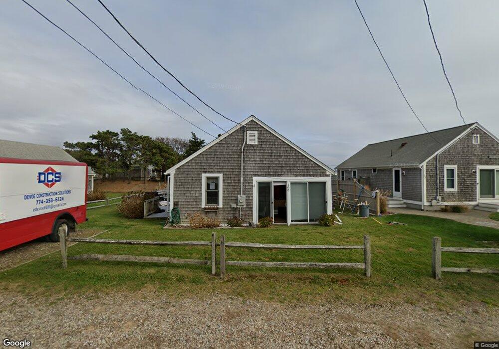
100 Uncle Rolf Rd Dennis Port, MA 02639
Dennis Port NeighborhoodEstimated Value: $569,000 - $666,036
3
Beds
1
Bath
800
Sq Ft
$796/Sq Ft
Est. Value
About This Home
This home is located at 100 Uncle Rolf Rd, Dennis Port, MA 02639 and is currently estimated at $637,009, approximately $796 per square foot. 100 Uncle Rolf Rd is a home located in Barnstable County with nearby schools including Dennis-Yarmouth Regional High School and St. Pius X. School.
Ownership History
Date
Name
Owned For
Owner Type
Purchase Details
Closed on
Jan 7, 2025
Sold by
Caron Catherine M
Bought by
Catherine M Caron Lt and Caron
Current Estimated Value
Purchase Details
Closed on
Apr 2, 1990
Sold by
Webster Arthur J
Bought by
Speca Bruce R
Home Financials for this Owner
Home Financials are based on the most recent Mortgage that was taken out on this home.
Original Mortgage
$118,400
Interest Rate
9.96%
Mortgage Type
Purchase Money Mortgage
Create a Home Valuation Report for This Property
The Home Valuation Report is an in-depth analysis detailing your home's value as well as a comparison with similar homes in the area
Home Values in the Area
Average Home Value in this Area
Purchase History
| Date | Buyer | Sale Price | Title Company |
|---|---|---|---|
| Catherine M Caron Lt | -- | None Available | |
| Speca Bruce R | $148,000 | -- | |
| Speca Bruce R | $148,000 | -- |
Source: Public Records
Mortgage History
| Date | Status | Borrower | Loan Amount |
|---|---|---|---|
| Previous Owner | Speca Bruce R | $118,400 |
Source: Public Records
Tax History Compared to Growth
Tax History
| Year | Tax Paid | Tax Assessment Tax Assessment Total Assessment is a certain percentage of the fair market value that is determined by local assessors to be the total taxable value of land and additions on the property. | Land | Improvement |
|---|---|---|---|---|
| 2025 | $2,504 | $578,200 | $302,500 | $275,700 |
| 2024 | $2,357 | $536,900 | $290,900 | $246,000 |
| 2023 | $2,279 | $488,100 | $264,500 | $223,600 |
| 2022 | $2,324 | $415,000 | $249,300 | $165,700 |
| 2021 | $4,198 | $380,400 | $244,400 | $136,000 |
| 2020 | $2,410 | $395,000 | $271,600 | $123,400 |
| 2019 | $2,327 | $377,100 | $266,300 | $110,800 |
| 2018 | $3,528 | $314,700 | $212,900 | $101,800 |
| 2017 | $3,294 | $311,400 | $213,000 | $98,400 |
| 2016 | $1,905 | $291,800 | $207,900 | $83,900 |
| 2015 | $1,868 | $291,800 | $207,900 | $83,900 |
| 2014 | $1,821 | $286,700 | $202,800 | $83,900 |
Source: Public Records
Map
Nearby Homes
- 154 Old Wharf Rd Unit 26
- 154 Old Wharf Rd Unit 14
- 112 Old Wharf Rd Unit E4
- 112 Old Wharf Rd Unit E1
- 37 Ocean Dr Unit 2
- 10 Grindell Ave
- 217 Old Wharf Rd Unit 64
- 230 Old Wharf Rd Unit 272
- 241 Old Wharf Rd Unit 82
- 241 Old Wharf Rd Unit 127
- 262 Old Wharf Rd Unit 67
- 262 Old Wharf Rd Unit 5
- 262 Old Wharf Rd Unit 5
- 262 Old Wharf Rd Unit 87
- 27 Mayflower Ln
- 37 Beach Hills Rd
- 37-A Beach Hills Rd
- 18 Holiday Ln
- 6 Baker Way
- 22 Ferncliff Rd
- 96 Uncle Rolf Rd
- 104 Uncle Rolf Rd
- 215 Captain Chase Rd
- 120 Sea Winds Condo Unit 7
- 130 Old Wharf Rd
- 94 Uncle Rolf Rd
- 124 Old Wharf Rd Unit 6
- 124 Old Wharf Rd Unit 5
- 124 Old Wharf Rd Unit 4
- 124 Old Wharf Rd Unit 3
- 124 Old Wharf Rd Unit 2
- 124 Old Wharf Rd Unit 1
- 124 Old Wharf Rd
- 213 Captain Chase Rd
- 134 Old Wharf Rd
- 14 Uncle Rolf Rd
- 97 Uncle Rolf Rd
- 95 Uncle Rolf Rd
- 95 Uncle Rolf Rd Unit 1
- 209 Captain Chase Rd