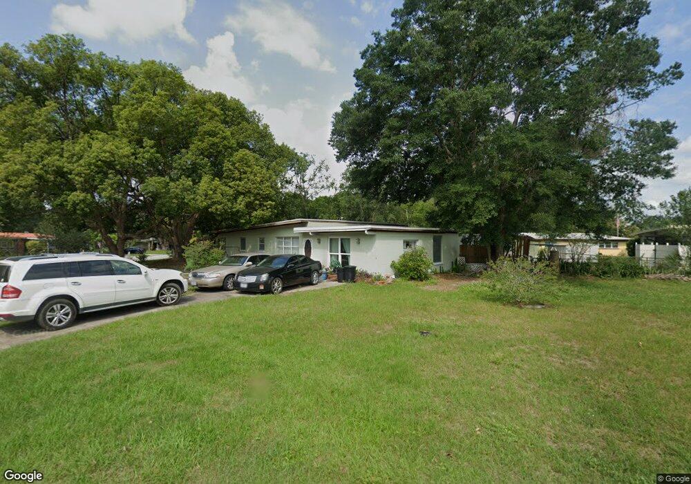
100 W 30th St Sanford, FL 32773
Estimated Value: $240,085 - $281,000
3
Beds
1
Bath
1,648
Sq Ft
$154/Sq Ft
Est. Value
About This Home
This home is located at 100 W 30th St, Sanford, FL 32773 and is currently estimated at $253,771, approximately $153 per square foot. 100 W 30th St is a home located in Seminole County with nearby schools including Pine Crest Elementary School, Seminole High School, and Midway Elementary School.
Ownership History
Date
Name
Owned For
Owner Type
Purchase Details
Closed on
Jul 11, 2016
Sold by
Dodson Larry A
Bought by
Dodson Larry A and Dodson Mary S
Current Estimated Value
Purchase Details
Closed on
May 17, 2016
Sold by
Smith Madge D and Crocker Chritina L
Bought by
Dodson Karry A
Purchase Details
Closed on
May 1, 2016
Bought by
Dodson Larry A and Dodson Mary S
Purchase Details
Closed on
Apr 27, 2001
Sold by
Edith J Dodson I
Bought by
Dodson Edith J and Smith Madge D
Purchase Details
Closed on
Apr 1, 2001
Bought by
Dodson Larry A and Dodson Mary S
Purchase Details
Closed on
Nov 1, 1994
Sold by
Dodson Emily Allman
Bought by
Dodson Edith Jane
Create a Home Valuation Report for This Property
The Home Valuation Report is an in-depth analysis detailing your home's value as well as a comparison with similar homes in the area
Home Values in the Area
Average Home Value in this Area
Purchase History
| Date | Buyer | Sale Price | Title Company |
|---|---|---|---|
| Dodson Larry A | -- | None Available | |
| Dodson Karry A | -- | None Available | |
| Dodson Larry A | $100 | -- | |
| Dodson Edith J | -- | -- | |
| Dodson Larry A | $100 | -- | |
| Dodson Edith Jane | -- | -- |
Source: Public Records
Tax History Compared to Growth
Tax History
| Year | Tax Paid | Tax Assessment Tax Assessment Total Assessment is a certain percentage of the fair market value that is determined by local assessors to be the total taxable value of land and additions on the property. | Land | Improvement |
|---|---|---|---|---|
| 2024 | $561 | $72,552 | -- | -- |
| 2023 | $554 | $70,439 | $0 | $0 |
| 2021 | $552 | $66,395 | $0 | $0 |
| 2020 | $551 | $65,478 | $0 | $0 |
| 2019 | $550 | $64,006 | $0 | $0 |
| 2018 | $550 | $62,813 | $0 | $0 |
| 2017 | $552 | $61,521 | $0 | $0 |
| 2016 | $534 | $57,660 | $0 | $0 |
| 2015 | $540 | $53,989 | $0 | $0 |
| 2014 | $526 | $53,561 | $0 | $0 |
Source: Public Records
Map
Nearby Homes
- 700 E Airport Blvd Unit G6
- 700 E Airport Blvd Unit B7
- 3105 S Park Ave
- 118 W Woodland Dr
- 2907 S Sanford Ave
- 300 Hibiscus Dr
- 2800 S Park Ave
- 122 W Coleman Cir
- 2829 S Sanford Ave
- 2808 S French Ave
- 0 S Sanford Ave Unit MFRO6297224
- 208 E 28th St
- 211 Woodmere Blvd
- 3408 S Sanford Ave
- 278 Carina Cir
- 409 E Mattie St
- 2647 S Myrtle Ave
- 104 Augustus Point
- 2638 S Laurel Ave
- 229 Carina Cir
- 102 W 30th St
- 2912 S Park Ct
- 2910 S Park Ct
- 104 W 30th St
- 2909 S Park Ave
- 3000 S Park Ave
- 103 W 30th St
- 2907 S Park Ave
- 2911 S Park Ave
- 2908 S Park Ct
- 106 W 30th St
- 2905 S Park Ave
- 105 W 30th St
- 3001 S Park Ave
- 3006 S Park Ave
- 107 W 30th St
- 2903 S Park Ave
- 3003 S Park Ave
- 2928 S Magnolia Ave
- 2910 S Magnolia Ave