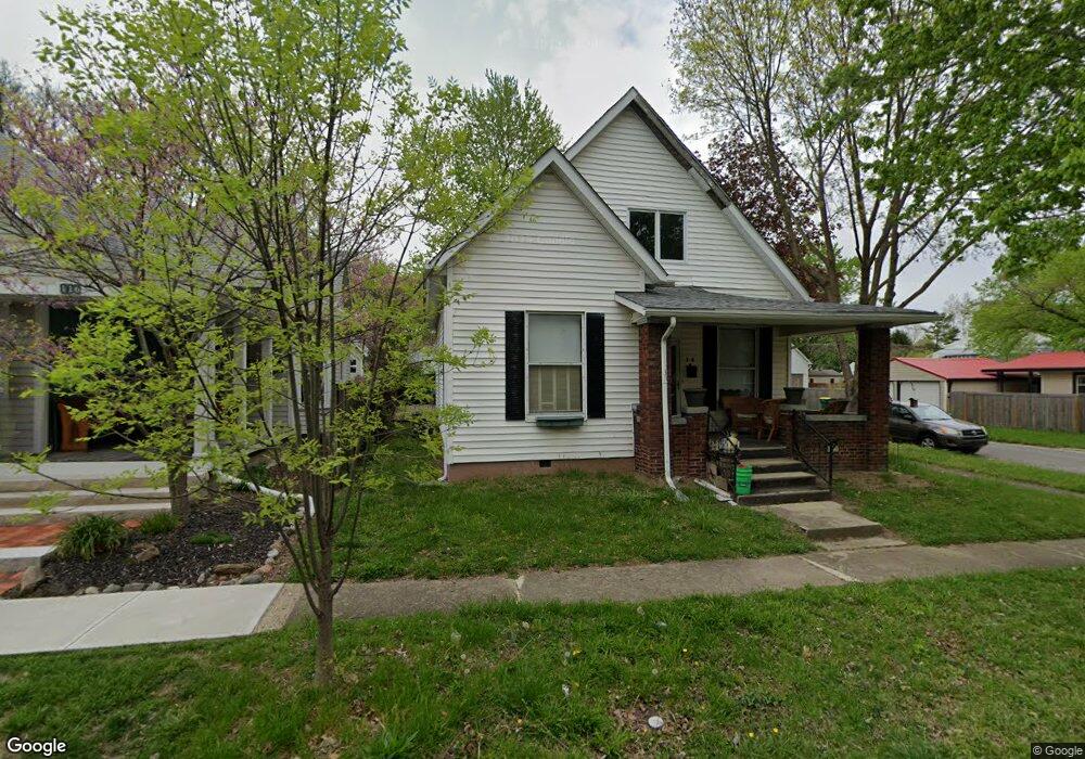
100 W Adams St Franklin, IN 46131
Estimated Value: $203,000 - $230,000
2
Beds
1
Bath
2,078
Sq Ft
$104/Sq Ft
Est. Value
About This Home
This home is located at 100 W Adams St, Franklin, IN 46131 and is currently estimated at $217,107, approximately $104 per square foot. 100 W Adams St is a home located in Johnson County with nearby schools including Northwood Elementary School, Franklin Community Middle School, and Custer Baker Intermediate School.
Ownership History
Date
Name
Owned For
Owner Type
Purchase Details
Closed on
Sep 20, 2021
Sold by
Chupp Christina K
Bought by
Chupp Christina K and Chupp Nathan
Current Estimated Value
Purchase Details
Closed on
Oct 6, 2020
Sold by
Chupp Daniel J and Chupp Christina K
Bought by
Chupp Christina K
Purchase Details
Closed on
Oct 3, 2005
Sold by
Secretary Of Hud
Bought by
Chupp Daniel J and Chupp Christina K
Purchase Details
Closed on
Mar 31, 2005
Sold by
Mortgage Electronic Systems Inc
Bought by
Secretary Of Hud
Purchase Details
Closed on
Feb 17, 2005
Sold by
Clark Sherri W
Bought by
Mortgage Electronic Registration Systems
Create a Home Valuation Report for This Property
The Home Valuation Report is an in-depth analysis detailing your home's value as well as a comparison with similar homes in the area
Home Values in the Area
Average Home Value in this Area
Purchase History
| Date | Buyer | Sale Price | Title Company |
|---|---|---|---|
| Chupp Christina K | -- | None Available | |
| Chupp Christina K | -- | None Available | |
| Chupp Daniel J | -- | Village Title Inc | |
| Secretary Of Hud | -- | None Available | |
| Mortgage Electronic Registration Systems | $105,401 | None Available |
Source: Public Records
Tax History Compared to Growth
Tax History
| Year | Tax Paid | Tax Assessment Tax Assessment Total Assessment is a certain percentage of the fair market value that is determined by local assessors to be the total taxable value of land and additions on the property. | Land | Improvement |
|---|---|---|---|---|
| 2025 | $1,774 | $150,300 | $20,800 | $129,500 |
| 2024 | $1,774 | $162,200 | $21,300 | $140,900 |
| 2023 | $1,289 | $93,500 | $21,300 | $72,200 |
| 2022 | $971 | $93,500 | $21,300 | $72,200 |
| 2021 | $924 | $92,200 | $20,000 | $72,200 |
| 2020 | $943 | $92,200 | $20,000 | $72,200 |
| 2019 | $769 | $85,000 | $12,800 | $72,200 |
| 2018 | $1,347 | $85,000 | $12,800 | $72,200 |
| 2017 | $752 | $85,000 | $12,800 | $72,200 |
| 2016 | $677 | $95,200 | $12,800 | $82,400 |
| 2014 | $543 | $75,000 | $11,400 | $63,600 |
| 2013 | $543 | $75,000 | $14,200 | $60,800 |
Source: Public Records
Map
Nearby Homes
- 298 N Water St
- 199 Walnut St
- 0 W 900 Hwy Unit 202537998
- 147 E King St
- 751 Graham St
- 178 S Water St Unit F
- 348 Ohio St
- 76 E Wayne St Unit B
- 252 S Main St
- 698 Yandes St
- 351 Cincinnati St
- 750 Hurricane St
- 651 Hamilton Ave
- 998 E King St
- 123 14th St
- 1110 Hillview Dr
- 1121 E Adams Dr
- 772 Franklin Lakes Blvd
- 1624 Roberts Rd
- 1860 Churchill Rd