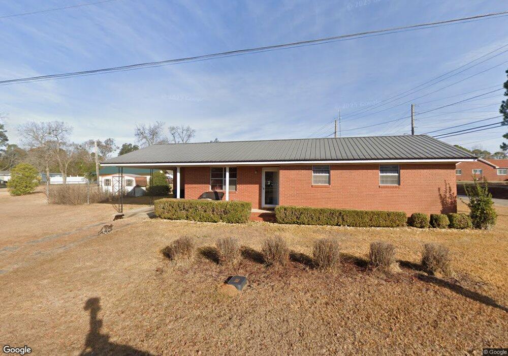
100 W Carr St Colquitt, GA 39837
Estimated Value: $83,592 - $140,000
3
Beds
1
Bath
1,104
Sq Ft
$106/Sq Ft
Est. Value
About This Home
This home is located at 100 W Carr St, Colquitt, GA 39837 and is currently estimated at $117,398, approximately $106 per square foot. 100 W Carr St is a home located in Miller County with nearby schools including Miller County Elementary School, Miller County Middle School, and Miller County High School.
Ownership History
Date
Name
Owned For
Owner Type
Purchase Details
Closed on
Oct 23, 2020
Sold by
Swearingain Barbara J
Bought by
Vaughn Richard M and Vaughn Vicky
Current Estimated Value
Purchase Details
Closed on
Feb 17, 2020
Sold by
Swearingain Barbara Jean
Bought by
Swearingain David D
Purchase Details
Closed on
Apr 2, 2010
Sold by
Phillips Nellie S
Bought by
Swearingain Walter and Swearingain Barbara J
Purchase Details
Closed on
Jul 19, 1996
Bought by
Phillips Nellie S Etal
Create a Home Valuation Report for This Property
The Home Valuation Report is an in-depth analysis detailing your home's value as well as a comparison with similar homes in the area
Home Values in the Area
Average Home Value in this Area
Purchase History
| Date | Buyer | Sale Price | Title Company |
|---|---|---|---|
| Vaughn Richard M | $32,000 | -- | |
| Swearingain David D | -- | -- | |
| Swearingain Walter | $8,432 | -- | |
| Phillips Nellie S Etal | -- | -- |
Source: Public Records
Tax History Compared to Growth
Tax History
| Year | Tax Paid | Tax Assessment Tax Assessment Total Assessment is a certain percentage of the fair market value that is determined by local assessors to be the total taxable value of land and additions on the property. | Land | Improvement |
|---|---|---|---|---|
| 2024 | $1,563 | $33,563 | $2,370 | $31,193 |
| 2023 | $939 | $21,058 | $2,370 | $18,688 |
| 2022 | $625 | $16,333 | $2,370 | $13,963 |
| 2021 | $485 | $16,333 | $2,370 | $13,963 |
| 2020 | $618 | $16,333 | $2,370 | $13,963 |
| 2019 | $620 | $16,333 | $2,370 | $13,963 |
| 2018 | $764 | $16,333 | $2,370 | $13,963 |
| 2017 | $764 | $16,333 | $2,370 | $13,963 |
| 2016 | $602 | $16,333 | $2,370 | $13,963 |
| 2015 | -- | $19,005 | $1,977 | $17,028 |
| 2014 | -- | $19,005 | $1,977 | $17,028 |
| 2013 | -- | $19,005 | $1,977 | $17,028 |
Source: Public Records
Map
Nearby Homes
- 102 Bremond St
- US 27 Us Highway 27
- 2835 Georgia 91
- 356 E Main St
- 157 E Pine St
- 210 N First St
- 570 E Pine St
- 300 N First St
- 708 E Crawford St
- 000 Thompson Town Rd
- 721 E Crawford St
- 000 Phillipsburg Rd
- 000 Bellview Rd
- 1203 Bellview Rd
- 113 Crooked Oak Ln
- 1502 Brinson Rd
- 745 Harmony Church Rd
- 1545 Phillipsburg Rd
- 1563 Ga Highway 27 N
- 430 Cox Rd