
Seller's Agent in 2023
Patricia Pomeranz
Keller Williams Realty - Moorestown
(848) 469-6691
3 in this area
36 Total Sales
Estimated Value: $304,518
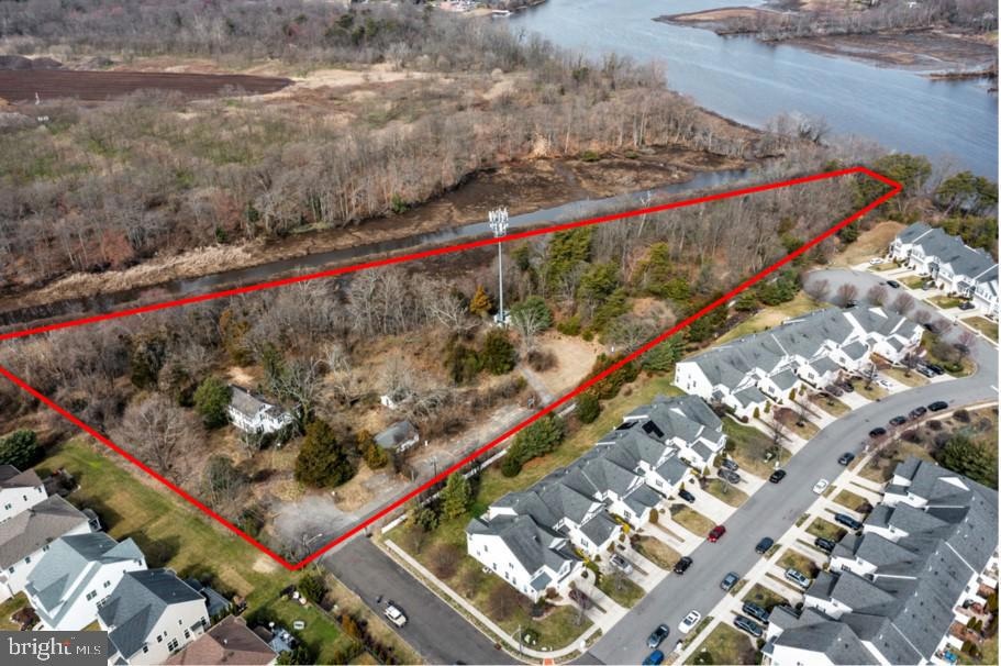
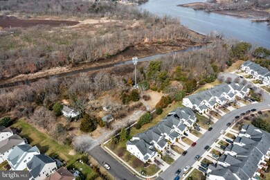
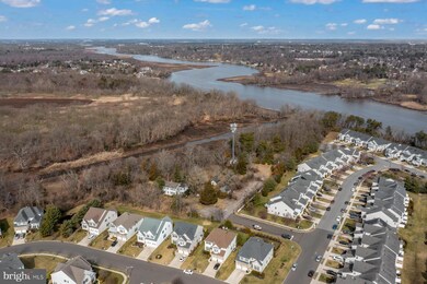
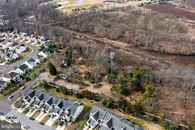
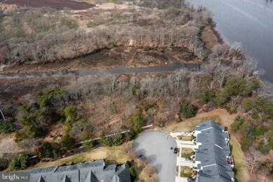
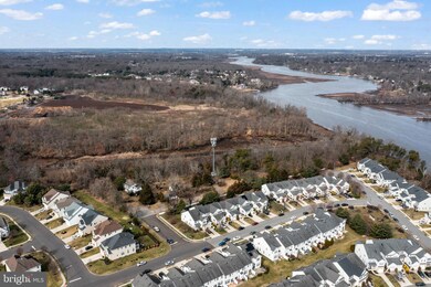
Almost 5 acres located between Creek and Centerton Roads nestled behind Rancocas Pointe. House and two other buildings are located on the property as well as an abandoned inground pool. Original Farm Home has extensive damage from vandals, however it has the potential to be saved should buyer choose to keep the 4.91 acres intact for their own private estate or demo'd and rebuilt. Property has been vacant for almost 10 years and has suffered some water damage. SELLER WILL EMPTY CONTENTS OF HOUSE and out buildings should buyer choose to keep the house to restore. Home features 9 foot ceilings, hardwood floors, fireplace, 4 bedrooms and 3 1/2 baths. Home was most recently used as offices and does have central air with public water and private septic. Electric has been turned off. Property itself is mostly wooded and runs along Parkers Creek to the west and Rancocas Creek to the north. A portion of the land is in wetlands and flood zone along the creek. Survey is available for inspection which designates all property, flood and wetland lines. CELL TOWER: there is no income from the cell tower. It is a long term lease which was completely paid in full. Property possibly could be subdivided. Sewer hook up from Wave Road. Sellers are civil engineers and are happy to discuss property and the probable subdivisions.
Last Agent to Sell the Property
(856) 316-1100 klrw984@kw.com Keller Williams Realty - Moorestown License #9231492 Listed on: 03/07/2023
Last Buyer's Agent
(856) 234-0011 madhuri.arora@foxroach.com BHHS Fox & Roach-Moorestown License #2182735
| Date | Buyer | Sale Price | Title Company |
|---|---|---|---|
| Yu Jie | $275,000 | Honest Title | |
| Burlington County Board Of Chosen Freeho | $240,000 | None Available | |
| Board Of Chosen Freeholders | -- | None Available | |
| The Board Of Chosen Freeholders Of The C | $222,000 | None Available | |
| Foxden Holdings Llc | -- | None Available | |
| Foxden Holdings Llc | -- | None Available | |
| Foxden Holdings Llc | -- | -- |
| Date | Event | Price | List to Sale | Price per Sq Ft |
|---|---|---|---|---|
| 07/18/2023 07/18/23 | Sold | $275,000 | -21.4% | -- |
| 06/23/2023 06/23/23 | Pending | -- | -- | -- |
| 03/07/2023 03/07/23 | For Sale | $350,000 | -- | -- |
| Year | Tax Paid | Tax Assessment Tax Assessment Total Assessment is a certain percentage of the fair market value that is determined by local assessors to be the total taxable value of land and additions on the property. | Land | Improvement |
|---|---|---|---|---|
| 2025 | $8,950 | $283,500 | $77,200 | $206,300 |
| 2024 | $8,613 | $283,500 | $77,200 | $206,300 |
| 2023 | $8,613 | $283,500 | $77,200 | $206,300 |
| 2022 | $8,584 | $283,500 | $77,200 | $206,300 |
| 2021 | $8,423 | $283,500 | $77,200 | $206,300 |
| 2020 | $8,258 | $283,500 | $77,200 | $206,300 |
| 2019 | $8,196 | $284,300 | $78,000 | $206,300 |
| 2018 | $10,815 | $378,000 | $156,000 | $222,000 |
| 2017 | $10,535 | $378,000 | $156,000 | $222,000 |
| 2016 | $10,376 | $378,000 | $156,000 | $222,000 |
| 2015 | $10,255 | $378,000 | $156,000 | $222,000 |
| 2014 | $10,153 | $378,000 | $156,000 | $222,000 |
Seller's Agent in 2023
Patricia Pomeranz
Keller Williams Realty - Moorestown
(848) 469-6691
3 in this area
36 Total Sales
Buyer's Agent in 2023
Maddy Arora
BHHS Fox & Roach
(609) 357-8027
2 in this area
8 Total Sales
Source: Bright MLS
MLS Number: NJBL2042372
APN: 24-00100-0000-00002-02
Disclaimer: Certain information contained herein is derived from information provided by parties other than Homes.com. All information provided is deemed reliable, but is not guaranteed to be accurate and should be independently verified.
![]() The data relating to real estate for sale on this website appears in part through the BRIGHT Internet Data Exchange program, a voluntary cooperative exchange of property listing data between licensed real estate brokerage firms, and is provided by BRIGHT through a licensing agreement.
The data relating to real estate for sale on this website appears in part through the BRIGHT Internet Data Exchange program, a voluntary cooperative exchange of property listing data between licensed real estate brokerage firms, and is provided by BRIGHT through a licensing agreement.
Listing information is from various brokers who participate in the Bright MLS IDX program and not all listings may be visible on the site.
The property information being provided on or through the website is for the personal, non-commercial use of consumers and such information may not be used for any purpose other than to identify prospective properties consumers may be interested in purchasing.
Some properties which appear for sale on the website may no longer be available because they are for instance, under contract, sold or are no longer being offered for sale.
Property information displayed is deemed reliable but is not guaranteed.
Copyright 2026 Bright MLS, Inc.
Ask me questions while you tour the home.