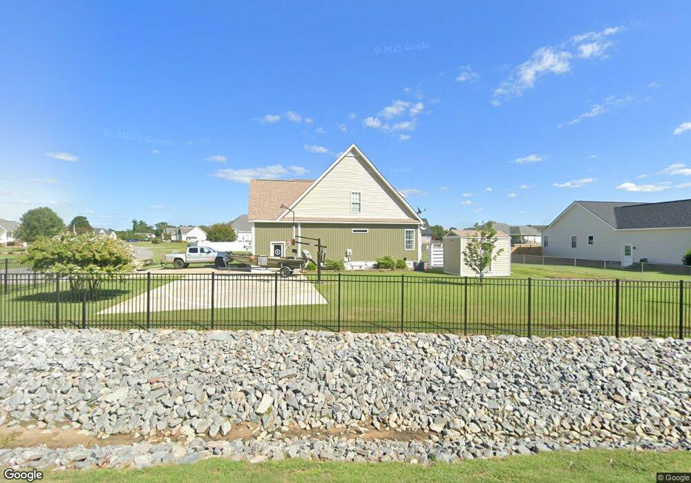
100 Wingspread Dr Goldsboro, NC 27530
Estimated Value: $236,000 - $249,000
3
Beds
3
Baths
1,333
Sq Ft
$183/Sq Ft
Est. Value
About This Home
This home is located at 100 Wingspread Dr, Goldsboro, NC 27530 and is currently estimated at $243,473, approximately $182 per square foot. 100 Wingspread Dr is a home located in Wayne County with nearby schools including Grantham School, Grantham Middle School, and Southern Wayne High School.
Ownership History
Date
Name
Owned For
Owner Type
Purchase Details
Closed on
Apr 28, 2016
Sold by
Tillett Julia
Bought by
Kelly Luther S and Kelly Amber Elaine
Current Estimated Value
Home Financials for this Owner
Home Financials are based on the most recent Mortgage that was taken out on this home.
Original Mortgage
$161,336
Outstanding Balance
$128,643
Interest Rate
3.71%
Mortgage Type
New Conventional
Estimated Equity
$114,830
Purchase Details
Closed on
Oct 26, 2015
Sold by
Secretary Of Hud Of Washington D C
Bought by
Tillett Julia
Purchase Details
Closed on
Oct 27, 2014
Sold by
Artis Robert Lee
Bought by
Secretary Housing Urban Development
Purchase Details
Closed on
Apr 1, 2004
Create a Home Valuation Report for This Property
The Home Valuation Report is an in-depth analysis detailing your home's value as well as a comparison with similar homes in the area
Home Values in the Area
Average Home Value in this Area
Purchase History
| Date | Buyer | Sale Price | Title Company |
|---|---|---|---|
| Kelly Luther S | -- | None Available | |
| Tillett Julia | -- | Attorney | |
| Secretary Housing Urban Development | $92,160 | None Available | |
| -- | $130,000 | -- |
Source: Public Records
Mortgage History
| Date | Status | Borrower | Loan Amount |
|---|---|---|---|
| Open | Kelly Luther S | $161,336 |
Source: Public Records
Tax History Compared to Growth
Tax History
| Year | Tax Paid | Tax Assessment Tax Assessment Total Assessment is a certain percentage of the fair market value that is determined by local assessors to be the total taxable value of land and additions on the property. | Land | Improvement |
|---|---|---|---|---|
| 2025 | $1,703 | $232,570 | $30,000 | $202,570 |
| 2024 | $1,344 | $154,180 | $22,000 | $132,180 |
| 2023 | $1,305 | $154,180 | $22,000 | $132,180 |
| 2022 | $1,305 | $154,180 | $22,000 | $132,180 |
| 2021 | $1,251 | $154,180 | $22,000 | $132,180 |
| 2020 | $1,184 | $154,180 | $22,000 | $132,180 |
| 2018 | $1,162 | $151,300 | $22,000 | $129,300 |
| 2017 | $1,162 | $151,300 | $22,000 | $129,300 |
| 2016 | $1,162 | $151,300 | $22,000 | $129,300 |
| 2015 | $1,165 | $151,300 | $22,000 | $129,300 |
| 2014 | -- | $151,300 | $22,000 | $129,300 |
Source: Public Records
Map
Nearby Homes
- 0 Armstrong Dr Unit 100541114
- 213 Torrent Dr
- 210 Torrent Dr
- 212 Torrent Dr
- 205 N Bali Ct
- 207 N Bali Ct
- 209 N Bali Ct
- 202 N Bali Ct
- 204 N Bali Ct
- The Caldwell Plan at Drake Estates
- The Piedmont Plan at Drake Estates
- The McGinnis Plan at Drake Estates
- The Telfair Plan at Drake Estates
- The Coleman Plan at Drake Estates
- The Benson II Plan at Drake Estates
- The Bradley Plan at Drake Estates
- 692 Sandhill Dr
- 000 Providence Ch
- 1317 Old Grantham Rd
- 616 Ridge Dr
- 1289 U S 13
- 1289 Us Highway 13 S
- 101 Tanager Ct
- 103 Tanager Ct
- 101 Wingspread Dr
- 1297 Us Highway 13 S
- 105 Tanager Ct
- 103 Wingspread Dr
- 1305 Us Highway 13 S
- 107 Tanager Ct
- 100 Tanager Ct
- 201 Wingspread Dr
- 102 Tanager Ct
- 1256 Us Highway 13 S
- 104 Tanager Ct
- 108 Tanager Ct
- 1315 Us Highway 13 S
- 106 Tanager Ct
- 203 Wingspread Dr
- 202 Wingspread Dr