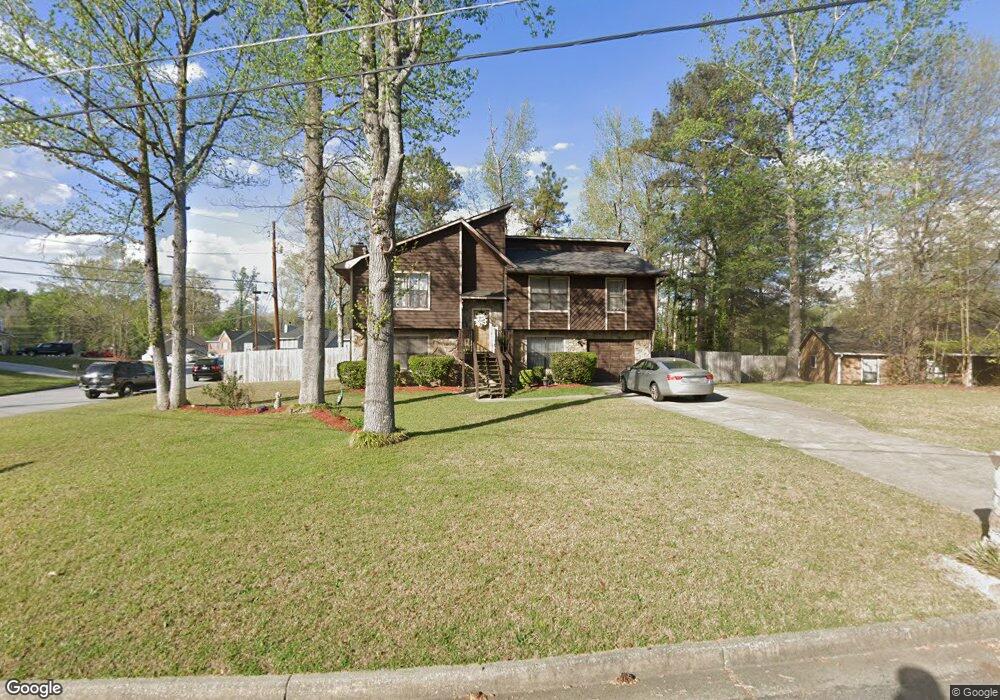
100 Woody Path Ln Atlanta, GA 30349
Estimated Value: $240,000 - $308,000
5
Beds
3
Baths
1,364
Sq Ft
$202/Sq Ft
Est. Value
About This Home
This home is located at 100 Woody Path Ln, Atlanta, GA 30349 and is currently estimated at $276,102, approximately $202 per square foot. 100 Woody Path Ln is a home located in Fulton County with nearby schools including S. L. Lewis Elementary School, Bethune Elementary School, and Mcnair Middle School.
Ownership History
Date
Name
Owned For
Owner Type
Purchase Details
Closed on
Aug 18, 2000
Sold by
Kley W Dougals
Bought by
Hoyle Ralpheal J and Hoyle Gloria
Current Estimated Value
Home Financials for this Owner
Home Financials are based on the most recent Mortgage that was taken out on this home.
Original Mortgage
$117,996
Outstanding Balance
$42,452
Interest Rate
8.11%
Mortgage Type
FHA
Estimated Equity
$233,650
Purchase Details
Closed on
Oct 5, 1999
Sold by
Williams Vincent L
Bought by
Bank Of New York
Create a Home Valuation Report for This Property
The Home Valuation Report is an in-depth analysis detailing your home's value as well as a comparison with similar homes in the area
Home Values in the Area
Average Home Value in this Area
Purchase History
| Date | Buyer | Sale Price | Title Company |
|---|---|---|---|
| Hoyle Ralpheal J | $118,700 | -- | |
| Bank Of New York | $76,415 | -- |
Source: Public Records
Mortgage History
| Date | Status | Borrower | Loan Amount |
|---|---|---|---|
| Open | Hoyle Ralpheal J | $117,996 |
Source: Public Records
Tax History Compared to Growth
Tax History
| Year | Tax Paid | Tax Assessment Tax Assessment Total Assessment is a certain percentage of the fair market value that is determined by local assessors to be the total taxable value of land and additions on the property. | Land | Improvement |
|---|---|---|---|---|
| 2025 | $1,174 | $98,560 | $22,320 | $76,240 |
| 2023 | $1,174 | $103,640 | $27,160 | $76,480 |
| 2022 | $1,057 | $62,680 | $10,440 | $52,240 |
| 2021 | $1,034 | $60,880 | $10,160 | $50,720 |
| 2020 | $1,035 | $60,160 | $10,040 | $50,120 |
| 2019 | $1,007 | $47,360 | $7,520 | $39,840 |
| 2018 | $782 | $36,960 | $6,440 | $30,520 |
| 2017 | $753 | $35,560 | $6,200 | $29,360 |
| 2016 | $752 | $35,560 | $6,200 | $29,360 |
| 2015 | $754 | $35,560 | $6,200 | $29,360 |
| 2014 | $402 | $23,280 | $4,960 | $18,320 |
Source: Public Records
Map
Nearby Homes
- 6650 Smoke Ridge Dr
- 3570 Keels Ln
- 6600 Connell Rd
- 6435 Connell Rd Unit 2
- 3455 Leisure Ln
- 6808 Merrywood Dr
- 3250 Valley Bend Rd
- 6410 Buckhurst Trail
- 3260 Valley Bend Rd Unit 2
- 3065 Keenan Rd
- 3410 Leisure Ln
- 1105 Buckhurst Dr
- 6575 Hidden Brook Trail
- 6595 Bellburn Rd
- 6665 Cedar Hurst Trail
- 6635 Hidden Brook Trail
- 6695 Buckhurst Trail
- 6645 Hidden Brook Trail
- 6590 Kimberly Mill Rd
- 2965 Forestside Ln Unit 4A
- 0 Woody Path Ln Unit 8527003
- 0 Woody Path Ln Unit 8378513
- 6660 Smoke Ridge Dr
- 110 Woody Path Ln
- 6690 Smoke Ridge Dr
- 6645 Smoke Ridge Dr
- 120 Woody Path Ln
- 6655 Smoke Ridge Dr Unit I
- 6635 Smoke Ridge Dr
- 6700 Smoke Ridge Dr
- 6665 Smoke Ridge Dr
- 6640 Smoke Ridge Dr
- 6675 Smoke Ridge Dr
- 6645 Commonwood Place
- 230 Springtree Ct
- 220 Springtree Ct Unit 1
- 6630 Smoke Ridge Dr
- 3510 Keels Ln
- 200 Springtree Ct
- 3520 Keels Ln