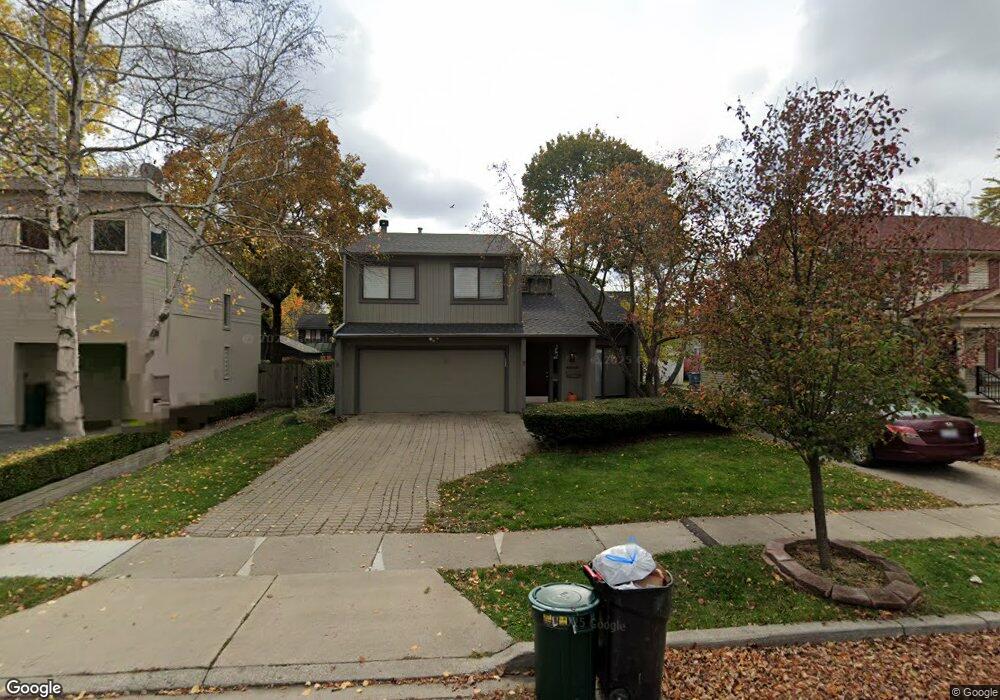
1000 Forest Ave Unit Bldg-Unit Birmingham, MI 48009
Estimated Value: $708,000 - $977,000
3
Beds
3
Baths
2,050
Sq Ft
$406/Sq Ft
Est. Value
About This Home
This home is located at 1000 Forest Ave Unit Bldg-Unit, Birmingham, MI 48009 and is currently estimated at $832,275, approximately $405 per square foot. 1000 Forest Ave Unit Bldg-Unit is a home located in Oakland County with nearby schools including Harlan Elementary School, Derby Middle School, and Ernest W. Seaholm High School.
Ownership History
Date
Name
Owned For
Owner Type
Purchase Details
Closed on
Apr 29, 2019
Sold by
Foxley Lindsay and Bayer Lindsay
Bought by
Wittbold Erik
Current Estimated Value
Purchase Details
Closed on
May 7, 2003
Sold by
Phillips David O and Phillips Valerie W
Bought by
Bayer Lindsay
Create a Home Valuation Report for This Property
The Home Valuation Report is an in-depth analysis detailing your home's value as well as a comparison with similar homes in the area
Home Values in the Area
Average Home Value in this Area
Purchase History
| Date | Buyer | Sale Price | Title Company |
|---|---|---|---|
| Wittbold Erik | $460,000 | None Available | |
| Bayer Lindsay | -- | Philip R Seaver Title Co Inc |
Source: Public Records
Tax History Compared to Growth
Tax History
| Year | Tax Paid | Tax Assessment Tax Assessment Total Assessment is a certain percentage of the fair market value that is determined by local assessors to be the total taxable value of land and additions on the property. | Land | Improvement |
|---|---|---|---|---|
| 2024 | $9,517 | $316,820 | $0 | $0 |
| 2023 | $9,120 | $287,500 | $0 | $0 |
| 2022 | $9,778 | $260,140 | $0 | $0 |
| 2021 | $9,865 | $249,740 | $0 | $0 |
| 2020 | $8,790 | $241,980 | $0 | $0 |
| 2019 | $7,274 | $232,110 | $0 | $0 |
| 2018 | $7,218 | $223,360 | $0 | $0 |
| 2017 | $7,206 | $215,870 | $0 | $0 |
| 2016 | $7,220 | $214,420 | $0 | $0 |
| 2015 | -- | $200,440 | $0 | $0 |
| 2014 | -- | $177,040 | $0 | $0 |
| 2011 | -- | $157,080 | $0 | $0 |
Source: Public Records
Map
Nearby Homes
- 1060 Hazel St
- 820 Hazel St
- 475 S Adams Rd Unit 21
- 1207 Villa Rd
- 411 S Old Woodward Ave Unit 708
- 411 S Old Woodward Ave Unit 923
- 411 S Old Woodward Ave Unit 911
- 411 S Old Woodward Ave Unit 924
- 411 S Old Woodward Ave Unit 1022
- 411 S Old Woodward Ave Unit 907
- 411 S Old Woodward Ave Unit 524
- 411 S Old Woodward Ave Unit 1007
- 647 Ann St
- 787 Ann St
- 1324 Holland St
- 907 Ann St
- 967 Ann St
- 512 George St
- 1489 Holland St
- 662 Purdy St Unit 105
- 1000 Forest Ave
- 984 Forest Ave
- 1030 Forest Ave
- 1044 Forest Ave
- 978 Forest Ave
- 1007 Chestnut St
- 991 Chestnut St
- 1035 Chestnut St Unit Bldg-Unit
- 1035 Chestnut St
- 977 Chestnut St
- 956 Forest Ave
- 1043 Chestnut St
- 949 Chestnut St
- 1011 Forest Ave
- 1027 Forest Ave
- 967 Forest Ave
- 932 Forest Ave
- 955 Forest Ave
- 336 S Adams Rd
- 312 S Adams Rd