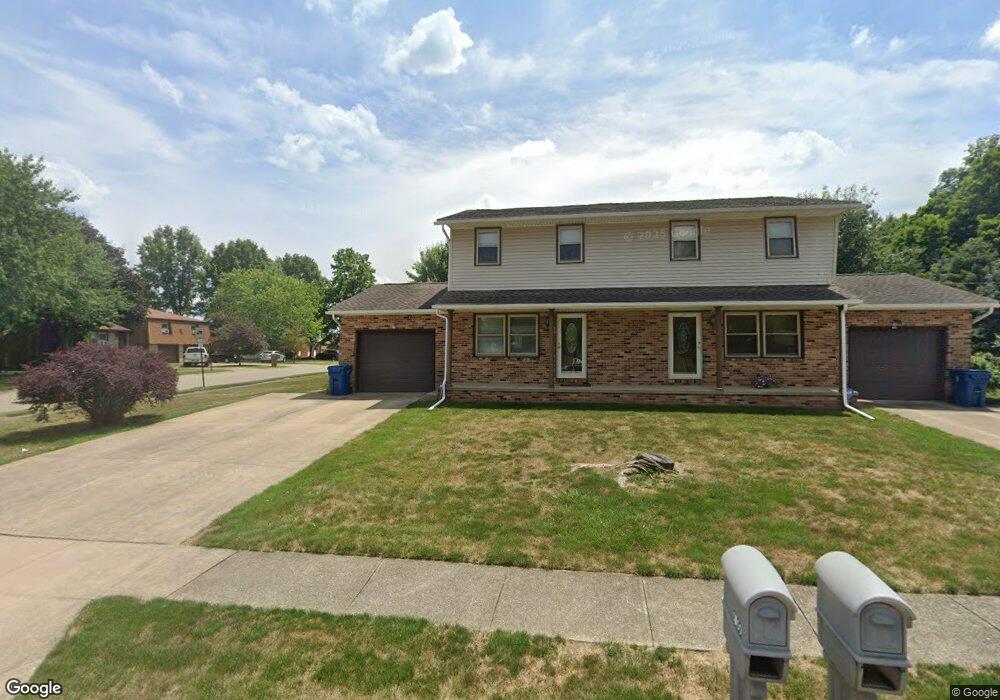
1000 Reno Dr Louisville, OH 44641
Estimated Value: $229,000 - $246,681
4
Beds
4
Baths
2,028
Sq Ft
$117/Sq Ft
Est. Value
About This Home
This home is located at 1000 Reno Dr, Louisville, OH 44641 and is currently estimated at $237,920, approximately $117 per square foot. 1000 Reno Dr is a home located in Stark County with nearby schools including Louisville High School and St. Thomas Aquinas High School & Middle School.
Ownership History
Date
Name
Owned For
Owner Type
Purchase Details
Closed on
Dec 23, 2020
Sold by
Gaelic Building Company Llc
Bought by
Wallace Eric S and Wallace Danielle
Current Estimated Value
Home Financials for this Owner
Home Financials are based on the most recent Mortgage that was taken out on this home.
Original Mortgage
$110,000
Outstanding Balance
$98,107
Interest Rate
2.8%
Mortgage Type
New Conventional
Estimated Equity
$139,813
Purchase Details
Closed on
Jun 30, 2015
Sold by
Dimmerling Noreen M
Bought by
Gaelic Building Company Llc
Create a Home Valuation Report for This Property
The Home Valuation Report is an in-depth analysis detailing your home's value as well as a comparison with similar homes in the area
Home Values in the Area
Average Home Value in this Area
Purchase History
| Date | Buyer | Sale Price | Title Company |
|---|---|---|---|
| Wallace Eric S | $159,000 | None Available | |
| Gaelic Building Company Llc | $140,000 | Attorney |
Source: Public Records
Mortgage History
| Date | Status | Borrower | Loan Amount |
|---|---|---|---|
| Open | Wallace Eric S | $110,000 |
Source: Public Records
Tax History Compared to Growth
Tax History
| Year | Tax Paid | Tax Assessment Tax Assessment Total Assessment is a certain percentage of the fair market value that is determined by local assessors to be the total taxable value of land and additions on the property. | Land | Improvement |
|---|---|---|---|---|
| 2025 | -- | $63,180 | $17,990 | $45,190 |
| 2024 | -- | $63,180 | $17,990 | $45,190 |
| 2023 | $2,359 | $53,590 | $14,880 | $38,710 |
| 2022 | $2,364 | $53,590 | $14,880 | $38,710 |
| 2021 | $2,371 | $53,590 | $14,880 | $38,710 |
| 2020 | $1,962 | $47,990 | $13,410 | $34,580 |
| 2019 | $1,972 | $50,130 | $13,410 | $36,720 |
| 2018 | $2,052 | $50,130 | $13,410 | $36,720 |
| 2017 | $1,906 | $44,940 | $11,200 | $33,740 |
| 2016 | $1,945 | $44,940 | $11,200 | $33,740 |
| 2015 | $1,951 | $44,940 | $11,200 | $33,740 |
| 2014 | $1,883 | $40,320 | $10,430 | $29,890 |
| 2013 | $945 | $40,320 | $10,430 | $29,890 |
Source: Public Records
Map
Nearby Homes
- 0 Brookridge Ave
- 0 Glenbar St
- 614 Reno Dr
- 524 Glenbar St
- 3580 Brookridge Ave Lot 15
- 1175 Sturbridge Dr
- 1149 Sturbridge Dr
- 300 Kennedy St
- 428 Honeycrisp Dr NE
- 3047 Mcintosh Dr NE
- 432 Honeycrisp Dr NE
- 2962 Mcintosh Dr NE
- 2963 Mcintosh Dr NE
- 430 Honeycrisp Dr NE
- 2957 Mcintosh Dr NE
- 5474 Ravenna Ave
- 316 E Reno Dr
- 248 Menegay Rd
- 1561 Noel St
- 910 Crosswyck Cir
- 1313 Baier Ave
- 1303 Baier Ave
- 906 Reno Dr
- 7027 Reno Dr
- 0 W Reno Dr
- 1312 Baier Ave
- 7028 Reno Dr
- 1304 Baier Ave
- 1267 Baier Ave
- 7005 Reno Dr
- 1268 Baier Ave
- 1426 Brookridge Ave
- 1446 Brookridge Ave
- 1259 Baier Ave
- 1453 Brookridge Ave
- 6981 Reno Dr
- 3578 Brookridge Ave Lot 13 NW
- 1258 Baier Ave
- 1110 Reno Dr
- 1249 Baier Ave