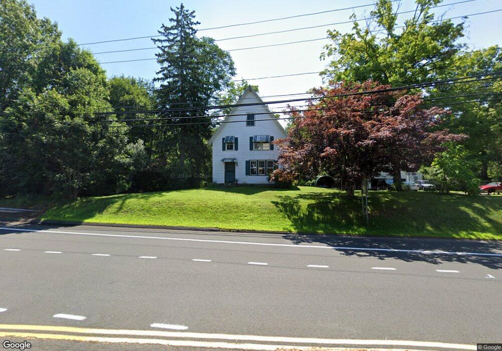
1000 S Main St Middletown, CT 06457
Estimated Value: $335,000 - $364,000
3
Beds
2
Baths
1,394
Sq Ft
$248/Sq Ft
Est. Value
About This Home
This home is located at 1000 S Main St, Middletown, CT 06457 and is currently estimated at $346,177, approximately $248 per square foot. 1000 S Main St is a home located in Middlesex County with nearby schools including Wesley School, Middletown High School, and St John Paul II School.
Ownership History
Date
Name
Owned For
Owner Type
Purchase Details
Closed on
Feb 25, 2009
Sold by
Neal Laurel J
Bought by
Neal Brandon E and Keurajian Alexandra P
Current Estimated Value
Home Financials for this Owner
Home Financials are based on the most recent Mortgage that was taken out on this home.
Original Mortgage
$196,377
Outstanding Balance
$122,929
Interest Rate
5%
Estimated Equity
$223,248
Purchase Details
Closed on
May 1, 1998
Sold by
Roberts Ethel E Est
Bought by
Neal Barry A and Neal Lauel J
Create a Home Valuation Report for This Property
The Home Valuation Report is an in-depth analysis detailing your home's value as well as a comparison with similar homes in the area
Home Values in the Area
Average Home Value in this Area
Purchase History
| Date | Buyer | Sale Price | Title Company |
|---|---|---|---|
| Neal Brandon E | $223,500 | -- | |
| Neal Barry A | $72,500 | -- |
Source: Public Records
Mortgage History
| Date | Status | Borrower | Loan Amount |
|---|---|---|---|
| Open | Neal Barry A | $196,377 | |
| Previous Owner | Neal Barry A | $247,000 | |
| Previous Owner | Neal Barry A | $132,000 | |
| Previous Owner | Neal Barry A | $28,200 |
Source: Public Records
Tax History Compared to Growth
Tax History
| Year | Tax Paid | Tax Assessment Tax Assessment Total Assessment is a certain percentage of the fair market value that is determined by local assessors to be the total taxable value of land and additions on the property. | Land | Improvement |
|---|---|---|---|---|
| 2025 | $5,921 | $159,970 | $61,920 | $98,050 |
| 2024 | $5,665 | $159,970 | $61,920 | $98,050 |
| 2023 | $5,377 | $159,970 | $61,920 | $98,050 |
| 2022 | $4,083 | $98,970 | $27,520 | $71,450 |
| 2021 | $4,065 | $98,970 | $27,520 | $71,450 |
| 2020 | $4,058 | $98,970 | $27,520 | $71,450 |
| 2019 | $4,078 | $98,970 | $27,520 | $71,450 |
| 2018 | $3,937 | $98,970 | $27,520 | $71,450 |
| 2017 | $4,179 | $108,050 | $38,320 | $69,730 |
| 2016 | $4,096 | $108,050 | $38,320 | $69,730 |
| 2015 | $4,005 | $108,050 | $38,320 | $69,730 |
| 2014 | $4,001 | $108,050 | $38,320 | $69,730 |
Source: Public Records
Map
Nearby Homes
- Lot 3 Coleman Rd
- 0 Arbutus St Unit 24065180
- 55 Lorelei Cir
- 498 Pine St
- 347 Farm Hill Rd
- 491 Long Hill Rd
- 10 Lorelei Cir
- 17 Mckenna Dr
- 30 Orange Rd Unit 30
- Lot 2 Coleman Rd
- 50 Garfield Ave
- 44 Trailside Crossing
- 66 Durant Terrace
- 58 Durant Terrace
- 73 Durant St
- 120 Scenic View Dr
- 77 Lindsey Rd
- 81 Aresco Dr
- 574 Butternut St
- 1 Russell St Unit 15
- 38 Acer Dr
- 0 Randolph Rd Unit 170024987
- 0 Randolph Rd Unit G10016347
- 0 Randolph Rd Unit 170539616
- 0 Randolph Rd Unit 170285307
- 0 Randolph Rd Unit 170153586
- 40 Acer Dr
- 1160 S Main St
- 34 Acer Dr
- 50 Acer Dr
- 1320 Randolph Rd
- 11 Maple Shade Rd
- 35 Maple Shade Rd
- 955 S Main St
- 47 Maple Shade Rd
- 53 Acer Dr
- 62 Acer Dr
- 772 Pine St
- 105 Baldwin Dr
- 2 Maple Shade Rd