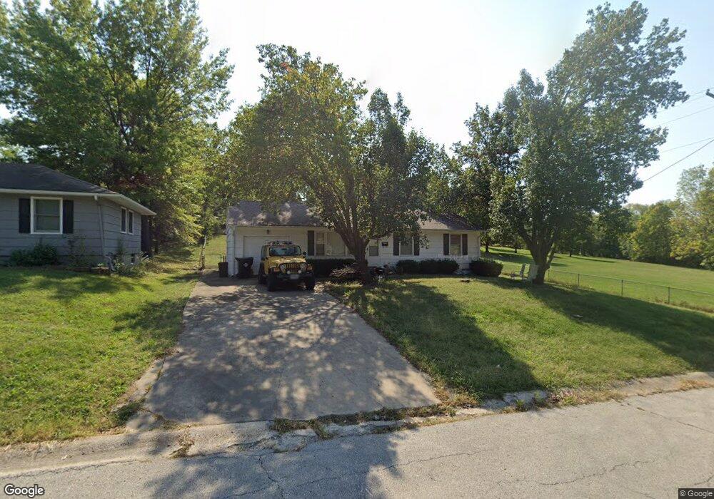
1000 Stafford Dr Pleasant Hill, MO 64080
Estimated Value: $203,000 - $241,000
3
Beds
1
Bath
984
Sq Ft
$219/Sq Ft
Est. Value
About This Home
This home is located at 1000 Stafford Dr, Pleasant Hill, MO 64080 and is currently estimated at $215,816, approximately $219 per square foot. 1000 Stafford Dr is a home located in Cass County with nearby schools including Pleasant Hill Primary School, Pleasant Hill Elementary School, and Pleasant Hill Middle School.
Ownership History
Date
Name
Owned For
Owner Type
Purchase Details
Closed on
Oct 26, 2015
Sold by
Borgstadt Clifforod A and Borgstadt Lora L
Bought by
Borgstadt Clifford A and Borgstadt Lora L
Current Estimated Value
Create a Home Valuation Report for This Property
The Home Valuation Report is an in-depth analysis detailing your home's value as well as a comparison with similar homes in the area
Home Values in the Area
Average Home Value in this Area
Purchase History
| Date | Buyer | Sale Price | Title Company |
|---|---|---|---|
| Borgstadt Clifford A | -- | None Available |
Source: Public Records
Tax History Compared to Growth
Tax History
| Year | Tax Paid | Tax Assessment Tax Assessment Total Assessment is a certain percentage of the fair market value that is determined by local assessors to be the total taxable value of land and additions on the property. | Land | Improvement |
|---|---|---|---|---|
| 2024 | $1,321 | $18,320 | $2,990 | $15,330 |
| 2023 | $1,312 | $18,320 | $2,990 | $15,330 |
| 2022 | $1,168 | $16,010 | $2,990 | $13,020 |
| 2021 | $1,136 | $16,010 | $2,990 | $13,020 |
| 2020 | $1,079 | $15,570 | $2,990 | $12,580 |
| 2019 | $1,064 | $15,570 | $2,990 | $12,580 |
| 2018 | $954 | $13,770 | $2,390 | $11,380 |
| 2017 | $916 | $13,770 | $2,390 | $11,380 |
| 2016 | $916 | $13,170 | $2,390 | $10,780 |
| 2015 | $928 | $13,170 | $2,390 | $10,780 |
| 2014 | $932 | $13,170 | $2,390 | $10,780 |
| 2013 | -- | $13,170 | $2,390 | $10,780 |
Source: Public Records
Map
Nearby Homes
- 501 Lexington Rd
- 502 N Armstrong St
- 1002 Lexington Rd
- 1209 Crest Dr
- 1206 Sycamore St
- 1003 Truman St
- 207 Lexington Rd
- 1704 Mulberry St
- 1700 Mulberry St
- 0 Route 7
- 204 Lexington Rd
- 1413 Country Club Dr
- 601 Hillcrest St
- 1004 Wright St
- 418 N Taylor St
- 1512 Country Club Dr
- 1504 Hawthorne Cir
- 105 N Campbell St
- 122 N Taylor St
- 0 Locust St
- 1002 Stafford Dr
- 1004 Stafford Dr
- 301 Timber St
- 937 Timber St
- 1001 Stafford Dr
- 1006 Stafford Dr
- 1003 Stafford Dr
- 1005 Stafford Dr
- 0 N Independence St
- 1008 Stafford Dr
- 1007 Stafford Dr
- 1000 Timber St
- 1004 Renee Lynde Dr
- 1002 Renee Lynde Dr
- 627 N Independence St
- 1006 Renee Lynde Dr
- 1000 Renee Lynde Dr
- 1009 Stafford Dr
- 1002 Timber St
- 616 N Independence St