1000 W Main St Unit TBB PAD Mount Joy, PA 17552
--
Bed
--
Bath
11,928
Sq Ft
2
Acres
About This Home
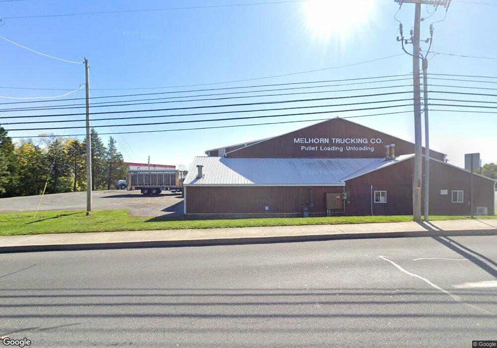
This home is located at 1000 W Main St Unit TBB PAD, Mount Joy, PA 17552. 1000 W Main St Unit TBB PAD is a home located in Lancaster County with nearby schools including Donegal Intermediate School, Donegal High School, and KELLY SCHOOL.
Ownership History
Date
Name
Owned For
Owner Type
Purchase Details
Closed on
Oct 30, 2015
Sold by
Melhorn Sandra R
Bought by
S R Holdings Of Mount Joy Llc
Home Financials for this Owner
Home Financials are based on the most recent Mortgage that was taken out on this home.
Original Mortgage
$2,160,000
Outstanding Balance
$1,703,547
Interest Rate
3.87%
Mortgage Type
Commercial
Purchase Details
Closed on
Apr 28, 2014
Sold by
Melhorn Sandra R
Bought by
Melhorn Sandra R
Create a Home Valuation Report for This Property
The Home Valuation Report is an in-depth analysis detailing your home's value as well as a comparison with similar homes in the area
Home Values in the Area
Average Home Value in this Area
Purchase History
| Date | Buyer | Sale Price | Title Company |
|---|---|---|---|
| S R Holdings Of Mount Joy Llc | $3,295,000 | None Available | |
| Melhorn Sandra R | -- | None Available |
Source: Public Records
Mortgage History
| Date | Status | Borrower | Loan Amount |
|---|---|---|---|
| Open | S R Holdings Of Mount Joy Llc | $2,160,000 |
Source: Public Records
Tax History Compared to Growth
Tax History
| Year | Tax Paid | Tax Assessment Tax Assessment Total Assessment is a certain percentage of the fair market value that is determined by local assessors to be the total taxable value of land and additions on the property. | Land | Improvement |
|---|---|---|---|---|
| 2025 | $20,821 | $778,200 | $144,000 | $634,200 |
| 2024 | $20,821 | $778,200 | $144,000 | $634,200 |
| 2023 | $20,535 | $778,200 | $144,000 | $634,200 |
| 2022 | $20,216 | $778,200 | $144,000 | $634,200 |
| 2021 | $19,678 | $778,200 | $144,000 | $634,200 |
| 2020 | $19,678 | $778,200 | $144,000 | $634,200 |
| 2019 | $19,324 | $778,200 | $144,000 | $634,200 |
| 2018 | $14,138 | $778,200 | $144,000 | $634,200 |
| 2017 | $24,337 | $782,300 | $126,000 | $656,300 |
| 2016 | $24,337 | $782,300 | $126,000 | $656,300 |
| 2015 | $6,763 | $782,300 | $126,000 | $656,300 |
| 2014 | $17,230 | $782,300 | $126,000 | $656,300 |
Source: Public Records
Map
Nearby Homes
- 104 Merchant Ave Unit MARLOW
- 104 Merchant Ave Unit CARTER
- 104 Merchant Ave Unit ANDOVER
- 104 Merchant Ave Unit BROMLEY
- 104 Merchant Ave Unit HELSTON
- 104 Merchant Ave Unit ANDERS
- 104 Merchant Ave Unit DARBY
- 104 Merchant Ave Unit 104
- 104 Merchant Ave Unit ARUNDEL
- 104 Merchant Ave Unit DUNDEE
- 104 Merchant Ave Unit ELGIN
- Arundel Plan at Florin Hill
- Dundee Plan at Florin Hill - Single Family
- Arundel Plan at Florin Hill - Single Family
- Marlow Plan at Florin Hill - Single Family
- Elgin Plan at Florin Hill - Single Family
- Carter Plan at Florin Hill - Single Family
- Helston Plan at Florin Hill - Single Family
- Andover Plan at Florin Hill - Single Family
- Anders Plan at Florin Hill - Single Family
- 1000 W Main St
- 104 Merchant Ave Unit 103
- 104 Merchant Ave Unit 105
- 104 Merchant Ave Unit 106
- 104 Merchant Ave
- 104 Merchant Ave
- BLDG B2 W Main St
- 980 W Main St
- 1031 W Main St
- 1031 W Main St
- 1031 W Main St
- 1031 W Main St
- 1031 W Main St
- 1031 W Main St
- 1031 W Main St
- 1029 W Main St Unit 38188828
- 1029 W Main St Unit 38188829
- 1029 W Main St Unit 36452735
- 1029 W Main St Unit 36484857
- 1029 W Main St Unit 36473797