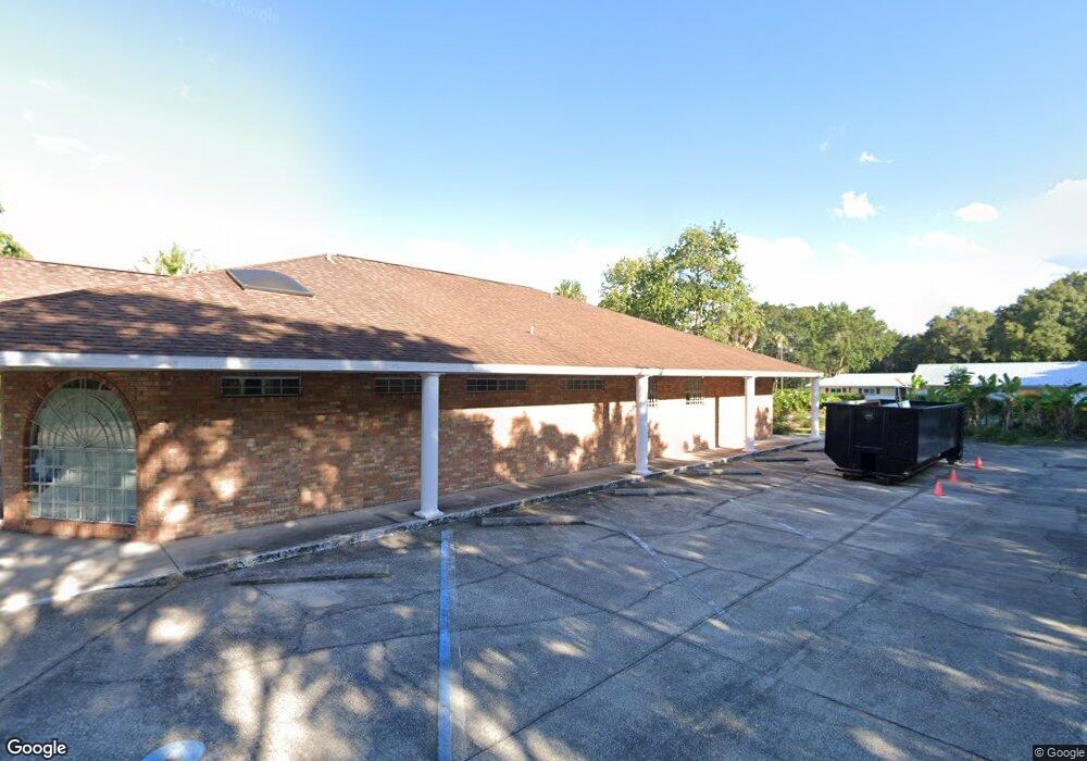
1000 W New York Ave Deland, FL 32720
Estimated Value: $593,710
--
Bed
3
Baths
3,417
Sq Ft
$174/Sq Ft
Est. Value
About This Home
This home is located at 1000 W New York Ave, Deland, FL 32720 and is currently estimated at $593,710, approximately $173 per square foot. 1000 W New York Ave is a home located in Volusia County with nearby schools including Edith I. Starke Elementary School, Deland High School, and Southwestern Middle School.
Ownership History
Date
Name
Owned For
Owner Type
Purchase Details
Closed on
Apr 6, 2022
Sold by
Gary D Hecht Family Trust
Bought by
Docs Mason Llc
Current Estimated Value
Home Financials for this Owner
Home Financials are based on the most recent Mortgage that was taken out on this home.
Original Mortgage
$488,000
Outstanding Balance
$460,363
Interest Rate
4.67%
Mortgage Type
New Conventional
Estimated Equity
$133,347
Purchase Details
Closed on
Oct 29, 1999
Sold by
Hecht Gary D and Hecht Hyman
Bought by
Heicht Gary D
Purchase Details
Closed on
Feb 6, 1996
Sold by
Hecht Gary D
Bought by
Hecht Gary D and Hecht Hyman
Purchase Details
Closed on
Dec 15, 1988
Bought by
Hecht Gary D Tr
Create a Home Valuation Report for This Property
The Home Valuation Report is an in-depth analysis detailing your home's value as well as a comparison with similar homes in the area
Home Values in the Area
Average Home Value in this Area
Purchase History
| Date | Buyer | Sale Price | Title Company |
|---|---|---|---|
| Docs Mason Llc | $585,000 | Munizzi Law Firm | |
| Docs Mason Llc | $585,000 | None Listed On Document | |
| Heicht Gary D | -- | -- | |
| Hecht Gary D | -- | -- | |
| Hecht Gary D Tr | $75,000 | -- |
Source: Public Records
Mortgage History
| Date | Status | Borrower | Loan Amount |
|---|---|---|---|
| Open | Docs Mason Llc | $488,000 | |
| Closed | Docs Mason Llc | $488,000 |
Source: Public Records
Tax History Compared to Growth
Tax History
| Year | Tax Paid | Tax Assessment Tax Assessment Total Assessment is a certain percentage of the fair market value that is determined by local assessors to be the total taxable value of land and additions on the property. | Land | Improvement |
|---|---|---|---|---|
| 2025 | $9,595 | $551,481 | $163,176 | $388,305 |
| 2024 | $9,595 | $537,037 | $163,176 | $373,861 |
| 2023 | $9,595 | $511,683 | $163,176 | $348,507 |
| 2022 | $8,560 | $469,059 | $163,176 | $305,883 |
| 2021 | $8,218 | $400,055 | $115,115 | $284,940 |
| 2020 | $8,099 | $393,049 | $115,115 | $277,934 |
| 2019 | $8,168 | $378,351 | $115,115 | $263,236 |
| 2018 | $8,286 | $368,114 | $115,115 | $252,999 |
| 2017 | $8,344 | $357,811 | $115,115 | $242,696 |
| 2016 | $8,130 | $353,980 | $0 | $0 |
| 2015 | $7,809 | $329,182 | $0 | $0 |
| 2014 | $7,512 | $309,375 | $0 | $0 |
Source: Public Records
Map
Nearby Homes
- W SR 44, New York Ave W
- 128 S Montgomery Ave
- 0 N Spring Garden Ave Unit MFRO6340602
- 0 N Spring Garden Ave Unit 1112700
- 0 N Spring Garden Ave Unit V4920996
- 807 W Church St
- 731 W Voorhis Ave
- 241 S Marydell Ave
- 247 S Marydell Ave
- 111 N Stone St
- 621 W Indiana Ave Unit 13
- 236 N Salisbury Ave
- 305 S Stone St
- 817 W Euclid Ave
- 1126 W Minnesota Ave
- 243 S Hull Ave
- 134 S Julia Ave
- 1314 Talton Ave
- 289 E Fiesta Key Loop
- 1405 Talton Ave
- 00 New York Ave W
- 1231 W New York Ave
- 502 W New York Ave
- 940 W New York Ave
- 1018 New York Ave W
- 104 S Brooks Ave
- 955 W New York Ave
- 103 S Brooks Ave
- 931 W New York Ave
- 107 S Dexter Ave
- 920 W New York Ave Unit B201
- 920 W New York Ave Unit B205
- 920 W New York Ave Unit B 107
- 920 W New York Ave Unit B101
- 920 W New York Ave Unit B105
- 920 W New York Ave Unit A207
- 920 W New York Ave Unit 204
- 920 W New York Ave
- 107 S Brooks Ave
- 1025 New York Ave W