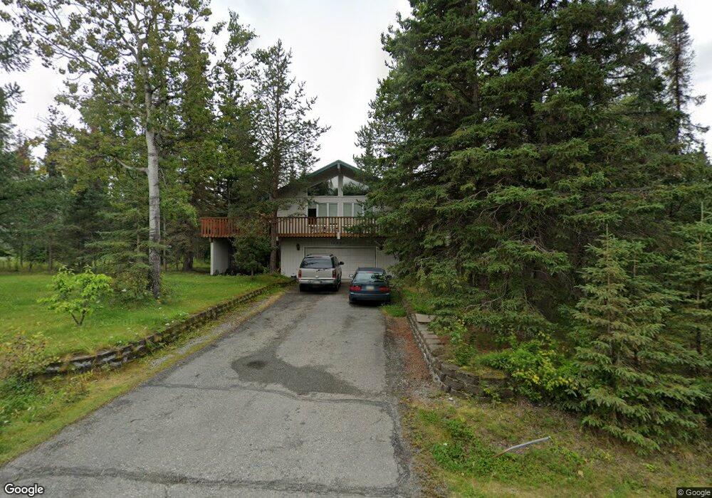
10000 Lone Tree Dr Anchorage, AK 99507
Mid-Hillside NeighborhoodEstimated Value: $544,000 - $671,000
4
Beds
3
Baths
2,420
Sq Ft
$255/Sq Ft
Est. Value
About This Home
This home is located at 10000 Lone Tree Dr, Anchorage, AK 99507 and is currently estimated at $616,337, approximately $254 per square foot. 10000 Lone Tree Dr is a home located in Anchorage Municipality with nearby schools including O'Malley Elementary School, Hanshew Middle School, and Service High School.
Ownership History
Date
Name
Owned For
Owner Type
Purchase Details
Closed on
Feb 24, 2014
Sold by
Markossian Marie H and Markossian Haig O
Bought by
Markossian Aram O
Current Estimated Value
Purchase Details
Closed on
Feb 15, 1990
Sold by
Kirkbride Raymond W and Kirkbride Beverly A
Bought by
Markossian Aram
Home Financials for this Owner
Home Financials are based on the most recent Mortgage that was taken out on this home.
Original Mortgage
$134,000
Interest Rate
9.98%
Mortgage Type
New Conventional
Create a Home Valuation Report for This Property
The Home Valuation Report is an in-depth analysis detailing your home's value as well as a comparison with similar homes in the area
Home Values in the Area
Average Home Value in this Area
Purchase History
| Date | Buyer | Sale Price | Title Company |
|---|---|---|---|
| Markossian Aram O | -- | None Available | |
| Markossian Aram | -- | -- |
Source: Public Records
Mortgage History
| Date | Status | Borrower | Loan Amount |
|---|---|---|---|
| Closed | Markossian Aram | $134,000 |
Source: Public Records
Tax History
| Year | Tax Paid | Tax Assessment Tax Assessment Total Assessment is a certain percentage of the fair market value that is determined by local assessors to be the total taxable value of land and additions on the property. | Land | Improvement |
|---|---|---|---|---|
| 2025 | $4,010 | $544,000 | $123,000 | $421,000 |
| 2024 | $4,010 | $492,600 | $117,200 | $375,400 |
| 2023 | $3,300 | $437,200 | $112,600 | $324,600 |
| 2022 | $3,567 | $427,200 | $112,600 | $314,600 |
| 2021 | $6,667 | $395,200 | $112,600 | $282,600 |
| 2020 | $2,567 | $383,900 | $112,600 | $271,300 |
| 2019 | $2,809 | $385,400 | $112,600 | $272,800 |
| 2018 | $2,769 | $382,900 | $127,800 | $255,100 |
| 2017 | $3,289 | $391,600 | $127,800 | $263,800 |
| 2016 | $4,395 | $398,000 | $127,800 | $270,200 |
| 2015 | $4,395 | $367,100 | $114,500 | $252,600 |
| 2014 | $4,395 | $343,400 | $99,300 | $244,100 |
Source: Public Records
Map
Nearby Homes
- 6324 Red Tree Cir
- 6130 Summit St
- 6770 Round Tree Dr
- 6815 Double Tree Ct
- 000 Valley View Dr
- 0 Rd
- 7509 Beacon Hill Dr
- L5 Panorama Dr
- L7 Panorama Dr
- L13 Panorama Dr
- L3 Panorama Dr
- L1 Panorama Dr
- L9 Panorama Dr
- L6 Panorama Dr
- L2 Panorama Dr
- 9400 Spring Hill Dr
- L2 Totem Rd
- 112 Chelsea St
- Lt 87 Carlson Rd
- L82 Carlson Rd
- 9960 Lone Tree Dr
- 10001 Lone Tree Dr
- 10001 Craig Creek Cir
- 10020 Lone Tree Dr
- 6304 Red Tree Cir
- 9945 Lone Tree Dr
- 6315 Red Tree Cir
- 10101 Lone Tree Dr
- 10100 Lone Tree Dr
- 9940 Lone Tree Dr
- 9925 Birch Rd
- 10111 Lone Tree Dr
- 10000 Craig Creek Cir
- 9901 Lone Tree Dr
- 6325 Red Tree Cir
- 10181 Craig Creek Cir
- 9920 Lone Tree Dr
- 9900 Lone Tree Dr
- 10121 Lone Tree Dr
- 6335 Red Tree Cir
Your Personal Tour Guide
Ask me questions while you tour the home.