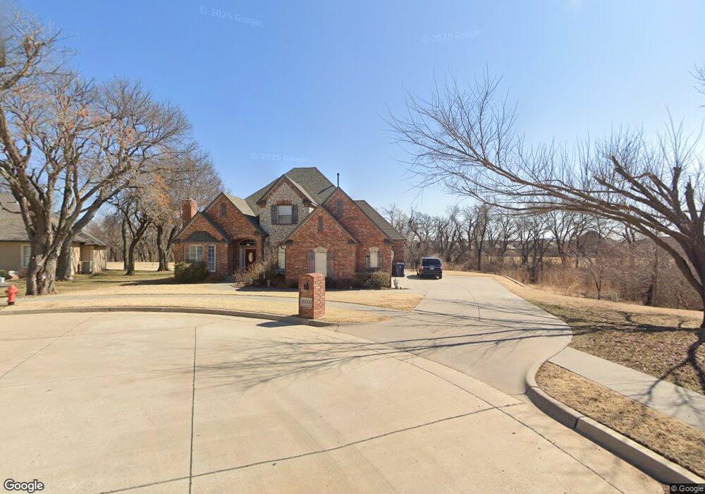
10000 Millspaugh Way Yukon, OK 73099
Westbury South NeighborhoodEstimated Value: $371,552 - $488,000
4
Beds
4
Baths
3,165
Sq Ft
$133/Sq Ft
Est. Value
About This Home
This home is located at 10000 Millspaugh Way, Yukon, OK 73099 and is currently estimated at $421,388, approximately $133 per square foot. 10000 Millspaugh Way is a home located in Canadian County with nearby schools including Mustang Valley Elementary School, Canyon Ridge Intermediate School, and Mustang North Middle School.
Ownership History
Date
Name
Owned For
Owner Type
Purchase Details
Closed on
Oct 8, 2002
Sold by
Mcnabb Jim and Mcnabb Linda
Bought by
Prestidge Ty Lee and Prestidge Margarett L
Current Estimated Value
Home Financials for this Owner
Home Financials are based on the most recent Mortgage that was taken out on this home.
Original Mortgage
$249,168
Outstanding Balance
$104,767
Interest Rate
6.2%
Estimated Equity
$316,621
Purchase Details
Closed on
Aug 14, 1996
Sold by
Daughety Brothers Propane Inc
Create a Home Valuation Report for This Property
The Home Valuation Report is an in-depth analysis detailing your home's value as well as a comparison with similar homes in the area
Home Values in the Area
Average Home Value in this Area
Purchase History
| Date | Buyer | Sale Price | Title Company |
|---|---|---|---|
| Prestidge Ty Lee | $242,500 | -- | |
| -- | $45,000 | -- | |
| -- | -- | -- |
Source: Public Records
Mortgage History
| Date | Status | Borrower | Loan Amount |
|---|---|---|---|
| Open | Prestidge Ty Lee | $249,168 |
Source: Public Records
Tax History Compared to Growth
Tax History
| Year | Tax Paid | Tax Assessment Tax Assessment Total Assessment is a certain percentage of the fair market value that is determined by local assessors to be the total taxable value of land and additions on the property. | Land | Improvement |
|---|---|---|---|---|
| 2024 | $3,726 | $34,926 | $4,509 | $30,417 |
| 2023 | $3,726 | $33,909 | $4,509 | $29,400 |
| 2022 | $3,669 | $32,921 | $4,509 | $28,412 |
| 2021 | $3,735 | $33,620 | $4,509 | $29,111 |
| 2020 | $3,814 | $33,969 | $4,509 | $29,460 |
| 2019 | $3,760 | $33,537 | $4,509 | $29,028 |
| 2018 | $3,715 | $32,560 | $4,509 | $28,051 |
| 2017 | $3,657 | $32,478 | $4,800 | $27,678 |
| 2016 | $3,538 | $32,210 | $4,800 | $27,410 |
| 2015 | $3,638 | $30,614 | $4,800 | $25,814 |
| 2014 | $3,638 | $32,152 | $4,800 | $27,352 |
Source: Public Records
Map
Nearby Homes
- 2901 Morgan Trace
- 10049 SW 27th St
- 10101 SW 27th St
- 10040 SW 22nd St
- 10109 SW 25th Ct
- 2716 Busheywood Dr
- 2509 Crystal Creek Dr
- 10065 SW 29
- 10025 SW 21st St
- 2405 Crystal Creek Dr
- 10217 SW 24th St
- 9820 SW 22nd St
- 2808 Ryder Dr
- 2828 Ryder Dr
- 2208 Rivera Rd
- 9809 SW 33rd St
- 3213 Wexford Ave
- 3616 Wimberley Dr
- 2705 Tracys Manor
- 2525 Tracy’s Manor
- 10001 Millspaugh Way
- 2900 Hodges Terrace
- 10009 Millspaugh Way
- 2908 Hodges Terrace
- 10009 SW 27th St
- 10017 Millspaugh Way
- 10017 SW 27th St
- 2916 Hodges Terrace
- 10024 Millspaugh Way
- 10025 Millspaugh Way
- 10025 SW 27th St
- 2924 Hodges Terrace
- 2915 Hodges Terrace
- 10032 Millspaugh Way
- 10033 Millspaugh Way
- 2905 Morgan Trace Rd
- 2833 Morgan Trace
- 2909 Morgan Trace Rd
- 2829 Morgan Trace
- 10009 Daughety Dr