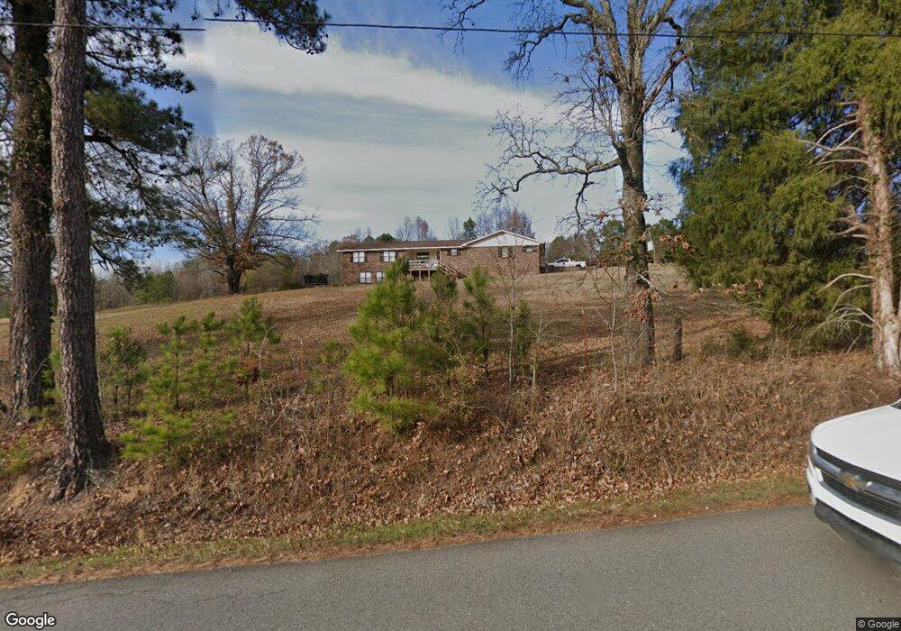
10000 Old Military Rd Benton, AR 72019
Estimated Value: $313,000 - $385,000
--
Bed
1
Bath
2,444
Sq Ft
$143/Sq Ft
Est. Value
About This Home
This home is located at 10000 Old Military Rd, Benton, AR 72019 and is currently estimated at $349,062, approximately $142 per square foot. 10000 Old Military Rd is a home with nearby schools including Glen Rose Elementary School, Glen Rose Middle School, and Glen Rose High School.
Ownership History
Date
Name
Owned For
Owner Type
Purchase Details
Closed on
Jun 1, 2015
Sold by
Triple B & W Management Llc
Bought by
Goss Jon and Goss Andrea
Current Estimated Value
Home Financials for this Owner
Home Financials are based on the most recent Mortgage that was taken out on this home.
Original Mortgage
$181,500
Outstanding Balance
$139,821
Interest Rate
3.68%
Mortgage Type
New Conventional
Estimated Equity
$209,241
Purchase Details
Closed on
Oct 15, 1997
Bought by
Barr Trust
Purchase Details
Closed on
Sep 11, 1970
Bought by
Barr
Create a Home Valuation Report for This Property
The Home Valuation Report is an in-depth analysis detailing your home's value as well as a comparison with similar homes in the area
Home Values in the Area
Average Home Value in this Area
Purchase History
| Date | Buyer | Sale Price | Title Company |
|---|---|---|---|
| Goss Jon | $181,500 | Lenders Title Company | |
| Barr Trust | -- | -- | |
| Barr | $3,000 | -- |
Source: Public Records
Mortgage History
| Date | Status | Borrower | Loan Amount |
|---|---|---|---|
| Open | Goss Jon | $181,500 |
Source: Public Records
Tax History Compared to Growth
Tax History
| Year | Tax Paid | Tax Assessment Tax Assessment Total Assessment is a certain percentage of the fair market value that is determined by local assessors to be the total taxable value of land and additions on the property. | Land | Improvement |
|---|---|---|---|---|
| 2025 | $2,237 | $52,917 | $5,400 | $47,517 |
| 2024 | $2,237 | $52,917 | $5,400 | $47,517 |
| 2023 | $1,810 | $52,917 | $5,400 | $47,517 |
| 2022 | $1,762 | $52,917 | $5,400 | $47,517 |
| 2021 | $1,665 | $40,610 | $4,400 | $36,210 |
| 2020 | $1,650 | $40,610 | $4,400 | $36,210 |
| 2019 | $1,650 | $40,610 | $4,400 | $36,210 |
| 2018 | $1,675 | $40,610 | $4,400 | $36,210 |
| 2017 | $1,675 | $40,610 | $4,400 | $36,210 |
| 2016 | $1,895 | $39,560 | $4,400 | $35,160 |
| 2015 | $2,035 | $42,490 | $6,710 | $35,780 |
| 2014 | $2,120 | $42,490 | $6,710 | $35,780 |
Source: Public Records
Map
Nearby Homes
- 8903 & 8905 Fairplay Rd
- 14124 Highway 67
- 000 Traskwood Rd
- 7000 Rolling Manor Dr
- 000 Eiler Loop
- 185 Edgewater Cove
- 2019 Traskwood Rd
- 6115 Point View Rd
- 7035 Point View Rd
- 4051 Whitney Ln
- 0000 Deer Creek Rd
- 500 R Tram - Rear Right
- 500 R Tram - Left Rear
- 1629 Glen Rose Rd
- 1500 Dwight Brown Rd
- 500 R Tram - Front Right
- 500 R Tram - Left Side - Front
- 4133 Brody Crossing
- 347 Chandler Rd
- 2009 Berkshire Dr
- 000 Military Rd
- 7020 Military Rd
- 0 Tiffiny Cove
- 238 Southridge Rd
- 12224 Highway 67
- 128 F G Jones Rd
- 13221 Dawson Rd
- 6801 Military Rd
- 12120 Highway 67
- 101 Tiffiny Cove Dr
- 0 Tuggle Stringtown
- 0 Tuggle Ln
- 0 Tuggle Stringtown Unit 16021517
- 383 F G Jones Rd
- 100 Tiffiny Cove Dr
- 12098 Highway 67
- 12743 Dawson Rd
- 12819 Dawson Rd
- 512 F G Jones Rd
- 13138 Highway 67