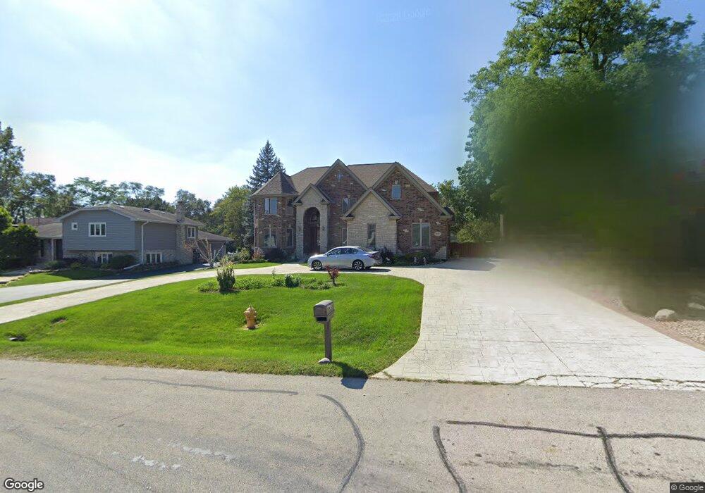
10000 S 81st Ave Palos Hills, IL 60465
Estimated Value: $427,000 - $711,000
4
Beds
3
Baths
3,233
Sq Ft
$181/Sq Ft
Est. Value
About This Home
This home is located at 10000 S 81st Ave, Palos Hills, IL 60465 and is currently estimated at $584,798, approximately $180 per square foot. 10000 S 81st Ave is a home located in Cook County with nearby schools including Sorrick Elementary School, Oak Ridge Elementary School, and H H Conrady Jr High School.
Ownership History
Date
Name
Owned For
Owner Type
Purchase Details
Closed on
Jul 31, 2007
Sold by
Kaminski Dariusz and Kaminski Helena
Bought by
Chicago Title Land Trust Co and Trust #8002349163
Current Estimated Value
Purchase Details
Closed on
Sep 2, 2004
Sold by
Serna Barbara
Bought by
Kaminski Dariusz and Kaminski Helena
Purchase Details
Closed on
Mar 9, 1995
Sold by
Jost Hilda
Bought by
Jost Hilda
Create a Home Valuation Report for This Property
The Home Valuation Report is an in-depth analysis detailing your home's value as well as a comparison with similar homes in the area
Home Values in the Area
Average Home Value in this Area
Purchase History
| Date | Buyer | Sale Price | Title Company |
|---|---|---|---|
| Chicago Title Land Trust Co | -- | None Available | |
| Kaminski Dariusz | $258,000 | Cti | |
| Jost Hilda | -- | -- |
Source: Public Records
Tax History Compared to Growth
Tax History
| Year | Tax Paid | Tax Assessment Tax Assessment Total Assessment is a certain percentage of the fair market value that is determined by local assessors to be the total taxable value of land and additions on the property. | Land | Improvement |
|---|---|---|---|---|
| 2024 | $15,224 | $56,000 | $13,880 | $42,120 |
| 2023 | $12,009 | $56,000 | $13,880 | $42,120 |
| 2022 | $12,009 | $36,330 | $12,089 | $24,241 |
| 2021 | $11,668 | $36,329 | $12,089 | $24,240 |
| 2020 | $11,502 | $36,329 | $12,089 | $24,240 |
| 2019 | $13,802 | $43,464 | $11,193 | $32,271 |
| 2018 | $13,284 | $43,464 | $11,193 | $32,271 |
| 2017 | $12,832 | $43,464 | $11,193 | $32,271 |
| 2016 | $12,233 | $37,908 | $9,850 | $28,058 |
| 2015 | $12,018 | $37,908 | $9,850 | $28,058 |
| 2014 | $11,821 | $37,908 | $9,850 | $28,058 |
| 2013 | $11,271 | $38,593 | $9,850 | $28,743 |
Source: Public Records
Map
Nearby Homes
- 10125 S 81st Ct
- 10226 S 81st Ave
- 9940 S Wood Ln
- 7822 W 99th Place
- 8360 W 100th Place
- 9719 S 81st Ave
- 10221 S Eleanor Ave
- 10324 S 81st Ave
- 7810 W 102nd St
- 7826 W 98th Place
- 10230 S 83rd Ct
- 9950 S 84th Terrace Unit 215
- 9954 S 84th Terrace Unit 109
- 9645 S 78th Ct
- 8556 W 102nd Terrace Unit 5315
- 10409 Sheffield Dr Unit 13
- 10300 S Kathy Ct
- 10441 S 83rd Ave
- 10531 S Roberts Rd Unit 2D
- 10408 S Alta Dr
- 9958 S 81st Ave
- 10006 S 81st Ave
- 10010 S 81st Ave
- 9950 S 81st Ave
- 10001 S 81st Ave
- 9959 S 81st Ave
- 10003 S 81st Ave
- 10005 S 81st Ave
- 9951 S 81st Ave
- 10050 S 81st Ave
- 10015 S 81st Ave
- 9937 S 81st Ave
- 8035 W 100th St
- 8120 W Erin Dr
- 8040 W 100th St
- 8126 W Erin Dr
- 9933 S 81st Ave
- 10035 S 81st Ave
- 10060 S 81st Ave
- 8132 W Erin Dr