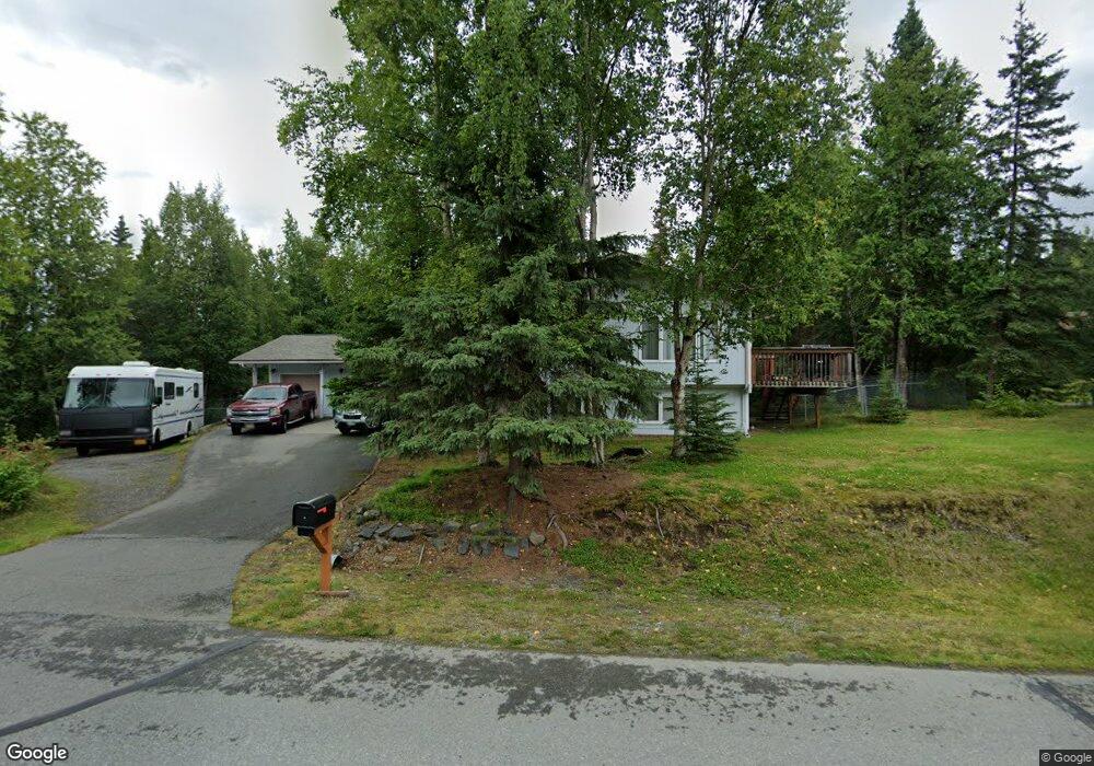
10001 Lone Tree Dr Anchorage, AK 99507
Mid-Hillside NeighborhoodEstimated Value: $581,000 - $686,814
4
Beds
3
Baths
2,760
Sq Ft
$229/Sq Ft
Est. Value
About This Home
This home is located at 10001 Lone Tree Dr, Anchorage, AK 99507 and is currently estimated at $632,454, approximately $229 per square foot. 10001 Lone Tree Dr is a home located in Anchorage Municipality with nearby schools including O'Malley Elementary School, Hanshew Middle School, and Service High School.
Ownership History
Date
Name
Owned For
Owner Type
Purchase Details
Closed on
Aug 5, 2010
Sold by
Counter Jeremy L and Counter Julie A
Bought by
Lenahan David J
Current Estimated Value
Home Financials for this Owner
Home Financials are based on the most recent Mortgage that was taken out on this home.
Original Mortgage
$413,793
Outstanding Balance
$275,075
Interest Rate
4.65%
Mortgage Type
VA
Estimated Equity
$357,379
Purchase Details
Closed on
Apr 14, 2004
Sold by
Marks Susan R and Desouza Anita M
Bought by
Counter Jeremy L and Counter Julie A
Home Financials for this Owner
Home Financials are based on the most recent Mortgage that was taken out on this home.
Original Mortgage
$260,800
Interest Rate
5.57%
Mortgage Type
Purchase Money Mortgage
Create a Home Valuation Report for This Property
The Home Valuation Report is an in-depth analysis detailing your home's value as well as a comparison with similar homes in the area
Home Values in the Area
Average Home Value in this Area
Purchase History
| Date | Buyer | Sale Price | Title Company |
|---|---|---|---|
| Lenahan David J | -- | Atga | |
| Counter Jeremy L | -- | -- |
Source: Public Records
Mortgage History
| Date | Status | Borrower | Loan Amount |
|---|---|---|---|
| Open | Lenahan David J | $413,793 | |
| Previous Owner | Counter Jeremy L | $260,800 | |
| Closed | Counter Jeremy L | $48,900 |
Source: Public Records
Tax History Compared to Growth
Tax History
| Year | Tax Paid | Tax Assessment Tax Assessment Total Assessment is a certain percentage of the fair market value that is determined by local assessors to be the total taxable value of land and additions on the property. | Land | Improvement |
|---|---|---|---|---|
| 2025 | $8,083 | $585,000 | $125,300 | $459,700 |
| 2024 | $8,083 | $539,400 | $119,300 | $420,100 |
| 2023 | $7,431 | $477,900 | $114,700 | $363,200 |
| 2022 | $7,428 | $473,100 | $114,600 | $358,500 |
| 2021 | $7,443 | $441,200 | $114,600 | $326,600 |
| 2020 | $6,357 | $423,800 | $114,600 | $309,200 |
| 2019 | $6,511 | $429,800 | $114,600 | $315,200 |
| 2018 | $6,371 | $420,800 | $130,100 | $290,700 |
| 2017 | $6,390 | $430,600 | $130,100 | $300,500 |
| 2016 | $5,352 | $437,800 | $130,100 | $307,700 |
| 2015 | $5,352 | $413,300 | $116,600 | $296,700 |
| 2014 | $5,352 | $394,000 | $103,400 | $290,600 |
Source: Public Records
Map
Nearby Homes
- 6411 Ridge Tree Cir
- 5900 Orth Cir
- 6460 Limestone Cir
- 6815 Double Tree Ct
- 000 Valley View Dr
- 9203 Strutz Ave
- L3 Totem Rd
- 0 Rd
- 10960 Totem Rd
- L7 Panorama Dr
- L13 Panorama Dr
- L3 Panorama Dr
- L6 Panorama Dr
- L11 Panorama Dr
- L2 Panorama Dr
- L10 Panorama Dr
- 6550 Rockridge Dr
- 112 Chelsea St
- 8933 Sahalee Dr
- Lt 87 Carlson Rd
- 6315 Red Tree Cir
- 9945 Lone Tree Dr
- 6304 Red Tree Cir
- 10000 Lone Tree Dr
- 6325 Red Tree Cir
- 9960 Lone Tree Dr
- 10101 Lone Tree Dr
- 9901 Lone Tree Dr
- 10020 Lone Tree Dr
- 6324 Red Tree Cir
- 6335 Red Tree Cir
- 10111 Lone Tree Dr
- 6334 Red Tree Cir
- 10001 Craig Creek Cir
- 10100 Lone Tree Dr
- 9940 Lone Tree Dr
- 10121 Lone Tree Dr
- 9900 Lone Tree Dr
- 9845 Lone Tree Dr
- 6401 Ridge Tree Cir