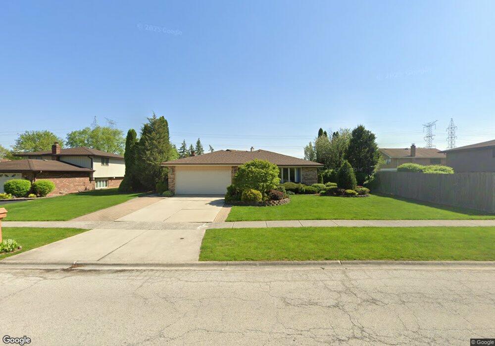
10001 W Creek Rd Palos Park, IL 60464
Palos Park West NeighborhoodEstimated Value: $447,367 - $480,000
4
Beds
2
Baths
1,776
Sq Ft
$259/Sq Ft
Est. Value
About This Home
This home is located at 10001 W Creek Rd, Palos Park, IL 60464 and is currently estimated at $459,842, approximately $258 per square foot. 10001 W Creek Rd is a home located in Cook County with nearby schools including Palos West Elementary School, Palos South Middle School, and Amos Alonzo Stagg High School.
Ownership History
Date
Name
Owned For
Owner Type
Purchase Details
Closed on
Aug 14, 1995
Sold by
Plachta Richard F and Plachta Mary Ann
Bought by
Pappanastos James P and Pappanastos Janet L
Current Estimated Value
Home Financials for this Owner
Home Financials are based on the most recent Mortgage that was taken out on this home.
Original Mortgage
$120,000
Interest Rate
7.43%
Create a Home Valuation Report for This Property
The Home Valuation Report is an in-depth analysis detailing your home's value as well as a comparison with similar homes in the area
Home Values in the Area
Average Home Value in this Area
Purchase History
| Date | Buyer | Sale Price | Title Company |
|---|---|---|---|
| Pappanastos James P | $205,000 | Ticor Title Insurance |
Source: Public Records
Mortgage History
| Date | Status | Borrower | Loan Amount |
|---|---|---|---|
| Closed | Pappanastos James P | $120,000 |
Source: Public Records
Tax History Compared to Growth
Tax History
| Year | Tax Paid | Tax Assessment Tax Assessment Total Assessment is a certain percentage of the fair market value that is determined by local assessors to be the total taxable value of land and additions on the property. | Land | Improvement |
|---|---|---|---|---|
| 2024 | $7,767 | $38,106 | $8,234 | $29,872 |
| 2023 | $6,020 | $41,000 | $8,234 | $32,766 |
| 2022 | $6,020 | $25,404 | $7,172 | $18,232 |
| 2021 | $5,593 | $25,403 | $7,171 | $18,232 |
| 2020 | $5,449 | $25,403 | $7,171 | $18,232 |
| 2019 | $6,634 | $31,406 | $6,640 | $24,766 |
| 2018 | $6,441 | $31,406 | $6,640 | $24,766 |
| 2017 | $6,267 | $31,406 | $6,640 | $24,766 |
| 2016 | $6,409 | $28,915 | $5,843 | $23,072 |
| 2015 | $6,312 | $28,915 | $5,843 | $23,072 |
| 2014 | $6,258 | $28,915 | $5,843 | $23,072 |
| 2013 | $6,473 | $31,682 | $5,843 | $25,839 |
Source: Public Records
Map
Nearby Homes
- 9836 W Circle Pkwy
- 11000 W 131st St
- 9726 Mill Ct E Unit B2
- 12543 S 100th Ave
- 12540 S 100th Ave
- 10300 Village Circle Dr Unit 1109
- 10300 Village Circle Dr Unit 4407
- 26 Laughry Ln
- 19 Laughry Ln
- 10401 Bloomfield Dr
- 9590 Southmoor Dr
- Fremont Plan at Suffield Woods
- Eden Plan at Suffield Woods
- Briarcliffe Plan at Suffield Woods
- Amberwood Plan at Suffield Woods
- Danbury Plan at Suffield Woods
- Calysta Plan at Suffield Woods
- 9249 Dunmore Dr
- 13344 S Stephen Dr
- 10760 Ridgewood Dr
- 9949 W Creek Rd
- 12901 E Tanglewood Cir
- 10014 W Lakeview Ct
- 12915 E Tanglewood Cir
- 10010 W Lakeview Ct Unit 1
- 12849 E Tanglewood Cir
- 12900 S Parkside Dr
- 12910 S Parkside Dr
- 12920 S Parkside Dr
- 12841 E Tanglewood Cir
- 12872 S Parkside Dr
- 10025 W Lakeview Ct
- 12930 S Parkside Dr
- 10015 W Lakeview Ct
- 12900 E Tanglewood Cir
- 12920 E Tanglewood Cir
- 12864 S Parkside Dr
- 10120 S Creek Rd
- 12833 E Tanglewood Cir
- CONFIDEN SW Confidential Ave