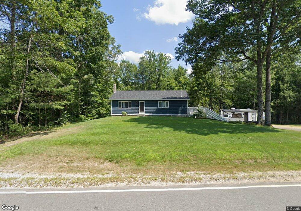
1001 Brownfield Rd Porter, ME 04068
Estimated Value: $291,000 - $356,478
2
Beds
2
Baths
1,144
Sq Ft
$272/Sq Ft
Est. Value
About This Home
This home is located at 1001 Brownfield Rd, Porter, ME 04068 and is currently estimated at $311,620, approximately $272 per square foot. 1001 Brownfield Rd is a home located in Oxford County.
Ownership History
Date
Name
Owned For
Owner Type
Purchase Details
Closed on
Dec 31, 2015
Sold by
Guptill Erica and Connors Mark
Bought by
Days Firewood Llc
Current Estimated Value
Purchase Details
Closed on
Jun 21, 2007
Sold by
Connors Erica L
Bought by
Connors Erica L
Home Financials for this Owner
Home Financials are based on the most recent Mortgage that was taken out on this home.
Original Mortgage
$153,450
Interest Rate
6.14%
Mortgage Type
FHA
Purchase Details
Closed on
Jun 12, 2006
Sold by
Bubar Kevin
Bought by
Jones Christopher C and Connors Erica L
Home Financials for this Owner
Home Financials are based on the most recent Mortgage that was taken out on this home.
Original Mortgage
$147,682
Interest Rate
6.62%
Mortgage Type
FHA
Create a Home Valuation Report for This Property
The Home Valuation Report is an in-depth analysis detailing your home's value as well as a comparison with similar homes in the area
Home Values in the Area
Average Home Value in this Area
Purchase History
| Date | Buyer | Sale Price | Title Company |
|---|---|---|---|
| Days Firewood Llc | -- | -- | |
| Connors Erica L | -- | -- | |
| Connors Erica L | -- | -- | |
| Jones Christopher C | -- | -- |
Source: Public Records
Mortgage History
| Date | Status | Borrower | Loan Amount |
|---|---|---|---|
| Previous Owner | Connors Erica L | $153,450 | |
| Previous Owner | Jones Christopher C | $147,682 |
Source: Public Records
Tax History Compared to Growth
Tax History
| Year | Tax Paid | Tax Assessment Tax Assessment Total Assessment is a certain percentage of the fair market value that is determined by local assessors to be the total taxable value of land and additions on the property. | Land | Improvement |
|---|---|---|---|---|
| 2025 | $2,065 | $212,900 | $60,000 | $152,900 |
| 2024 | $2,579 | $216,690 | $49,600 | $167,090 |
| 2023 | $2,172 | $123,600 | $32,000 | $91,600 |
| 2022 | $2,051 | $123,558 | $32,000 | $91,558 |
| 2021 | $2,051 | $123,558 | $32,000 | $91,558 |
| 2020 | $2,012 | $123,558 | $32,000 | $91,558 |
| 2019 | $2,082 | $123,558 | $32,000 | $91,558 |
| 2018 | $2,082 | $123,558 | $32,000 | $91,558 |
| 2017 | $2,051 | $123,558 | $32,000 | $91,558 |
| 2016 | $1,866 | $123,558 | $32,000 | $91,558 |
| 2014 | $1,856 | $137,460 | $29,870 | $107,590 |
| 2013 | $1,856 | $137,460 | $29,870 | $107,590 |
Source: Public Records
Map
Nearby Homes
- 839 Brownfield Rd
- 00 Brownfield Rd
- 42AC Ben Gilpatrick Rd
- 272 Tripptown Rd
- 00 Cottage Ln
- 492 Moses Chapman Rd
- 248 Spec Pond Rd
- 10 Caitlin Dr
- TBD Portland Ln
- 17 Wakefield Rd
- MU16L23b East Ln
- 79 Pasture Ln
- 80 Pasture Ln
- 80A Pasture Ln
- 15 Promised Land Dr
- 35 Pine St
- 133 Plantation Ln
- 32 Summer St
- 30 Mountain View Ave
- 12 Main St
- 992 Brownfield Rd
- 1012 Brownfield Rd
- 1015 Brownfield Rd
- 370 370 Brownfield Rd
- 000 Uptha
- 1087 Brownfield Rd
- TBB Broadmeadow Ln
- 41 Broadmeadow Ln
- 32 Broad Meadow Ln
- 1107 Brownfield Rd
- 1111 Brownfield Rd
- 61 Broadmeadow Ln
- 1126 Brownfield Rd
- 9 Twin Pines Ln
- 100 Notch
- 40 Notch
- 220 Notch Rd
- 12 Acorn Ln
- 41a Notch Rd
- 14 Pine Haven