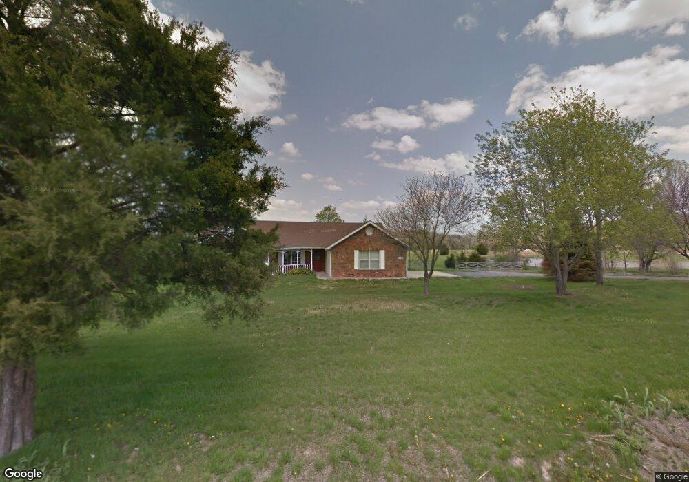
1001 E High Point Ln Columbia, MO 65203
Estimated Value: $359,478 - $486,000
3
Beds
2
Baths
1,734
Sq Ft
$238/Sq Ft
Est. Value
About This Home
This home is located at 1001 E High Point Ln, Columbia, MO 65203 and is currently estimated at $411,826, approximately $237 per square foot. 1001 E High Point Ln is a home located in Boone County with nearby schools including Rock Bridge Elementary School, Ann Hawkins Gentry Middle School, and Rock Bridge High School.
Ownership History
Date
Name
Owned For
Owner Type
Purchase Details
Closed on
Apr 7, 2021
Sold by
Moosmann Paul Gustave and Burnett Alma
Bought by
Simms Emily and Simms Ronald
Current Estimated Value
Home Financials for this Owner
Home Financials are based on the most recent Mortgage that was taken out on this home.
Original Mortgage
$216,000
Outstanding Balance
$194,707
Interest Rate
2.9%
Mortgage Type
New Conventional
Estimated Equity
$217,119
Purchase Details
Closed on
Feb 2, 2009
Sold by
Harman James M and Peters Elizabeth A
Bought by
Moosmann Paul G
Home Financials for this Owner
Home Financials are based on the most recent Mortgage that was taken out on this home.
Original Mortgage
$201,684
Interest Rate
5.09%
Mortgage Type
Purchase Money Mortgage
Create a Home Valuation Report for This Property
The Home Valuation Report is an in-depth analysis detailing your home's value as well as a comparison with similar homes in the area
Purchase History
| Date | Buyer | Sale Price | Title Company |
|---|---|---|---|
| Simms Emily | -- | Boone Central Title Co | |
| Moosmann Paul G | -- | Boone Central Title Company |
Source: Public Records
Mortgage History
| Date | Status | Borrower | Loan Amount |
|---|---|---|---|
| Open | Simms Emily | $216,000 | |
| Previous Owner | Moosmann Paul G | $201,684 |
Source: Public Records
Tax History
| Year | Tax Paid | Tax Assessment Tax Assessment Total Assessment is a certain percentage of the fair market value that is determined by local assessors to be the total taxable value of land and additions on the property. | Land | Improvement |
|---|---|---|---|---|
| 2025 | $2,818 | $40,071 | $3,477 | $36,594 |
| 2024 | $2,634 | $36,423 | $3,477 | $32,946 |
| 2023 | $2,612 | $36,423 | $3,477 | $32,946 |
| 2022 | $2,416 | $33,725 | $3,477 | $30,248 |
| 2021 | $2,420 | $33,725 | $3,477 | $30,248 |
| 2020 | $2,374 | $31,232 | $3,477 | $27,755 |
| 2019 | $2,375 | $31,232 | $3,477 | $27,755 |
| 2018 | $2,212 | $0 | $0 | $0 |
| 2017 | $1,946 | $25,726 | $3,477 | $22,249 |
| 2016 | $1,943 | $25,726 | $3,477 | $22,249 |
| 2015 | $1,794 | $25,726 | $3,477 | $22,249 |
| 2014 | $1,798 | $25,726 | $3,477 | $22,249 |
Source: Public Records
Map
Nearby Homes
- 1260 E High Point Ln
- 70 E High Point Ln
- LOT 205 S Lagos Dr
- 8533 S Lagos Dr
- LOT 240 Lagos Dr
- LOT 222 S Lagos Dr
- LOT 239 S Lagos Dr
- 370 W High Point Ln
- LOT 6 Lagos Dr
- LOT 242 E Brook Valley Dr
- LOT 202 E Brook Valley Dr
- LOT 201 E Brook Valley Dr
- LOT 209 E Monaco Ct
- 214 E Brook Valley Dr
- LOT 243 Brook Valley Dr
- LOT 210 E Monaco Ct
- TBD E Bluebird Ln
- 6700 S Hill Creek Rd
- 350 W Route K
- TRACT 6 W High Point Ln
- 921 E High Point Ln
- 950 E High Point Ln
- 850 E High Point Ln
- 870 E Rock Bridge Ln
- 830 E High Point Ln
- 7800 E Rock Bridge Ln
- 810 E High Point Ln
- 1151 E High Point Ln
- 1199 E High Point Ln
- 750 E High Point Ln
- 705 E High Point Ln
- 700 E High Point Ln
- 651 E High Point Ln
- 0 Lot 2 Firepond Subdivision
- 7890 S Turtle Creek Ln
- 8101 S Route N
- 500 E High Point Ln
- TRACT 11 Turtle Creek Ln
- - Turtle Creek Ln
- TR 11 Turtle Creek Ln
Your Personal Tour Guide
Ask me questions while you tour the home.