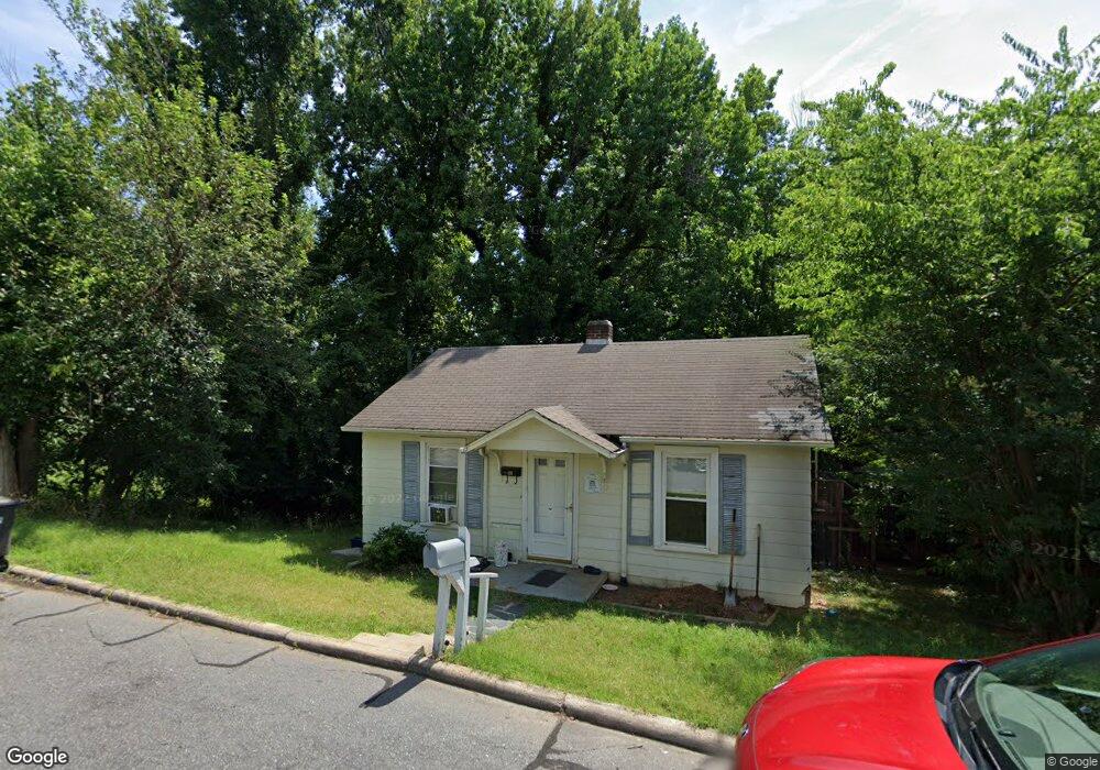
1001 Lane St Reidsville, NC 27320
Estimated Value: $46,000 - $101,000
2
Beds
1
Bath
784
Sq Ft
$103/Sq Ft
Est. Value
About This Home
This home is located at 1001 Lane St, Reidsville, NC 27320 and is currently estimated at $80,803, approximately $103 per square foot. 1001 Lane St is a home located in Rockingham County with nearby schools including South End Elementary School, Reidsville High School, and Reidsville Middle School.
Ownership History
Date
Name
Owned For
Owner Type
Purchase Details
Closed on
Jan 10, 2023
Sold by
Csa Property Solutions Inc
Bought by
Lane Street Trust
Current Estimated Value
Home Financials for this Owner
Home Financials are based on the most recent Mortgage that was taken out on this home.
Original Mortgage
$91,746
Interest Rate
6.95%
Mortgage Type
Construction
Purchase Details
Closed on
Dec 16, 2022
Sold by
Branch Granville D and Price Jeannie
Bought by
Csa Property Solutions Inc
Home Financials for this Owner
Home Financials are based on the most recent Mortgage that was taken out on this home.
Original Mortgage
$91,746
Interest Rate
6.95%
Mortgage Type
Construction
Create a Home Valuation Report for This Property
The Home Valuation Report is an in-depth analysis detailing your home's value as well as a comparison with similar homes in the area
Home Values in the Area
Average Home Value in this Area
Purchase History
| Date | Buyer | Sale Price | Title Company |
|---|---|---|---|
| Lane Street Trust | $38,000 | -- | |
| Csa Property Solutions Inc | $60,000 | -- |
Source: Public Records
Mortgage History
| Date | Status | Borrower | Loan Amount |
|---|---|---|---|
| Closed | Csa Property Solutions Inc | $91,746 |
Source: Public Records
Tax History Compared to Growth
Tax History
| Year | Tax Paid | Tax Assessment Tax Assessment Total Assessment is a certain percentage of the fair market value that is determined by local assessors to be the total taxable value of land and additions on the property. | Land | Improvement |
|---|---|---|---|---|
| 2025 | $469 | $37,797 | $4,065 | $33,732 |
| 2024 | $469 | $37,797 | $4,065 | $33,732 |
| 2023 | $469 | $22,418 | $3,696 | $18,722 |
| 2022 | $321 | $22,418 | $3,696 | $18,722 |
| 2021 | $321 | $22,418 | $3,696 | $18,722 |
| 2020 | $321 | $22,418 | $3,696 | $18,722 |
| 2019 | $321 | $22,418 | $3,696 | $18,722 |
| 2018 | $497 | $34,618 | $7,158 | $27,460 |
| 2017 | $497 | $34,618 | $7,158 | $27,460 |
| 2015 | $502 | $34,618 | $7,158 | $27,460 |
| 2014 | $497 | $34,618 | $7,158 | $27,460 |
Source: Public Records
Map
Nearby Homes
- 812 Watson St
- 801 Watson St
- 202 Woodrow St
- 1213 Barnes St
- 209 Allison St
- 802 Montgomery St
- 612 Parkway Blvd
- 1320 S Park Dr
- 704 S Main St
- 816 Barnes St
- 812 Barnes St
- 105 Edna St
- 538 Maple Ave
- 1214 Fillman Dr
- 1410 Pennrose Dr
- 607 Lancaster Dr
- 1729 S Scales St
- 715 Russell Ave
- 502 Thomas St
- 613 Thomas St