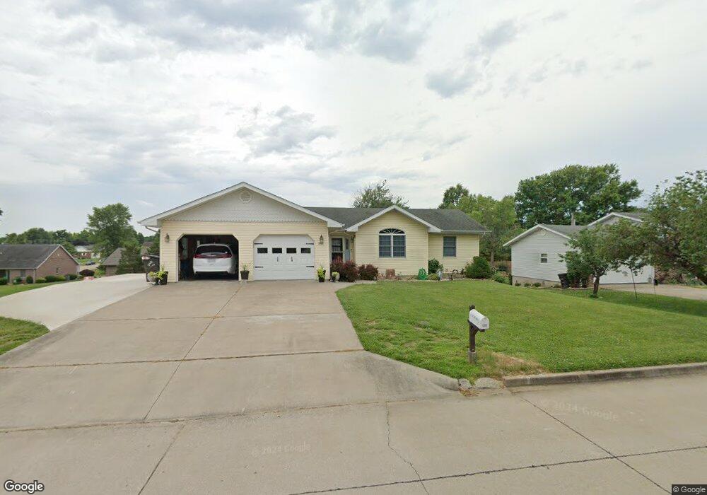
1001 Michael St Perryville, MO 63775
Estimated Value: $235,608 - $306,000
3
Beds
3
Baths
1,398
Sq Ft
$193/Sq Ft
Est. Value
About This Home
This home is located at 1001 Michael St, Perryville, MO 63775 and is currently estimated at $269,902, approximately $193 per square foot. 1001 Michael St is a home located in Perry County with nearby schools including Perryville Primary Center, Perryville Elementary School, and Perry County Middle School.
Ownership History
Date
Name
Owned For
Owner Type
Purchase Details
Closed on
Jun 30, 2014
Sold by
Moore Robert J
Bought by
Huber Amanda M and Huber Timothy P
Current Estimated Value
Home Financials for this Owner
Home Financials are based on the most recent Mortgage that was taken out on this home.
Original Mortgage
$146,940
Outstanding Balance
$112,217
Interest Rate
4.23%
Mortgage Type
New Conventional
Estimated Equity
$157,685
Purchase Details
Closed on
May 13, 2002
Bought by
Huber Amanda M and Huber Timothy P
Create a Home Valuation Report for This Property
The Home Valuation Report is an in-depth analysis detailing your home's value as well as a comparison with similar homes in the area
Home Values in the Area
Average Home Value in this Area
Purchase History
| Date | Buyer | Sale Price | Title Company |
|---|---|---|---|
| Huber Amanda M | $183,675 | -- | |
| Huber Amanda M | -- | -- |
Source: Public Records
Mortgage History
| Date | Status | Borrower | Loan Amount |
|---|---|---|---|
| Open | Huber Amanda M | $146,940 |
Source: Public Records
Tax History Compared to Growth
Tax History
| Year | Tax Paid | Tax Assessment Tax Assessment Total Assessment is a certain percentage of the fair market value that is determined by local assessors to be the total taxable value of land and additions on the property. | Land | Improvement |
|---|---|---|---|---|
| 2024 | $1,517 | $29,209 | $4,813 | $24,396 |
| 2023 | $1,513 | $29,209 | $4,813 | $24,396 |
| 2022 | $1,472 | $28,407 | $4,011 | $24,396 |
| 2021 | $1,473 | $28,407 | $4,011 | $24,396 |
| 2020 | $1,429 | $27,321 | $3,394 | $23,927 |
| 2019 | $1,426 | $27,321 | $3,394 | $23,927 |
| 2018 | $1,258 | $26,711 | $3,085 | $23,626 |
| 2017 | $1,258 | $26,711 | $3,085 | $23,626 |
| 2016 | $1,258 | $24,807 | $3,085 | $21,722 |
| 2015 | -- | $24,807 | $3,085 | $21,722 |
| 2014 | -- | $24,454 | $2,980 | $21,474 |
Source: Public Records
Map
Nearby Homes
- 223 Magnolia St
- 0 N Highway 51
- 7c Deerpath Dr
- 118 W Saint Joseph St
- 818 Trade Winds Dr
- 221 N Walnut St
- 1608 Dogwood Ct
- 1656 Redbud Ct
- 1654 Redbud Ct
- 1650 Redbud Ct
- 1662 Redbud Ct
- 1661 Redbud Ct
- 1645 Redbud Ct
- 1649 Redbud Ct
- 1648 Redbud Ct
- 1655 Redbud Ct
- 1660 Redbud Ct
- 0 Redbud Ct
- 1004 Edgemont Blvd
- 0 Mission St
- 1001 Gibbar St
- 1005 Michael St
- 0 Michael St Unit 15033857
- 0 Michael St Unit 17010387
- 1022 Jenkins St
- 1006 Michael St
- 1009 Michael St
- 908 Jenkins St
- 1026 Jenkins St
- 912 Old Saint Marys Rd
- 3 Jenkins
- 2 Jenkins
- 904 Jenkins St
- 1105 Daisy Ln
- 1013 Michael St
- 908 Old Saint Marys Rd
- 1012 Michael St
- 1021 Jenkins St
- 812 Gray St
- 0 Jenkins St