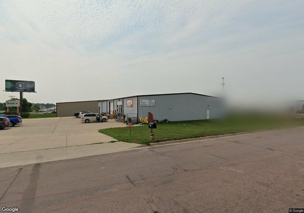
1001 N Splitrock Blvd Brandon, SD 57005
Estimated Value: $490,659
--
Bed
--
Bath
10,000
Sq Ft
$49/Sq Ft
Est. Value
About This Home
This home is located at 1001 N Splitrock Blvd, Brandon, SD 57005 and is currently estimated at $490,659, approximately $49 per square foot. 1001 N Splitrock Blvd is a home located in Minnehaha County with nearby schools including Brandon Elementary School, Brandon Valley Middle School, and Brandon Valley Intermediate School.
Ownership History
Date
Name
Owned For
Owner Type
Purchase Details
Closed on
Aug 18, 2025
Sold by
Koehn Properties Llc
Bought by
Splitrock Blvd Llc
Current Estimated Value
Purchase Details
Closed on
Sep 29, 2014
Sold by
Thomas A Thomas A
Bought by
Koehn Trevor
Home Financials for this Owner
Home Financials are based on the most recent Mortgage that was taken out on this home.
Original Mortgage
$400,000
Interest Rate
4.08%
Mortgage Type
Commercial
Create a Home Valuation Report for This Property
The Home Valuation Report is an in-depth analysis detailing your home's value as well as a comparison with similar homes in the area
Home Values in the Area
Average Home Value in this Area
Purchase History
| Date | Buyer | Sale Price | Title Company |
|---|---|---|---|
| Splitrock Blvd Llc | -- | -- | |
| Koehn Trevor | $250,000 | -- | |
| Koehn Trevor | $250,000 | -- |
Source: Public Records
Mortgage History
| Date | Status | Borrower | Loan Amount |
|---|---|---|---|
| Previous Owner | Koehn Trevor | $400,000 |
Source: Public Records
Tax History Compared to Growth
Tax History
| Year | Tax Paid | Tax Assessment Tax Assessment Total Assessment is a certain percentage of the fair market value that is determined by local assessors to be the total taxable value of land and additions on the property. | Land | Improvement |
|---|---|---|---|---|
| 2024 | $5,298 | $329,800 | $235,900 | $93,900 |
| 2023 | $7,536 | $218,700 | $196,600 | $22,100 |
| 2022 | $7,751 | $429,700 | $196,600 | $233,100 |
| 2021 | $7,061 | $377,700 | $0 | $0 |
| 2020 | $7,061 | $377,500 | $0 | $0 |
| 2019 | $6,852 | $358,878 | $0 | $0 |
| 2018 | $6,646 | $348,910 | $0 | $0 |
| 2017 | $6,654 | $344,639 | $196,565 | $148,074 |
| 2016 | $6,654 | $334,293 | $186,219 | $148,074 |
| 2015 | $7,125 | $334,293 | $186,219 | $148,074 |
| 2014 | $7,202 | $334,293 | $186,219 | $148,074 |
Source: Public Records
Map
Nearby Homes
- 1520 E Birch St
- 1600 E Liberty Cir
- 1418 E Redwood Blvd
- 1012 Magnolia Dr
- 1604 E Redwood Blvd
- 1000 Maywood St
- 421 9th Ave
- 812 E Heatherwood Cir
- 408 N Oak Ridge Rd
- 1025 Cottonwood Dr
- 26007 482nd Ave
- 101 N Pipestone St Unit 2
- 101 N Pipestone St Unit 3
- 1617 E Sylvan Cir
- 104 S Needles Dr
- 100 S Teton Dr
- 1513 Sylvan Cir
- 1601 E Sylvan Cir
- Lt9 Blk15 E Stone St
- Lt8 Blk15 E Stone St
- 1008 9th Ave
- 414 N 9th Ave
- 1005 9th Ave
- 1005 N 9th Ave
- 0 Ash St Unit 21205474
- 0 Ash St Unit 21104619
- 0 Mountain Ash St
- 805 N 9th Ave
- 805 9th Ave
- 1009 E Birch St
- 1009 E Birch St
- 1408 E Liberty St
- 900 N Joslyn Dr
- 809 9th Ave
- 809 9th Ave
- 913 N Snowberry Ave
- 913 Snowberry Ave
- 900 Joslyn Dr
- 909 Snowberry Ave
- 905 N Snowberry Ave