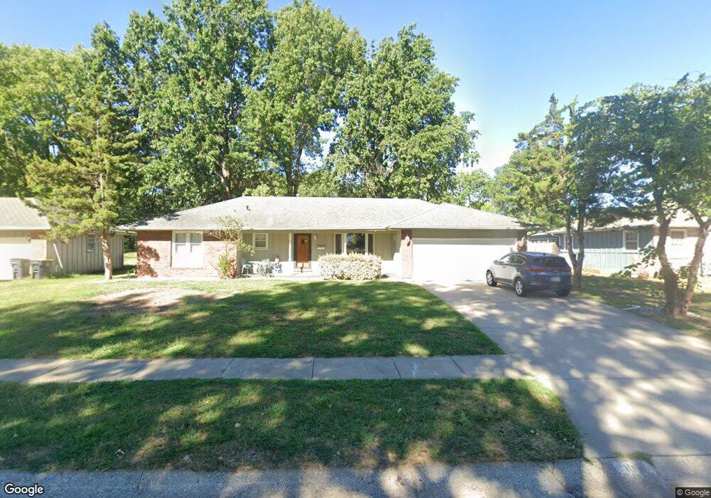
1001 NW Range St Blue Springs, MO 64015
Estimated Value: $253,878 - $275,000
3
Beds
3
Baths
1,264
Sq Ft
$211/Sq Ft
Est. Value
About This Home
This home is located at 1001 NW Range St, Blue Springs, MO 64015 and is currently estimated at $266,970, approximately $211 per square foot. 1001 NW Range St is a home located in Jackson County with nearby schools including Thomas J. Ultican Elementary School, Paul Kinder Middle School, and Blue Springs High School.
Ownership History
Date
Name
Owned For
Owner Type
Purchase Details
Closed on
Mar 2, 2016
Sold by
Mcwhirt William J and Mcwhirt Carol S
Bought by
Raaja Investments Llc
Current Estimated Value
Purchase Details
Closed on
Jun 10, 1998
Sold by
Nora Myles Helen and Nora Paul John
Bought by
Mcwhirt William J and Mcwhirt Carol S
Home Financials for this Owner
Home Financials are based on the most recent Mortgage that was taken out on this home.
Original Mortgage
$86,400
Interest Rate
7.17%
Mortgage Type
Purchase Money Mortgage
Purchase Details
Closed on
Aug 29, 1996
Sold by
Myles Helen Nora
Bought by
Myles Helen Nora and Howe John Paul
Purchase Details
Closed on
May 10, 1996
Sold by
Gugger Thomas P and Gugger Deborah L
Bought by
Myles Helen Nora
Create a Home Valuation Report for This Property
The Home Valuation Report is an in-depth analysis detailing your home's value as well as a comparison with similar homes in the area
Home Values in the Area
Average Home Value in this Area
Purchase History
| Date | Buyer | Sale Price | Title Company |
|---|---|---|---|
| Raaja Investments Llc | $1,000 | None Available | |
| Mcwhirt William J | -- | -- | |
| Myles Helen Nora | -- | Old Republic Title Company | |
| Myles Helen Nora | -- | -- |
Source: Public Records
Mortgage History
| Date | Status | Borrower | Loan Amount |
|---|---|---|---|
| Previous Owner | Mcwhirt William J | $86,400 |
Source: Public Records
Tax History Compared to Growth
Tax History
| Year | Tax Paid | Tax Assessment Tax Assessment Total Assessment is a certain percentage of the fair market value that is determined by local assessors to be the total taxable value of land and additions on the property. | Land | Improvement |
|---|---|---|---|---|
| 2025 | $3,140 | $34,925 | $6,452 | $28,473 |
| 2024 | $3,080 | $38,486 | $5,917 | $32,569 |
| 2023 | $3,080 | $38,486 | $5,510 | $32,976 |
| 2022 | $2,391 | $26,410 | $5,995 | $20,415 |
| 2021 | $2,389 | $26,410 | $5,995 | $20,415 |
| 2020 | $2,244 | $25,230 | $5,995 | $19,235 |
| 2019 | $2,169 | $25,230 | $5,995 | $19,235 |
| 2018 | $2,214 | $24,790 | $3,384 | $21,406 |
| 2017 | $2,214 | $24,790 | $3,384 | $21,406 |
| 2016 | $2,153 | $24,168 | $3,344 | $20,824 |
| 2014 | $2,125 | $23,772 | $3,127 | $20,645 |
Source: Public Records
Map
Nearby Homes
- 804 NW Maynard St
- 1109 NW Mock Ave
- 1109 NW B St
- 723 NW 6th Street Terrace
- 503 NW 15th St
- 0 NW Jefferson St
- 813 NW North Ridge Ct
- 409 NW Locust Dr
- 804 NW North Summit Cir
- 1513 NW Weatherstone Ct
- 1601 NW Weatherstone Ct
- 1501 NW 18th St
- 305 NW 17th St
- 1389 NW Jefferson Ct
- 678 NW Valleybrook Rd
- 1400 NW Deer Run Trail
- 205 NW 4th Street Ct
- 1200 NE Hilltop Dr
- 403 NW Lakeview Rd
- 2317 NW Kensington Ct
- 1003 NW Range St
- 909 NW Range St
- 904 NW 10th St
- 904 NW 10th St
- 906 NW 10th St
- 908 NW 10th St
- 907 NW Range St
- 910 NW 10th St
- 1005 NW Range St
- 912 NW Kabel St
- 1004 NW Range St
- 902 NW Mock Ave
- 905 NW Range St
- 906 NW Range St
- 1006 NW Range St
- 902 NW 10th St
- 906 NW Mock Ave
- 908 NW Kabel St
- 909 NW 10th St
- 904 NW Range St