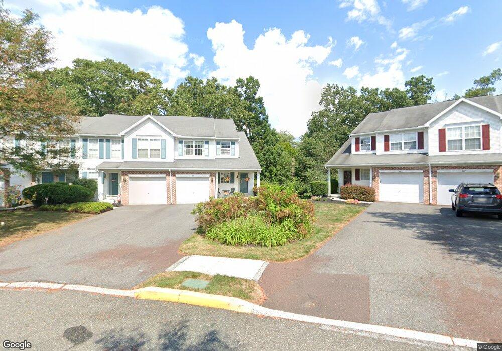
1001 Red Rock Cir Royersford, PA 19468
Limerick Township NeighborhoodEstimated Value: $384,000 - $413,000
3
Beds
3
Baths
1,642
Sq Ft
$244/Sq Ft
Est. Value
About This Home
This home is located at 1001 Red Rock Cir, Royersford, PA 19468 and is currently estimated at $400,482, approximately $243 per square foot. 1001 Red Rock Cir is a home located in Montgomery County with nearby schools including Brooke Elementary School, Spring-Ford Middle School 8th Grade Center, and Spring-Ford Middle School 5/6/7 Grade Center.
Ownership History
Date
Name
Owned For
Owner Type
Purchase Details
Closed on
Dec 20, 2004
Sold by
Mozi Patrick C and Mozi Meghan A
Bought by
Lawson Heather A
Current Estimated Value
Home Financials for this Owner
Home Financials are based on the most recent Mortgage that was taken out on this home.
Original Mortgage
$187,920
Outstanding Balance
$94,111
Interest Rate
5.73%
Estimated Equity
$306,371
Purchase Details
Closed on
Feb 17, 2004
Sold by
Mozi Patrick C and Mozi Meghan A
Bought by
Mozi Patrick C and Mozi Meghan A
Home Financials for this Owner
Home Financials are based on the most recent Mortgage that was taken out on this home.
Original Mortgage
$120,000
Interest Rate
5.62%
Purchase Details
Closed on
Jul 18, 2001
Sold by
Linfield Knoll Partnership
Bought by
Mozi Patrick C and Vernon Meghan A
Create a Home Valuation Report for This Property
The Home Valuation Report is an in-depth analysis detailing your home's value as well as a comparison with similar homes in the area
Home Values in the Area
Average Home Value in this Area
Purchase History
| Date | Buyer | Sale Price | Title Company |
|---|---|---|---|
| Lawson Heather A | $234,900 | -- | |
| Mozi Patrick C | -- | -- | |
| Mozi Patrick C | $149,415 | -- |
Source: Public Records
Mortgage History
| Date | Status | Borrower | Loan Amount |
|---|---|---|---|
| Open | Lawson Heather A | $187,920 | |
| Previous Owner | Mozi Patrick C | $120,000 |
Source: Public Records
Tax History Compared to Growth
Tax History
| Year | Tax Paid | Tax Assessment Tax Assessment Total Assessment is a certain percentage of the fair market value that is determined by local assessors to be the total taxable value of land and additions on the property. | Land | Improvement |
|---|---|---|---|---|
| 2025 | $4,808 | $124,350 | $19,470 | $104,880 |
| 2024 | $4,808 | $124,350 | $19,470 | $104,880 |
| 2023 | $4,587 | $124,350 | $19,470 | $104,880 |
| 2022 | $4,432 | $124,350 | $19,470 | $104,880 |
| 2021 | $4,328 | $124,350 | $19,470 | $104,880 |
| 2020 | $4,218 | $124,350 | $19,470 | $104,880 |
| 2019 | $4,141 | $124,350 | $19,470 | $104,880 |
| 2018 | $3,139 | $124,350 | $19,470 | $104,880 |
| 2017 | $4,065 | $124,350 | $19,470 | $104,880 |
| 2016 | $4,015 | $124,350 | $19,470 | $104,880 |
| 2015 | $3,843 | $124,350 | $19,470 | $104,880 |
| 2014 | $3,843 | $124,350 | $19,470 | $104,880 |
Source: Public Records
Map
Nearby Homes
- 34 Mill Ln
- 75 Gristmill Ln
- 523 W Linfield Rd
- 523 Linfield Rd #Carlton Grand
- The Carlton Plan at Alderwood Run
- The Sutton Grand Plan at Alderwood Run
- The Sutton Plan at Alderwood Run
- The Carlton Grand Plan at Alderwood Run
- 511 Linfield Rd
- 2004 Drake Run
- 4 Boraten Rd
- 33 Boraten Rd
- 60 Brownback Rd
- 358 Limerick Center Rd
- 25 Walters Ln
- 17 Lightcap Rd
- 420 N Lewis Rd
- 691 N Lewis Rd
- 610 King Rd
- 135 Winged Foot Ct
- 1003 Red Rock Cir
- 1005 Red Rock Cir
- 909 Red Rock Cir
- 1007 Red Rock Cir
- 907 Red Rock Cir
- 905 Red Rock Cir
- 903 Red Rock Cir
- 1101 Red Rock Cir
- 901 Red Rock Cir
- 810 Red Rock Cir
- 1103 Red Rock Cir
- 808 Red Rock Cir
- 1105 Red Rock Cir
- 711 Red Rock Cir
- 806 Red Rock Cir
- 1107 Red Rock Cir
- 709 Red Rock Cir
- 1202 Red Rock Cir
- 804 Red Rock Cir
- 707 Red Rock Cir