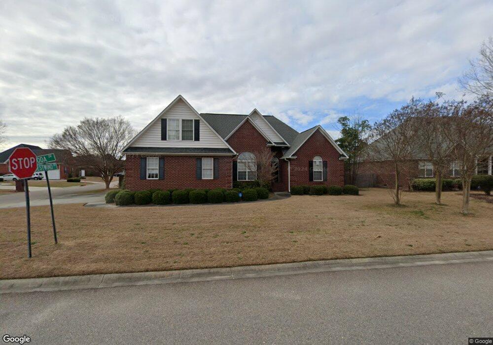
1001 Roda Dr Florence, SC 29501
Estimated Value: $342,000 - $373,000
--
Bed
3
Baths
2,251
Sq Ft
$158/Sq Ft
Est. Value
About This Home
This home is located at 1001 Roda Dr, Florence, SC 29501 and is currently estimated at $355,334, approximately $157 per square foot. 1001 Roda Dr is a home located in Florence County with nearby schools including Carver Elementary School, Henry L. Sneed Middle School, and John W. Moore Middle School.
Ownership History
Date
Name
Owned For
Owner Type
Purchase Details
Closed on
May 23, 2005
Sold by
Knight David and Knight Rhonda F
Bought by
Smith William L
Current Estimated Value
Home Financials for this Owner
Home Financials are based on the most recent Mortgage that was taken out on this home.
Original Mortgage
$217,710
Outstanding Balance
$111,907
Interest Rate
5.62%
Mortgage Type
Adjustable Rate Mortgage/ARM
Estimated Equity
$243,427
Purchase Details
Closed on
Oct 29, 2003
Sold by
Doulaveris Steven and Doulaveris William
Bought by
Knight David and Knight Rhonda F
Create a Home Valuation Report for This Property
The Home Valuation Report is an in-depth analysis detailing your home's value as well as a comparison with similar homes in the area
Home Values in the Area
Average Home Value in this Area
Purchase History
| Date | Buyer | Sale Price | Title Company |
|---|---|---|---|
| Smith William L | $241,900 | -- | |
| Knight David | $28,500 | -- |
Source: Public Records
Mortgage History
| Date | Status | Borrower | Loan Amount |
|---|---|---|---|
| Open | Smith William L | $217,710 | |
| Closed | Smith William L | $24,190 |
Source: Public Records
Tax History Compared to Growth
Tax History
| Year | Tax Paid | Tax Assessment Tax Assessment Total Assessment is a certain percentage of the fair market value that is determined by local assessors to be the total taxable value of land and additions on the property. | Land | Improvement |
|---|---|---|---|---|
| 2024 | $1,146 | $13,253 | $1,400 | $11,853 |
| 2023 | $999 | $9,549 | $1,400 | $8,149 |
| 2022 | $1,212 | $9,549 | $1,400 | $8,149 |
| 2021 | $1,237 | $9,550 | $0 | $0 |
| 2020 | $1,123 | $9,550 | $0 | $0 |
| 2019 | $1,126 | $9,549 | $1,400 | $8,149 |
| 2018 | $1,018 | $9,550 | $0 | $0 |
| 2017 | $961 | $9,550 | $0 | $0 |
| 2016 | $878 | $9,550 | $0 | $0 |
| 2015 | $867 | $9,550 | $0 | $0 |
| 2014 | $797 | $9,549 | $1,400 | $8,149 |
Source: Public Records
Map
Nearby Homes
- 4023 Roxboro Ct
- 4058 W Pelican Ln
- 4135 W Pelican Ln
- 4037 Crest Cove Dr
- 4050 Crest Cove Dr
- 3312 State Road S-21-545
- 1048 S Peninsula Rd
- 1031 Left Bank Dr
- 711 A8 Coventry Ln
- 1040 Left Bank Dr
- 3844 W Lake Dr
- 1092 Greenview Dr
- 731 Coventry Ln
- 1002 Left Bank Dr
- 1 Acre Greenview Dr
- 711 Harriett Dr
- 4145 Rodanthe Cir
- 4540 Tightrope Dr
- 4165 Rodanthe Cir
- 4169 Rodanthe Cir