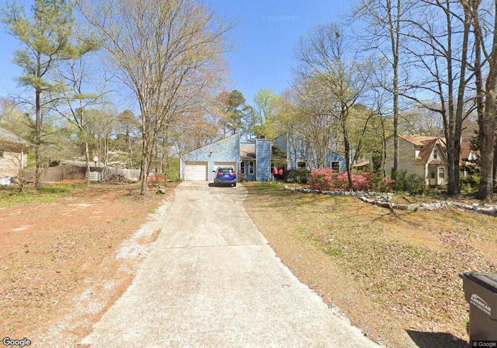
1001 Rolling Green Dr Unit 3 Acworth, GA 30102
Oak Grove NeighborhoodEstimated Value: $316,624 - $346,000
3
Beds
2
Baths
1,468
Sq Ft
$226/Sq Ft
Est. Value
About This Home
This home is located at 1001 Rolling Green Dr Unit 3, Acworth, GA 30102 and is currently estimated at $331,312, approximately $225 per square foot. 1001 Rolling Green Dr Unit 3 is a home located in Cherokee County with nearby schools including Carmel Elementary School, Woodstock Middle School, and Woodstock High School.
Ownership History
Date
Name
Owned For
Owner Type
Purchase Details
Closed on
May 29, 1998
Sold by
Lofton Jerry and Lofton Dale
Bought by
Brown Celeste Marie
Current Estimated Value
Home Financials for this Owner
Home Financials are based on the most recent Mortgage that was taken out on this home.
Original Mortgage
$93,900
Outstanding Balance
$17,841
Interest Rate
7.11%
Mortgage Type
New Conventional
Estimated Equity
$313,471
Create a Home Valuation Report for This Property
The Home Valuation Report is an in-depth analysis detailing your home's value as well as a comparison with similar homes in the area
Home Values in the Area
Average Home Value in this Area
Purchase History
| Date | Buyer | Sale Price | Title Company |
|---|---|---|---|
| Brown Celeste Marie | $96,900 | -- |
Source: Public Records
Mortgage History
| Date | Status | Borrower | Loan Amount |
|---|---|---|---|
| Open | Brown Celeste Marie | $93,900 |
Source: Public Records
Tax History Compared to Growth
Tax History
| Year | Tax Paid | Tax Assessment Tax Assessment Total Assessment is a certain percentage of the fair market value that is determined by local assessors to be the total taxable value of land and additions on the property. | Land | Improvement |
|---|---|---|---|---|
| 2025 | $2,866 | $109,132 | $32,000 | $77,132 |
| 2024 | $2,690 | $103,532 | $26,000 | $77,532 |
| 2023 | $2,687 | $103,412 | $26,000 | $77,412 |
| 2022 | $2,356 | $89,652 | $22,000 | $67,652 |
| 2021 | $1,977 | $69,652 | $18,000 | $51,652 |
| 2020 | $1,695 | $59,652 | $14,000 | $45,652 |
| 2019 | $1,572 | $55,320 | $14,000 | $41,320 |
| 2018 | $1,331 | $46,560 | $11,200 | $35,360 |
| 2017 | $1,315 | $114,100 | $11,200 | $34,440 |
| 2016 | $1,289 | $110,700 | $11,200 | $33,080 |
| 2015 | $1,240 | $105,400 | $11,200 | $30,960 |
| 2014 | $1,155 | $98,000 | $10,400 | $28,800 |
Source: Public Records
Map
Nearby Homes
- 1071 Ferry Creek Way
- 1172 Ridgeside Dr NW
- 1220 Wade Green Cir NW Unit 1
- 4949 Woodland Way NW
- 243 Odell St
- 1033 Justice Ln NW
- 5357 Wade Green Rd
- 4815 Wade Green Rd NW Unit 1
- 4815 Wade Green Rd NW
- 5464 Wade Green Rd
- 367 Lake Forest Dr
- 313 Stations Ave
- 1361 Summit Ln NW
- 405 Hobo Ln
- 4955 Day Lily Way NW
- 611 Ashley Forest Dr NW
- 5119 Verbena Dr NW
- 5198 Legendary Tarn
- 1013 Rolling Green Dr
- 5291 Ferry Creek Ln
- 5287 Ferry Creek Ln Unit 2
- 1025 Rolling Green Dr Unit 2
- 5283 Ferry Creek Ln
- 5277 Ferry Creek Ln
- 5273 Ferry Creek Ln
- 1004 Rolling Green Dr
- 1008 Rolling Green Dr
- 5299 Ferry Creek Ln
- 5292 Ferry Creek Ln
- 5323 Ferry Creek Ln
- 1016 Rolling Green Dr
- 1016 Rolling Green Dr Unit 17
- 5284 Ferry Creek Ln Unit 2
- 5296 Ferry Creek Ln Unit 2
- 5269 Ferry Creek Ln
- 5300 Ferry Creek Ln
- 5280 Ferry Creek Ln
- 1028 Rolling Green Dr Unit 2