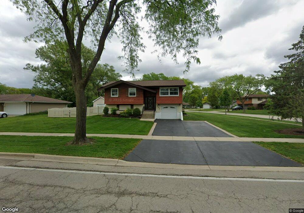
1001 S Cedarcrest Dr Schaumburg, IL 60193
South Schaumburg NeighborhoodEstimated Value: $370,700 - $396,000
3
Beds
2
Baths
950
Sq Ft
$407/Sq Ft
Est. Value
About This Home
This home is located at 1001 S Cedarcrest Dr, Schaumburg, IL 60193 and is currently estimated at $386,925, approximately $407 per square foot. 1001 S Cedarcrest Dr is a home located in Cook County with nearby schools including Edwin Aldrin Elementary School, Robert Frost Junior High School, and Schaumburg High School.
Ownership History
Date
Name
Owned For
Owner Type
Purchase Details
Closed on
May 19, 1998
Sold by
Bacon John J and Bacon Linda K
Bought by
Haiducu Daniel and Haiducu Luminita
Current Estimated Value
Home Financials for this Owner
Home Financials are based on the most recent Mortgage that was taken out on this home.
Original Mortgage
$151,023
Outstanding Balance
$29,946
Interest Rate
7.27%
Mortgage Type
FHA
Estimated Equity
$356,979
Create a Home Valuation Report for This Property
The Home Valuation Report is an in-depth analysis detailing your home's value as well as a comparison with similar homes in the area
Home Values in the Area
Average Home Value in this Area
Purchase History
| Date | Buyer | Sale Price | Title Company |
|---|---|---|---|
| Haiducu Daniel | $154,000 | Professional National Title |
Source: Public Records
Mortgage History
| Date | Status | Borrower | Loan Amount |
|---|---|---|---|
| Open | Haiducu Daniel | $151,023 |
Source: Public Records
Tax History Compared to Growth
Tax History
| Year | Tax Paid | Tax Assessment Tax Assessment Total Assessment is a certain percentage of the fair market value that is determined by local assessors to be the total taxable value of land and additions on the property. | Land | Improvement |
|---|---|---|---|---|
| 2024 | $6,634 | $27,000 | $7,255 | $19,745 |
| 2023 | $6,405 | $27,000 | $7,255 | $19,745 |
| 2022 | $6,405 | $27,000 | $7,255 | $19,745 |
| 2021 | $5,164 | $20,369 | $4,922 | $15,447 |
| 2020 | $5,143 | $20,369 | $4,922 | $15,447 |
| 2019 | $5,587 | $24,275 | $4,922 | $19,353 |
| 2018 | $4,569 | $18,658 | $4,404 | $14,254 |
| 2017 | $4,514 | $18,658 | $4,404 | $14,254 |
| 2016 | $4,464 | $18,658 | $4,404 | $14,254 |
| 2015 | $5,033 | $19,448 | $3,886 | $15,562 |
| 2014 | $4,994 | $19,448 | $3,886 | $15,562 |
| 2013 | $4,849 | $19,448 | $3,886 | $15,562 |
Source: Public Records
Map
Nearby Homes
- 415 Laconia Ln
- 1109 Beach Comber Dr
- 357 Lucille Ln Unit 30
- 1342 Lunt Ct Unit 56
- 712 Dante Ct
- 635 Limerick Ln Unit 2B
- 733 Limerick Ln Unit 7333D
- 631 Derry Ct Unit 3C
- 516 W Weathersfield Way
- 711 Tipperary Ct Unit 2D
- 36 Shore Dr
- 1520 Grant St
- 614 Tralee Ct Unit 2-C
- 818 Brentwood Ct
- 988 Chelsea Ln
- 1008 Shannock Ln
- 315 Ashwood Dr
- 412 Redwood Ln
- 1104 Taunton Ct
- 124 E Monterey Ave
- 935 S Cedarcrest Dr
- 412 Laconia Ln
- 419 Laconia Ln
- 934 S Cedarcrest Dr
- 1000 S Cedarcrest Dr
- 937 Gregory Ln
- 406 Laconia Ln
- 935 Gregory Ln
- 1011 S Cedarcrest Dr
- 409 Laconia Ln
- 1004 S Cedarcrest Dr
- 924 S Cedarcrest Dr
- 427 Putnam Ln
- 1006 S Cedarcrest Dr
- 400 Laconia Ln
- 405 Laconia Ln
- 1010 S Cedarcrest Dr
- 424 Putnam Ln
- 431 Putnam Ln
- 420 Clifton Ct