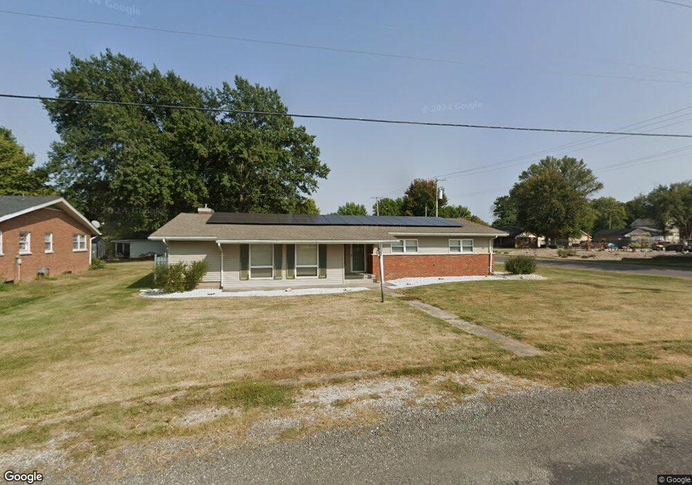
1001 Westlake Dr Jerseyville, IL 62052
Estimated Value: $221,840 - $273,000
3
Beds
2
Baths
1,936
Sq Ft
$124/Sq Ft
Est. Value
About This Home
This home is located at 1001 Westlake Dr, Jerseyville, IL 62052 and is currently estimated at $240,960, approximately $124 per square foot. 1001 Westlake Dr is a home located in Jersey County with nearby schools including Jersey Community High School, St Francis/Holy Ghost Catholic School, and Victory Baptist School.
Ownership History
Date
Name
Owned For
Owner Type
Purchase Details
Closed on
Feb 8, 2021
Sold by
Jones Jason R
Bought by
Jones Jason R and Jones Renae E
Current Estimated Value
Purchase Details
Closed on
Jul 26, 2011
Sold by
Jones Lathurna
Bought by
Jones Jason R
Home Financials for this Owner
Home Financials are based on the most recent Mortgage that was taken out on this home.
Original Mortgage
$135,600
Interest Rate
4.54%
Create a Home Valuation Report for This Property
The Home Valuation Report is an in-depth analysis detailing your home's value as well as a comparison with similar homes in the area
Home Values in the Area
Average Home Value in this Area
Purchase History
| Date | Buyer | Sale Price | Title Company |
|---|---|---|---|
| Jones Jason R | -- | Preferred Title & Escrow Inc | |
| Jones Jason R | -- | -- |
Source: Public Records
Mortgage History
| Date | Status | Borrower | Loan Amount |
|---|---|---|---|
| Previous Owner | Jones Jason R | $135,600 |
Source: Public Records
Tax History Compared to Growth
Tax History
| Year | Tax Paid | Tax Assessment Tax Assessment Total Assessment is a certain percentage of the fair market value that is determined by local assessors to be the total taxable value of land and additions on the property. | Land | Improvement |
|---|---|---|---|---|
| 2024 | $4,622 | $65,700 | $11,155 | $54,545 |
| 2023 | $4,401 | $61,400 | $10,425 | $50,975 |
| 2022 | $4,220 | $57,385 | $9,745 | $47,640 |
| 2021 | $4,044 | $54,390 | $9,235 | $45,155 |
| 2020 | $3,800 | $52,300 | $8,880 | $43,420 |
| 2019 | $3,800 | $51,025 | $8,665 | $42,360 |
| 2018 | $3,676 | $50,645 | $8,600 | $42,045 |
| 2017 | $3,732 | $50,265 | $8,535 | $41,730 |
| 2016 | $3,751 | $50,615 | $8,595 | $42,020 |
| 2015 | -- | $51,385 | $8,725 | $42,660 |
| 2014 | -- | $51,465 | $8,740 | $42,725 |
Source: Public Records
Map
Nearby Homes
- 119 Dressel Dr
- 404 Lott St
- 820 N Liberty St
- 1141 Warren St
- 1137 Warren St
- 621 Cleveland St
- 706 Harrison St
- 703 Harrison St
- 105 Hollow Ave
- 713 N State St
- 405 W Pine St
- 125 Roberts St
- 910 W Pine St
- 505 W Spruce St
- 302 Harrison St
- 36 Witt Mill Rd
- 40 Witt Mill Rd
- 46 Witt Mill Rd
- 34 Witt Mill Rd
- 38 Witt Mill Rd
- 1003 Westlake Dr
- 615 W Woodlawn Ave
- 613 W Woodlawn Ave
- 4 Parr Place
- 1005 Westlake Dr
- 1000 Westlake Dr
- 999 Westlake Dr
- 1002 Westlake Dr
- 6 Parr Place
- 909 Chestnut St
- 1007 Westlake Dr
- 1004 Westlake Dr
- 2 Parr Place
- 605 W Woodlawn Ave
- 909 Westlake Dr
- 613 Lott St
- 613 W Lott St
- 1006 Westlake Dr
- 1009 Westlake Dr
- 606 W Woodlawn Ave