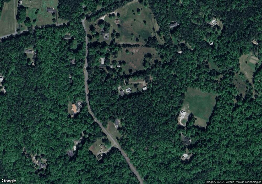
10011 N Donegal Rd Midlothian, VA 23112
South Chesterfield County NeighborhoodEstimated Value: $550,000 - $594,000
3
Beds
3
Baths
2,496
Sq Ft
$231/Sq Ft
Est. Value
About This Home
This home is located at 10011 N Donegal Rd, Midlothian, VA 23112 and is currently estimated at $576,349, approximately $230 per square foot. 10011 N Donegal Rd is a home located in Chesterfield County with nearby schools including Spring Run Elementary School, Bailey Bridge Middle School, and Manchester High.
Ownership History
Date
Name
Owned For
Owner Type
Purchase Details
Closed on
May 17, 2022
Sold by
Taylor Roy H
Bought by
Taylor Roy H and Taylor Michael C
Current Estimated Value
Purchase Details
Closed on
Apr 3, 2002
Bought by
Taylor Roy H and Taylor Deborah Y
Home Financials for this Owner
Home Financials are based on the most recent Mortgage that was taken out on this home.
Original Mortgage
$80,000
Interest Rate
6.85%
Mortgage Type
New Conventional
Purchase Details
Closed on
Feb 7, 1997
Sold by
Miller David S and Miller Allyson S
Bought by
Taylor Roy H and Taylor Deborah Y
Home Financials for this Owner
Home Financials are based on the most recent Mortgage that was taken out on this home.
Original Mortgage
$167,850
Interest Rate
7.57%
Mortgage Type
New Conventional
Create a Home Valuation Report for This Property
The Home Valuation Report is an in-depth analysis detailing your home's value as well as a comparison with similar homes in the area
Home Values in the Area
Average Home Value in this Area
Purchase History
| Date | Buyer | Sale Price | Title Company |
|---|---|---|---|
| Taylor Roy H | -- | None Listed On Document | |
| Taylor Roy H | -- | -- | |
| Taylor Roy H | $153,000 | -- |
Source: Public Records
Mortgage History
| Date | Status | Borrower | Loan Amount |
|---|---|---|---|
| Previous Owner | Taylor Roy H | $80,000 | |
| Previous Owner | Taylor Roy H | $167,850 |
Source: Public Records
Tax History Compared to Growth
Tax History
| Year | Tax Paid | Tax Assessment Tax Assessment Total Assessment is a certain percentage of the fair market value that is determined by local assessors to be the total taxable value of land and additions on the property. | Land | Improvement |
|---|---|---|---|---|
| 2025 | $3,025 | $518,600 | $115,800 | $402,800 |
| 2024 | $3,025 | $495,700 | $112,800 | $382,900 |
| 2023 | $4,263 | $468,500 | $112,800 | $355,700 |
| 2022 | $4,028 | $437,800 | $102,800 | $335,000 |
| 2021 | $3,943 | $412,400 | $100,800 | $311,600 |
| 2020 | $3,672 | $386,500 | $98,800 | $287,700 |
| 2019 | $3,251 | $342,200 | $89,800 | $252,400 |
| 2018 | $3,247 | $341,800 | $91,200 | $250,600 |
| 2017 | $3,139 | $327,000 | $90,200 | $236,800 |
| 2016 | $2,909 | $303,000 | $90,200 | $212,800 |
| 2015 | $2,830 | $294,800 | $90,200 | $204,600 |
| 2014 | $2,724 | $283,700 | $90,200 | $193,500 |
Source: Public Records
Map
Nearby Homes
- 13006 Hensley Rd
- 10302 Teelin Ct
- 12900 Craftsbury Ct
- 10001 Craftsbury Dr
- 13100 Fieldfare Dr
- 12841 Penny Ln
- 9400 Kinnerton Dr
- 14219 Ashleyville Ln
- 14300 Brading Ct
- 13727 Nashua Terrace
- 14412 Mission Hills Loop
- 14007 Palomino Way
- 10119 Cravensford Terrace
- 13824 Brandycrest Dr
- 13619 Brandy Oaks Rd
- 10338 Qualla Rd
- 10344 Qualla Rd
- 14537 Parracombe Ln
- 10370 Qualla Rd
- 10376 Qualla Rd
- 10101 N Donegal Rd
- 10001 N Donegal Rd
- 10010 N Donegal Rd
- 10006 N Donegal Rd
- 10000 N Donegal Rd
- 9901 N Donegal Rd
- 13201 Hensley Rd
- 10121 N Donegal Rd
- 13111 Hensley Rd
- 13170 Hensley Rd
- 13170 Hensley Rd
- 13160 Hensley Rd
- 13301 Hensley Rd
- 13180 Hensley Rd
- 13311 Hensley Rd
- 13220 Hensley Rd
- 13150 Hensley Rd
- 13101 Hensley Rd
- 10200 N Donegal Rd
- 13130 Hensley Rd
