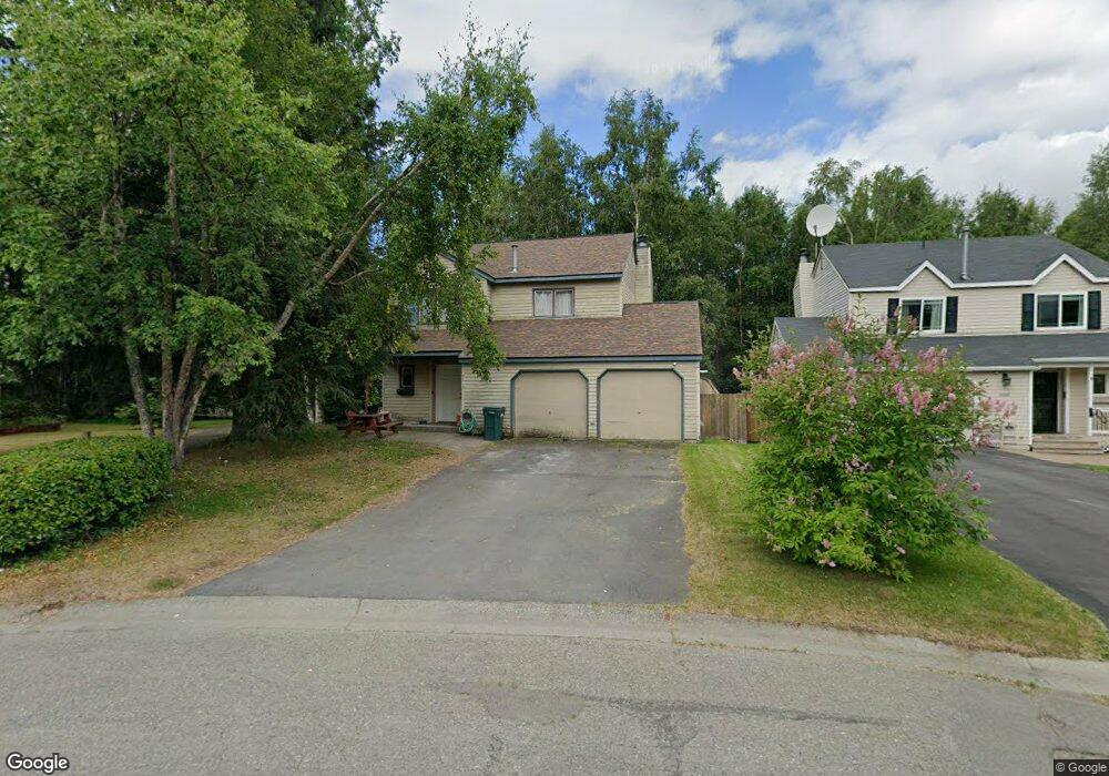
10012 Nantucket Cir Anchorage, AK 99507
Abbott Loop NeighborhoodEstimated Value: $406,886 - $623,000
3
Beds
3
Baths
1,308
Sq Ft
$375/Sq Ft
Est. Value
About This Home
This home is located at 10012 Nantucket Cir, Anchorage, AK 99507 and is currently estimated at $490,222, approximately $374 per square foot. 10012 Nantucket Cir is a home located in Anchorage Municipality with nearby schools including Spring Hill Elementary School, Hanshew Middle School, and Service High School.
Ownership History
Date
Name
Owned For
Owner Type
Purchase Details
Closed on
Sep 21, 2006
Sold by
Fisher Bill C and Fisher Georgia L
Bought by
Shuravloff Alana K and Crain Sophie
Current Estimated Value
Home Financials for this Owner
Home Financials are based on the most recent Mortgage that was taken out on this home.
Original Mortgage
$194,500
Outstanding Balance
$115,783
Interest Rate
6.51%
Mortgage Type
Purchase Money Mortgage
Estimated Equity
$374,439
Purchase Details
Closed on
Oct 19, 1999
Sold by
Bucher Jeffrey L and Byford Joanne E
Bought by
Fisher Bill C and Fisher Georgia L
Home Financials for this Owner
Home Financials are based on the most recent Mortgage that was taken out on this home.
Original Mortgage
$149,489
Interest Rate
7.86%
Mortgage Type
FHA
Purchase Details
Closed on
May 28, 1997
Sold by
Cuesta Jorge G and Cuesta Silvia
Bought by
Bucher Jeffrey L and Byford Joanne E
Home Financials for this Owner
Home Financials are based on the most recent Mortgage that was taken out on this home.
Original Mortgage
$130,400
Interest Rate
8.13%
Mortgage Type
New Conventional
Purchase Details
Closed on
Nov 3, 1995
Sold by
Tyler Thomas H and Tyler Margaret A
Bought by
Cuesta Jorge G and Cuesta Silvia
Home Financials for this Owner
Home Financials are based on the most recent Mortgage that was taken out on this home.
Original Mortgage
$86,100
Interest Rate
7.58%
Mortgage Type
New Conventional
Purchase Details
Closed on
Dec 25, 1989
Sold by
Jennings Mark A and Jennings Rossana
Bought by
Tyler Thomas H and Tyler Margaret A
Home Financials for this Owner
Home Financials are based on the most recent Mortgage that was taken out on this home.
Original Mortgage
$87,295
Interest Rate
9.89%
Mortgage Type
FHA
Create a Home Valuation Report for This Property
The Home Valuation Report is an in-depth analysis detailing your home's value as well as a comparison with similar homes in the area
Home Values in the Area
Average Home Value in this Area
Purchase History
| Date | Buyer | Sale Price | Title Company |
|---|---|---|---|
| Shuravloff Alana K | -- | None Available | |
| Fisher Bill C | -- | -- | |
| Bucher Jeffrey L | -- | -- | |
| Bucher Jeffrey L | -- | -- | |
| Cuesta Jorge G | -- | -- | |
| Tyler Thomas H | -- | -- |
Source: Public Records
Mortgage History
| Date | Status | Borrower | Loan Amount |
|---|---|---|---|
| Open | Shuravloff Alana K | $194,500 | |
| Previous Owner | Fisher Bill C | $149,489 | |
| Previous Owner | Bucher Jeffrey L | $130,400 | |
| Previous Owner | Cuesta Jorge G | $86,100 | |
| Previous Owner | Tyler Thomas H | $87,295 |
Source: Public Records
Tax History
| Year | Tax Paid | Tax Assessment Tax Assessment Total Assessment is a certain percentage of the fair market value that is determined by local assessors to be the total taxable value of land and additions on the property. | Land | Improvement |
|---|---|---|---|---|
| 2025 | $5,819 | $387,500 | $88,700 | $298,800 |
| 2024 | $5,819 | $360,400 | $88,700 | $271,700 |
| 2023 | $5,654 | $332,000 | $88,700 | $243,300 |
| 2022 | $5,318 | $315,800 | $88,700 | $227,100 |
| 2021 | $5,175 | $287,200 | $88,700 | $198,500 |
| 2020 | $4,950 | $291,200 | $88,700 | $202,500 |
| 2019 | $4,654 | $284,500 | $88,700 | $195,800 |
| 2018 | $4,505 | $274,700 | $84,500 | $190,200 |
| 2017 | $4,496 | $287,100 | $84,500 | $202,600 |
| 2016 | $3,720 | $273,600 | $81,300 | $192,300 |
| 2015 | $3,720 | $264,700 | $81,300 | $183,400 |
| 2014 | $3,720 | $257,600 | $81,300 | $176,300 |
Source: Public Records
Map
Nearby Homes
- 9751 Newhaven Loop
- 10229 Jamestown Dr Unit 605
- 8000 Independence Park Dr
- 9750 Vanguard Dr Unit 54
- 9715 Independence Dr Unit B306
- 1900-1941 Marthas Vineyard Cir
- 9710 Vanguard Dr Unit 80
- 2211 Sentry Dr Unit B6
- 1962 Commodore Dr
- 2300 Sentry Dr Unit E102
- 2300 Sentry Dr Unit E106
- 1935 Commodore Dr
- 9599 Brayton Dr Unit 422
- 2430 Sentry Dr Unit B306
- 9130 Golovin St
- 9499 Brayton Dr Unit 39
- 9499 Brayton Dr Unit 152
- 9499 Brayton Dr Unit 245
- 9387 Morningside Loop
- 9610 Morningside Loop Unit B1
- 10006 Nantucket Cir
- 10018 Nantucket Cir
- 10000 Nantucket Cir
- 10024 Nantucket Cir
- 2061 Sturbridge Cir
- 1828 Colony Loop Unit 7
- 1817 Colony Loop Unit 16
- 10030 Nantucket Cir
- 10001 Nantucket Cir
- 2050 Sturbridge Cir
- 10037 Nantucket Cir
- 10007 Nantucket Cir
- 10036 Nantucket Cir
- 2037 Jamestown Cir
- 2051 Sturbridge Cir
- 2033 Jamestown Cir
- 2041 Jamestown Cir
- 2040 Sturbridge Cir
- 10031 Nantucket Cir
- 2023 Jamestown Cir
Your Personal Tour Guide
Ask me questions while you tour the home.