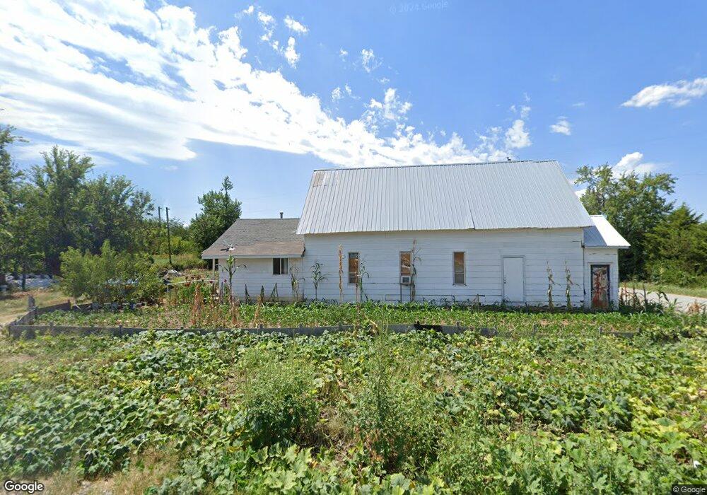
10013 S Highway 43 Gentry, AR 72734
Estimated Value: $37,981
--
Bed
--
Bath
1,541
Sq Ft
$25/Sq Ft
Est. Value
About This Home
This home is located at 10013 S Highway 43, Gentry, AR 72734 and is currently estimated at $37,981, approximately $24 per square foot. 10013 S Highway 43 is a home located in Benton County with nearby schools including Gentry Intermediate School, Gentry Primary School, and Gentry Middle School.
Ownership History
Date
Name
Owned For
Owner Type
Purchase Details
Closed on
Oct 29, 2002
Bought by
Evans Rev Trust
Current Estimated Value
Purchase Details
Closed on
Dec 26, 2001
Bought by
Evans Tr
Purchase Details
Closed on
Aug 17, 1993
Bought by
Evans D
Purchase Details
Closed on
Jul 18, 1993
Bought by
Dod 07-18-1993
Purchase Details
Closed on
Apr 30, 1993
Bought by
Evans Rev Tr
Purchase Details
Closed on
Jun 26, 1992
Bought by
Evans Tennant and Evans Evans
Purchase Details
Closed on
Mar 7, 1984
Bought by
Church Of God In Christ Mennonite Inc
Create a Home Valuation Report for This Property
The Home Valuation Report is an in-depth analysis detailing your home's value as well as a comparison with similar homes in the area
Home Values in the Area
Average Home Value in this Area
Purchase History
| Date | Buyer | Sale Price | Title Company |
|---|---|---|---|
| Evans Rev Trust | -- | -- | |
| Evans Tr | -- | -- | |
| Evans D | -- | -- | |
| Dod 07-18-1993 | -- | -- | |
| Evans Rev Tr | -- | -- | |
| Evans Tennant | $11,000 | -- | |
| Church Of God In Christ Mennonite Inc | $7,000 | -- |
Source: Public Records
Tax History Compared to Growth
Tax History
| Year | Tax Paid | Tax Assessment Tax Assessment Total Assessment is a certain percentage of the fair market value that is determined by local assessors to be the total taxable value of land and additions on the property. | Land | Improvement |
|---|---|---|---|---|
| 2025 | $460 | $12,977 | $5,600 | $7,377 |
| 2024 | $412 | $12,977 | $5,600 | $7,377 |
| 2023 | $374 | $7,480 | $1,400 | $6,080 |
| 2022 | $398 | $7,480 | $1,400 | $6,080 |
| 2021 | $397 | $7,480 | $1,400 | $6,080 |
| 2020 | $348 | $6,560 | $860 | $5,700 |
| 2019 | $348 | $6,560 | $860 | $5,700 |
| 2018 | $348 | $6,560 | $860 | $5,700 |
| 2017 | $348 | $6,560 | $860 | $5,700 |
| 2016 | $348 | $6,560 | $860 | $5,700 |
| 2015 | $305 | $6,090 | $1,060 | $5,030 |
| 2014 | $305 | $6,090 | $1,060 | $5,030 |
Source: Public Records
Map
Nearby Homes
- 23963 Floyd Moore Rd
- 0 Ruby Hall Rd Unit 1296833
- 0 Ruby Hall Rd Unit 25-289
- Tract 1 E 495 Rd
- 23540 Arkansas 12
- 23586 Oklahoma 116
- 24530 & 24540 Coon Hollow Rd
- 22844 Floyd Moore Rd
- 24530 & 24540 Coon's Hollow Rd
- 9065 Pine Grove Rd
- 21942 E 510 Rd
- TBD N Bloomfield Rd
- 9037 Pine Grove Rd
- 10302 Bloomfield North Rd
- 23775 Carlton Dr
- 24530 Coon's Hollow Rd
- 11419 Cripps Rd
- 0 Bozarth Cemetery Rd
- 0003 Colcord Rd
- 22006 Bozarth Cemetery Rd
- 10011 Boyles Rd
- 10061 S Highway 43
- 10062 Boyles Rd
- 10170 Cherokee Main St
- 10063 Boyles Rd
- 10047 Cherokee Main St
- 10074 Cherokee Main St
- 24692 Cherokee Rd
- 10102 S Highway 43
- 24547 Cherokee Rd
- 10099 Cherokee Main St
- 10108 S Highway 43
- 10195 Cherokee Main St
- 10141 Boyles Rd
- 24744 Cherokee Rd
- 24490 Cherokee Rd
- 24441 Cherokee Rd
- 10138 S Highway 43
- 10182 Boyles Rd
- 10174 Davis Cir